Historic Map Collection (page 5)

Step back in time with The Historic Map of Scotland, "Scotland of Old, " and explore the rich history that lies within its borders

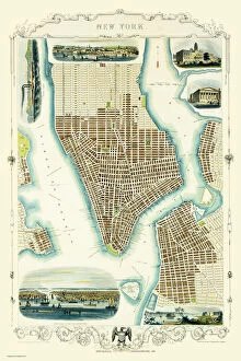
Background imageHistoric Map Collection: Old Map of New York United States of America 1851 by John Tallis

Old Map of New York United States of America 1851 by John Tallis
This is a most attractive yet detailed plan 1851 by John Tallis of New York and districts of Jersey, Panovia, Hoboken, Brooklyn and Williamsburgh in the U.S.A

Background imageHistoric Map Collection: Old County Map of Ross and Cromarty Scotland 1847 by A&C Black

Old County Map of Ross and Cromarty Scotland 1847 by A&C Black
A finely detailed facimile remastered in full colour from an antique original map of Ross and Cromarty featured in A&C Blacks Atlas of 1847

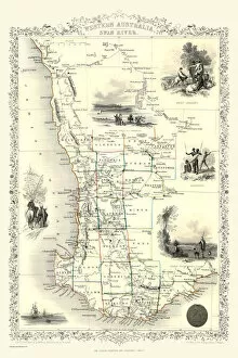
Background imageHistoric Map Collection: Western Australia and the Swan River 1851

Western Australia and the Swan River 1851
A fine facimile artworked from an antique original map of Western Australia and the Swan River, issued as part of the 1851 edition of John Tallis and Companys " The Illustrated Atlas

Background imageHistoric Map Collection: Old County Map of Fife and Kinross Scotland 1847 by A&C Black

Old County Map of Fife and Kinross Scotland 1847 by A&C Black
A finely detailed facimile remastered in full colour from an antique original map of Fife and Kinross featured in A&C Blacks Atlas of 1847

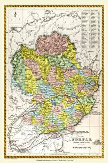
Background imageHistoric Map Collection: Old County Map of Forfar Scotland 1847 by A&C Black

Old County Map of Forfar Scotland 1847 by A&C Black
A finely detailed facimile remastered in full colour from an antique original map of Forfar featured in A&C Blacks Atlas of 1847

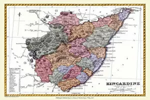
Background imageHistoric Map Collection: Old County Map of Kincardine Scotland 1847 by A&C Black

Old County Map of Kincardine Scotland 1847 by A&C Black
A finely detailed facimile remastered in full colour from an antique original map of Kincardine featured in A&C Blacks Atlas of 1847

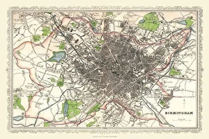
Background imageHistoric Map Collection: Old Map of Birmingham 1893 from the Comprehensive Gazetteer Atlas of England and Wales

Old Map of Birmingham 1893 from the Comprehensive Gazetteer Atlas of England and Wales
This detailed reproduction plan of Birmingham has been re-worked from an antique originally published in the oComprehensive Gazetteer of England and Waleso 1893

Background imageHistoric Map Collection: Old Map of Birmingham 1883

Old Map of Birmingham 1883
==

Background imageHistoric Map Collection: Old Map of Preston 1824 by Edward Baines

Old Map of Preston 1824 by Edward Baines
This is a fine detailed reproduction Map of The City of Preston from the First Edition series of Thomas Moule Maps, originally Published in 1836

Background imageHistoric Map Collection: Old Map of Manchester and its Environs 1824 by William Swire

Old Map of Manchester and its Environs 1824 by William Swire
J128

Background imageHistoric Map Collection: Old Map of Boldmere near Sutton Coldfield 1885

Old Map of Boldmere near Sutton Coldfield 1885
PL045

Background imageHistoric Map Collection: Old Map of the Mining Village of Hednesford in Staffordshire 1865

Old Map of the Mining Village of Hednesford in Staffordshire 1865
PL032

Background imageHistoric Map Collection: Old Map of the Town of Tamworth in Staffordshire 1885

Old Map of the Town of Tamworth in Staffordshire 1885
PL018

Background imageHistoric Map Collection: Old Map of the Town of Darlaston in the West Midlands 1838

Old Map of the Town of Darlaston in the West Midlands 1838
PL39

Background imageHistoric Map Collection: Old Map of Birmingham 1866 by Fullarton & Co

Old Map of Birmingham 1866 by Fullarton & Co
This detailed reproduction plan of Birmingham has been re-worked from an antique originally published in the 1860,s by Archibold Fullarton & Company

Background imageHistoric Map Collection: Old Map of the Royal Town of Sutton Coldfield 1884

Old Map of the Royal Town of Sutton Coldfield 1884
PL050

Background imageHistoric Map Collection: Old Map of Birmingham 1832 by James Drake

Old Map of Birmingham 1832 by James Drake
J069

Background imageHistoric Map Collection: Old Map of the Village of Norton Canes in Staffordshire 1884

Old Map of the Village of Norton Canes in Staffordshire 1884
PL033

Background imageHistoric Map Collection: Old Map of Walsall 1824 by Mason

Old Map of Walsall 1824 by Mason
J022

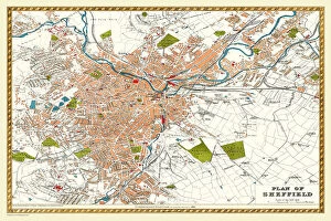
Background imageHistoric Map Collection: Old Map of Sheffield 1893 from the Comprehensive Gazetteer Atlas of England and Wales

Old Map of Sheffield 1893 from the Comprehensive Gazetteer Atlas of England and Wales
J112

Background imageHistoric Map Collection: Old Map of the Village of Walmley near Sutton Coldfield 1886

Old Map of the Village of Walmley near Sutton Coldfield 1886
PL020

Background imageHistoric Map Collection: Old Map of the Village of Cheslyn Hay in Staffordshire 1884

Old Map of the Village of Cheslyn Hay in Staffordshire 1884
PL022

Background imageHistoric Map Collection: Old Map of the Village of Two Gates near Tamworth in Staffordshire 1884

Old Map of the Village of Two Gates near Tamworth in Staffordshire 1884
PL019

Background imageHistoric Map Collection: Old Map of West Bromwich in the West Midlands 1837

Old Map of West Bromwich in the West Midlands 1837
PL021

Background imageHistoric Map Collection: Old Map of Mere Green to Little Sutton in the West Midlands 1884

Old Map of Mere Green to Little Sutton in the West Midlands 1884
PL027

Background imageHistoric Map Collection: Old Map of Leeds 1866 by Fullarton & Co

Old Map of Leeds 1866 by Fullarton & Co
This is an interesting and detailed reproduction Victorian town plan of Leeds which was originally published in John Marius Wilsons The Imperial Gazeteer of England and Wales (A.Fullarton & co)

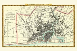
Background imageHistoric Map Collection: Old Map of Kingston Upon Hull 1862 by Fullarton & Co

Old Map of Kingston Upon Hull 1862 by Fullarton & Co
This is an interesting and detailed reproduction Victorian town plan of Kingston-upon-Hull which was originally published in John Marius Wilsons The Imperial Gazeteer of England and Wales

Background imageHistoric Map Collection: Old Map of Wednesbury Town in the Black Country 1846

Old Map of Wednesbury Town in the Black Country 1846
J023

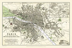
Background imageHistoric Map Collection: Paris at the Outbreak of the French Revolution 1789

Paris at the Outbreak of the French Revolution 1789
This is a detailed Plan of Paris showing the Parks, Gardens and Squares, Palaces, Bridges over the River Seine, Churches, Convents

Background imageHistoric Map Collection: Old Map of the Counties of Argyll and Bute from the Philips Handy Atlas of 1882

Old Map of the Counties of Argyll and Bute from the Philips Handy Atlas of 1882
PHA003

Background imageHistoric Map Collection: Old Map of Liverpool 1821 by J. Gore

Old Map of Liverpool 1821 by J. Gore
J121

Background imageHistoric Map Collection: Old Map of Aston Manor near Birmingham 1796

Old Map of Aston Manor near Birmingham 1796
J122

Background imageHistoric Map Collection: Old Map of the Village of Bloxwich near Walsall 1884

Old Map of the Village of Bloxwich near Walsall 1884
PL002

Background imageHistoric Map Collection: Old map of Liverpool 1650 by Thomas Kaye

Old map of Liverpool 1650 by Thomas Kaye
An interesting map originally published in 1829 by Thomas Kaye, this reproduction map represents the town of Liverpool in 1650

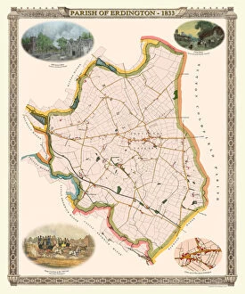
Background imageHistoric Map Collection: Old Map of The Parish of Erdington 1833

Old Map of The Parish of Erdington 1833
J129

Background imageHistoric Map Collection: Old Map of the City of Bath 1836 by Thomas Moule

Old Map of the City of Bath 1836 by Thomas Moule
This is a fine decorative reproduction Map of The City of Bath from the First Edition series of Thomas Moule Maps, originally Published in 1836

Background imageHistoric Map Collection: Old Map of the Environs of London 1836 by Thomas Moule

Old Map of the Environs of London 1836 by Thomas Moule
This is a fine decorative reproduction Map of The Environs of London from the First Edition series of Thomas Moule Maps, originally Published in 1836

Background imageHistoric Map Collection: Old Map of the Orkney and Shetland Isles from the Philips Handy Atlas of 1882

Old Map of the Orkney and Shetland Isles from the Philips Handy Atlas of 1882
PHA022

Background imageHistoric Map Collection: Old Map of the County of Peebles from the Philips Handy Atlas of 1882

Old Map of the County of Peebles from the Philips Handy Atlas of 1882
PHA023

Background imageHistoric Map Collection: Old Map of the County of Lanark from the Philips Handy Atlas of 1882

Old Map of the County of Lanark from the Philips Handy Atlas of 1882
PHA020

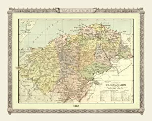
Background imageHistoric Map Collection: Old Map of the Counties of Elgin and Nairn from the Philips Handy Atlas of 1882

Old Map of the Counties of Elgin and Nairn from the Philips Handy Atlas of 1882
PHA013

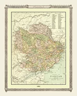
Background imageHistoric Map Collection: Old Map of the County of Forfar from the Philips Handy Atlas of 1882

Old Map of the County of Forfar from the Philips Handy Atlas of 1882
PHA015

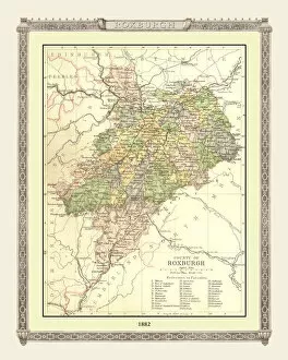
Background imageHistoric Map Collection: Old Map of the County of Roxburgh from the Philips Handy Atlas of 1882

Old Map of the County of Roxburgh from the Philips Handy Atlas of 1882
PHA027

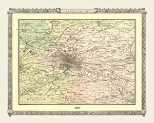
Background imageHistoric Map Collection: Old Map of the Environs of Glasgow from the Philips Handy Atlas of 1882

Old Map of the Environs of Glasgow from the Philips Handy Atlas of 1882
PHA012

Background imageHistoric Map Collection: Old Map of the County of Edinburgh from the Philips Handy Atlas of 1882

Old Map of the County of Edinburgh from the Philips Handy Atlas of 1882
PHA010

Background imageHistoric Map Collection: Old Map of the County of Perth from the Philips Handy Atlas of 1882

Old Map of the County of Perth from the Philips Handy Atlas of 1882
PHA024

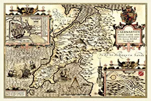
Background imageHistoric Map Collection: Old County Map of Caernarvonshire, Wales 1611 by John Speed

Old County Map of Caernarvonshire, Wales 1611 by John Speed
A facimile of John Speeds historical map of Caernarvonshire originally published for the " Theatre of the Empire of Great Britain"

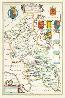
Background imageHistoric Map Collection: Old County Map of Buckinghamshire 1648 by Johan Blaeu from the Atlas Novus

Old County Map of Buckinghamshire 1648 by Johan Blaeu from the Atlas Novus
This detailed and most attractive reproduction map of Buckinghamshire has been carefully art worked from a scan of an antique original


For sale as Licensed Images

Choose your image, Select your licence and Download the media

Step back in time with The Historic Map of Scotland, "Scotland of Old, " and explore the rich history that lies within its borders. This old map takes you on a journey through ancient towns and villages, showcasing the beauty and charm of Scotland's past. Delve into the enchanting world of Sutton Park near Sutton Coldfield with an Old Map from 1885. Uncover hidden paths and forgotten landmarks as you navigate this historical treasure. Immerse yourself in a Pictorial Story Map of Scotland, where each stroke tells a tale of battles fought, castles conquered, and legends born. Let your imagination run wild as you traverse this visual masterpiece. Travel back to Wolverhampton in 1750 with Isaac Taylor's Old Map. Witness the birthplace of industry come alive as you trace the streets that once bustled with trade and innovation. Discover The Isle of Wight like never before through Thomas Moule's Old Map from 1836. Lose yourself amidst picturesque landscapes while uncovering hidden gems scattered across this idyllic island. Unearth Stoke-on-Trent and the Potteries' fascinating history through an Old Map dating back to 1831. Follow the footsteps of potters past as you unravel their stories etched into every street corner. Journey to Islay, Scotland's mystical isle, with Johan Blaeu's captivating Old Map from 1654. Traverse rugged terrains dotted with ancient ruins while immersing yourself in tales whispered by winds long gone by. Transport yourself to Fazeley near Tamworth using an Old Map from 1885. Wander along quaint village lanes lined with charming cottages that have stood for centuries - witnesses to countless stories yet untold. Experience Brighton's vibrant past through John Tallis' intricate depiction on an Old Map from 1851. Stroll along bustling promenades filled with Victorian elegance while soaking up breathtaking coastal views.