
Human Geography Collection (#3)

"Exploring the Tapestry of Human Geography

Background imageHuman Geography Collection: Firefighters attending a house fire C016 / 5336

Firefighters attending a house fire C016 / 5336
Firefighters attending a house fire at night. The fire, thought to have started in a bedroom, spread to the roof of the terraced property. Photographed in Norwich, UK

Background imageHuman Geography Collection: Ukivok stilt village, early 20th century C016 / 4583

Ukivok stilt village, early 20th century C016 / 4583
Ukivok stilt village, early 20th century. This settlement is located on King Island, Alaska, in the Bering Sea. It was inhabited by around 200 Inupiat people who called themselves the Ukivokmiut

Background imageHuman Geography Collection: Berlin street traffic, 1913 C016 / 4511

Berlin street traffic, 1913 C016 / 4511
Berlin street traffic. Pedestrians crossing a road in front of motor cars in Berlin, Germany. A policeman at right is regulating the flow of traffic. A carriage with passengers is passing at left

Background imageHuman Geography Collection: Cork Harbour, 1872 C016 / 4315

Cork Harbour, 1872 C016 / 4315
Cork Harbour. 19th-century artwork of part of Cork Harbour, a natural harbour and estuary on the coast of County Cork, Ireland

Background imageHuman Geography Collection: Pakistan-India at night, ISS image C016 / 4204

Pakistan-India at night, ISS image C016 / 4204
Pakistan-India at night. View from the International Space Station (ISS) of the western Himalayas (left) with the city lights of northern Pakistan and India (upper right) on the Indo-Gangetic Plain

Background imageHuman Geography Collection: London, true-colour satellite image C016 / 3888

London, true-colour satellite image C016 / 3888
London and its surrounds, true-colour satellite image. North is at top. The Thames Estuary is at right. London is the capital city of the UK

Background imageHuman Geography Collection: London, infrared satellite image C016 / 3890

London, infrared satellite image C016 / 3890
London and its surrounds, infrared satellite image. North is at top. The Thames Estuary is at right. This view is used for geological, agricultural

Background imageHuman Geography Collection: London, infrared satellite image C016 / 3889

London, infrared satellite image C016 / 3889
London and its surrounds, infrared satellite image. North is at top. The Thames Estuary is at right. This view is used for studies of vegetation

Background imageHuman Geography Collection: North-western Europe at night, ISS image C016 / 3892

North-western Europe at night, ISS image C016 / 3892
North-western Europe at night. View from the International Space Station (ISS) of the city lights of north-western Europe. North is at left

Background imageHuman Geography Collection: Italy at night, ISS image C016 / 3891

Italy at night, ISS image C016 / 3891
Italy at night. View from the International Space Station (ISS) of the city lights of Italy. North is towards upper right. Sicily is at lower left, below Sardinia and Corsica

Background imageHuman Geography Collection: Isle of Man, satellite image C016 / 3886

Isle of Man, satellite image C016 / 3886
Isle of Man, satellite image. North is at bottom. Visible features include fields and hills (shades of green), beaches and barren or dry areas (brown), clouds (white, across upper left)

Background imageHuman Geography Collection: Isle of Man, satellite image C013 / 5151

Isle of Man, satellite image C013 / 5151
Isle of Man, satellite image. North is towards top left. Visible features include fields and hills (shades of green), beaches and clouds (white), lakes and reservoirs (dark blue)

Background imageHuman Geography Collection: Paris, France

Paris, France
Paris, satellite image. A sweeping bend in the River Seine meanders through the centre of Paris, the capital city of France

Background imageHuman Geography Collection: Gloucester and Cheltenham, aerial view

Gloucester and Cheltenham, aerial view
Gloucester and Cheltenham. Aerial photograph mosaic of the area between the UK city of Gloucester (lower left) and town of Cheltenham (upper right), in the English county of Gloucestershire

Background imageHuman Geography Collection: Global water supply, conceptual image

Global water supply, conceptual image
Global water supply. Conceptual artwork of the Earth inside a water droplet. This represents global water supplies and conservation of the Earths water resources

Background imageHuman Geography Collection: Lhasa, Tibet, satellite image

Lhasa, Tibet, satellite image
Lhasa, Tibet, 3D satellite image. North is towards upper left. Lhasa (elevation 3650 metres) is one of the highest cities in the world

Background imageHuman Geography Collection: Global time bomb, conceptual image

Global time bomb, conceptual image
Global time bomb. Conceptual image of a smouldering fuse on top of a globe (centred on Europe), representing various issues that threaten the future of the Earth

Background imageHuman Geography Collection: Building site, Spain

Building site, Spain
Building site with cranes being used to construct new apartment blocks. This building site is in Mostoles, a town near Madrid, Spain

Background imageHuman Geography Collection: Overpopulation, conceptual image

Overpopulation, conceptual image. Artwork of a crowd of human couples representing overpopulation of the Earth. The Earths population grew rapidly in the 20th century due to increased healthcare

Background imageHuman Geography Collection: The Old Churches of London, 1942 book

The Old Churches of London, 1942 book
The Old Churches of London. Cover page from The Old Churches of London (1942) by the British antiquary and architectural historian Gerald Cobb (19001986)

Background imageHuman Geography Collection: Global meat eating, conceptual artwork

Global meat eating, conceptual artwork. This global map with the outline of the Earths countries filled in with a close-up of raw beef

Background imageHuman Geography Collection: Block of flats, Spain

Block of flats, Spain
Block of flats with air conditioning unit outlets on the exterior wall. These apartments are in Mostoles, a town near Madrid, Spain

Background imageHuman Geography Collection: Vancouver at night, time-exposure image

Vancouver at night, time-exposure image. The lights of the city reduce the visibility of the stars in the night sky, a phenomenon known as light pollution

Background imageHuman Geography Collection: Moon over Vancouver, time-exposure image

Moon over Vancouver, time-exposure image. The longer exposure means that the unlit portion of the Moon is visible here, and the stars of the constellation of Orion are seen at upper centre

Background imageHuman Geography Collection: Unfinished flats, Spain

Unfinished flats, Spain
Unfinished block of flats at a building site. This building site is in Mostoles, a town near Madrid, Spain. Construction work in Spain slowed

Background imageHuman Geography Collection: Himba kraal, Namibia

Himba kraal, Namibia. Aerial photograph of a kraal (livestock enclosure) of the Himba people of northern Namibia. The Himba are pastoral and nomadic, tending herds of goats and cattle

Background imageHuman Geography Collection: High-rise flats at night

High-rise flats at night. Photographed in Kemp Town, Brighton, UK

Background imageHuman Geography Collection: Coastal erosion, Norfolk

Coastal erosion, Norfolk
Coastal erosion. Eroded coastline at Happisburgh, Norfolk, UK. The Norfolk area of the English coastline is particularly prone to erosion by the sea

Background imageHuman Geography Collection: Coastal defences, Norfolk

Coastal defences, Norfolk
Coastal defences. Waves breaking against a groyne at high tide at Happisburgh, Norfolk, UK. The Norfolk area of the English coastline is particularly prone to erosion by the sea

Background imageHuman Geography Collection: Europe at night, satellite image

Europe at night, satellite image
Europe at night. Satellite image of the Earth seen at 00:00 (midnight) GMT (UTC), centred on Europe. City lights (yellow) in dark areas show areas of dense population

Background imageHuman Geography Collection: The Americas, satellite image

The Americas, satellite image. Oceans are blue and land is green and brown. City lights (yellow) in dark areas show areas of dense population

Background imageHuman Geography Collection: The Arctic, night-day satellite image

The Arctic, night-day satellite image
Asia, night-day satellite image. This composite image of the Earth is set against a background of stars, and is centred on the continent of Asia. North is at top

Background imageHuman Geography Collection: Asia at night, satellite image

Asia at night, satellite image. City lights (yellow) show areas of dense population. Large, densely populated areas include India (lower centre), China (lower right) and Japan (right)


For sale as Licensed Images

Choose your image, Select your licence and Download the media

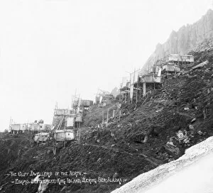
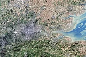
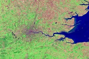
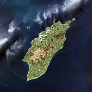
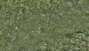
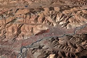
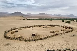
"Exploring the Tapestry of Human Geography: A Journey Through Time and Space" From the vibrant glow of North America at night to the enchanting charm of Europe illuminated under a starry sky, satellite images unveil the intricate patterns woven by human geography. Witnessing Hong Kong's bustling streets in the 1890s, one can almost feel the pulse of history beating through time. South America emerges as a constellation of lights, showcasing its diverse cultures and landscapes. London and its iconic Thames river transport us back to the 18th century, where trade and innovation shaped this global metropolis. Southeast Asia dazzles with its nocturnal radiance, reflecting both urban development and ancient traditions that coexist harmoniously. The dance between day and night reveals Africa's vastness; from dusk till dawn, it pulsates with life across deserts, savannas, and teeming cities. Gazing upon our planet from space during nighttime unveils humanity's interconnectedness - every corner aglow with activity. Australia shines brightly as darkness descends; a testament to resilience amidst vast wilderness. Within Torre Bellesguard's ornate ceiling in Barcelona lies Antoni Gaudi's architectural masterpiece – an embodiment of modernism blending seamlessly into history. Human geography is more than just maps; it is an exploration of how people shape their environments while being shaped by them in return, and is a tapestry woven over centuries - threads connecting continents, cultures merging into kaleidoscopic diversity. Let us marvel at these snapshots that capture our shared human experience on this beautiful blue planet we call home.