Ireland Collection

Discover the enchanting beauty of Ireland, a land steeped in history and natural wonders

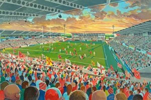
Background imageIreland Collection: Ravenhill Stadium Fine Art - Ulster Rugby Union

Ravenhill Stadium Fine Art - Ulster Rugby Union
Ravenhill Stadium (known as the Kingspan Stadium for sponsorship reasons) is a rugby stadium located in Belfast, Northern Ireland. It is the home of Ulster Rugby

Background imageIreland Collection: Cliffs of Moher at sunset, with flowers in the foreground, Liscannor, County Clare

Cliffs of Moher at sunset, with flowers in the foreground, Liscannor, County Clare, Munster province, Republic of Ireland, Europe

Background imageIreland Collection: Skellig Michael, County Kerry, Munster, Republic of Ireland, Europe

Skellig Michael, County Kerry, Munster, Republic of Ireland, Europe

Background imageIreland Collection: Ireland, North, Derry, The Peoples Gallery series of murals in the Bogside Mural known

Ireland, North, Derry, The Peoples Gallery series of murals in the Bogside Mural known as " Bernadette"

Background imageIreland Collection: Valentia Island, Ring of Kerry, County Kerry, Munster, Republic of Ireland, Europe

Valentia Island, Ring of Kerry, County Kerry, Munster, Republic of Ireland, Europe

Background imageIreland Collection: The Peace Bridge over the River Foyle in Londonderry, Northern Ireland

The Peace Bridge over the River Foyle in Londonderry, Northern Ireland

Background imageIreland Collection: Windsor Park - Northern Ireland

Windsor Park - Northern Ireland
National Football Stadium at Windsor Park is a football stadium in Belfast, Northern Ireland

Background imageIreland Collection: JERSEY Geological map. Channel Islands. STANFORD, 1913

JERSEY Geological map. Channel Islands. STANFORD, 1913 'Jersey'. Artist/engraver/cartographer: Edward Stanford Ltd. Provenance: "Stanford Geological Atlas of Great Britain and Ireland"; by Horace B

Background imageIreland Collection: Ireland, North, Belfast, West

Ireland, North, Belfast, West, Falls Road, Divis Tower Block Of Flats Which Had A British Army Look Out Position On Top During The Troubles

Background imageIreland Collection: An illustration by an unknown artist of Members of the Irish Parliamentary Party sitting in the British House of

An illustration by an unknown artist of Members of the Irish Parliamentary Party sitting in the British House of Commons, London, England

Background imageIreland Collection: EyeUbiquitous_10010612

EyeUbiquitous_10010612
Ireland, North, Belfast, PLO IRA Irish Republican mural on the side of a terrace house on the corner with Falls Road

Background imageIreland Collection: Lesser Black Backed Gull (Larus fuscus) perched on a rock

Lesser Black Backed Gull (Larus fuscus) perched on a rock. Great Saltee Island, Kilmore Quay, County Wexford, Ireland, June

Background imageIreland Collection: Portrait of Mrs. Thomas Conolly, seated side-saddle in a black riding habit on a chestnut

Portrait of Mrs. Thomas Conolly, seated side-saddle in a black riding habit on a chestnut
CH414922 Portrait of Mrs

Background imageIreland Collection: Old Midleton Distillery, Co Cork, Ireland; 17Th Century Jameson Distillery

Old Midleton Distillery, Co Cork, Ireland; 17Th Century Jameson Distillery

Background imageIreland Collection: Recovering George Eystons fire-damaged Bugatti T43

Recovering George Eystons fire-damaged Bugatti T43, Irish Grand Prix, Phoenix Park Dublin, 1929. Eystons car is being passed by John Fields Bugatti T43, which also caught fire in the pits later

Background imageIreland Collection: Trinity College, Dublin. Taken during the Irish Convention. 1920

Trinity College, Dublin. Taken during the Irish Convention. 1920

Background imageIreland Collection: River Awbeg, Annesgrove, Castletownroche, Co Cork, Ireland; Bridge Over A River

River Awbeg, Annesgrove, Castletownroche, Co Cork, Ireland; Bridge Over A River

Background imageIreland Collection: Trim Castle And The River Boyne, Trim, Co Meath, Ireland

Trim Castle And The River Boyne, Trim, Co Meath, Ireland

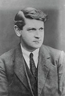
Background imageIreland Collection: The late Michael Collins. 7 November 1922

The late Michael Collins. 7 November 1922

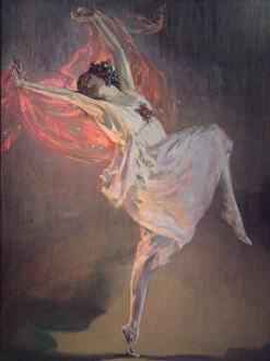
Background imageIreland Collection: Ballerina Anna Pavlova (1881-1931), 1910s. Artist: Lavery, Sir John (1856-1941)

Ballerina Anna Pavlova (1881-1931), 1910s. Artist: Lavery, Sir John (1856-1941)
Ballerina Anna Pavlova (1881-1931), 1910s. From a private collection

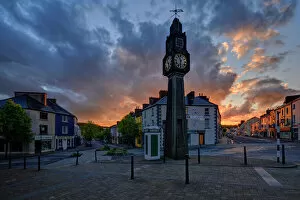
Background imageIreland Collection: The Clock, Westport, County Mayo, Connacht, Republic of Ireland, Europe

The Clock, Westport, County Mayo, Connacht, Republic of Ireland, Europe

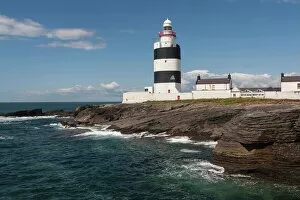
Background imageIreland Collection: Hook Head Lighthouse, County Wexford, Leinster, Republic of Ireland, Europe

Hook Head Lighthouse, County Wexford, Leinster, Republic of Ireland, Europe

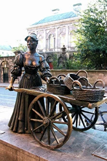
Background imageIreland Collection: Molly Malone statue, Grafton Street, Dublin, Republic of Ireland, Europe

Molly Malone statue, Grafton Street, Dublin, Republic of Ireland, Europe

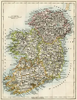
Background imageIreland Collection: Ireland map, 1870s

Ireland map, 1870s
Map of Ireland, or Eire, 1870s. Printed color lithograph

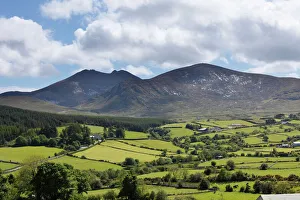
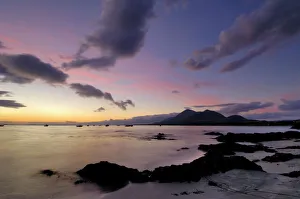
Background imageIreland Collection: Mourne Mountains and Mt. Slieve Bearnagh

Mourne Mountains and Mt. Slieve Bearnagh, County Down, Northern Ireland, Ireland, Great Britain, Europe

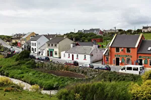
Background imageIreland Collection: Fisher Street, Doolin, County Clare, Ireland, Europe

Fisher Street, Doolin, County Clare, Ireland, Europe

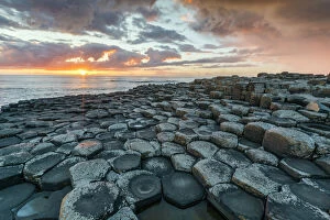
Background imageIreland Collection: Giants Causeway at sunset, UNESCO World Heritage Site

Giants Causeway at sunset, UNESCO World Heritage Site, County Antrim, Ulster, Northern Ireland, United Kingdom, Europe

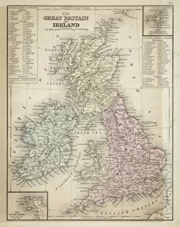
Background imageIreland Collection: Great Britain and Ireland map 1867

Great Britain and Ireland map 1867
Mitchell's Modern Atlas - Published by E.H. Butler and Co - Philadelphia 1867

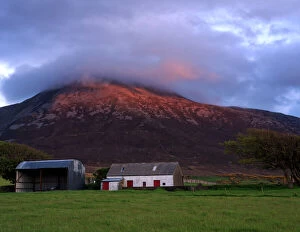
Background imageIreland Collection: Croagh Patrick, County Mayo, Connacht, Republic of Ireland, Europe

Croagh Patrick, County Mayo, Connacht, Republic of Ireland, Europe

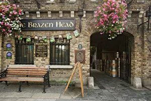
Background imageIreland Collection: Europe, Ireland, Dublin. Exterior of Brazen Head pub, established in 1198 AD. Credit as

Europe, Ireland, Dublin. Exterior of Brazen Head pub, established in 1198 AD. Credit as
Ireland, Dublin. Exterior of Brazen Head pub, established in 1198 AD. Credit as: Dennis Flaherty / Jaynes Gallery / DanitaDelimont(RF)

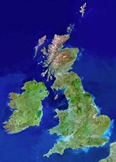
Background imageIreland Collection: British Isles, satellite image

British Isles, satellite image
UK and Ireland. Satellite image of the UK and the Republic of Ireland (Eire). North is at top. Water is blue, vegetation is green, dry or barren areas are brown, and snow and ice are white

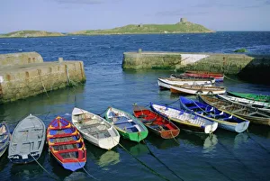
Background imageIreland Collection: Dalkey Island and Coliemore Harbour

Dalkey Island and Coliemore Harbour, Dublin, Ireland, Europe

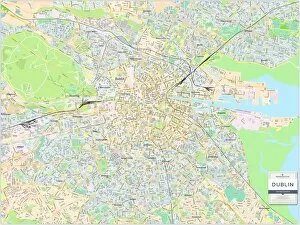
Background imageIreland Collection: Dublin City Centre Street Map

Dublin City Centre Street Map
A detailed street level map of central Dublin. Covers from Glasnevin in the north to Clonskeagh in the south and from Clontarf in the east to Chapelizod in the west

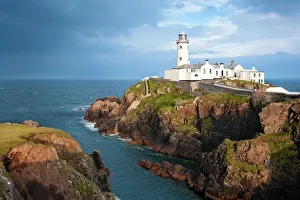
Background imageIreland Collection: Fanad Head Lighthouse

Fanad Head Lighthouse
Fanad is a peninsula that lies between Lough Swilly and Mulroy Bay on the north coast of County Donegal in Ireland

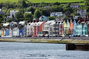
Background imageIreland Collection: Whitehead, County Antrim, Northern Ireland, Great Britain, Europe, PublicGround

Whitehead, County Antrim, Northern Ireland, Great Britain, Europe, PublicGround

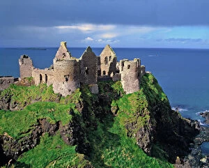
Background imageIreland Collection: Northern Ireland, County Antrim, Dunluce Castle. Picturesque Dunluce Castle attracts

Northern Ireland, County Antrim, Dunluce Castle. Picturesque Dunluce Castle attracts visitors with its stunning location on the Antrim Coast in Northern Ireland

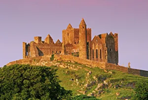
Background imageIreland Collection: Ireland, County Tipperary. View of the Rock of Cashel, a medieval fortress

Ireland, County Tipperary. View of the Rock of Cashel, a medieval fortress

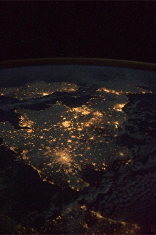
Background imageIreland Collection: UK at night from space

UK at night from space
UK at night, as seen from the International Space Station (ISS). City lights (yellow) show areas of dense population. France is at bottom. Image taken on 24th December 2010

Background imageIreland Collection: Ireland AL 2367 Dingle peninsula © Ake Lindau / ARDEA LONDON

Ireland AL 2367 Dingle peninsula © Ake Lindau / ARDEA LONDON
AL-2367 Ireland, The Dingle peninsula Ake Lindau Please note that prints are for personal display purposes only and may not be reproduced in any way

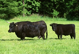
Background imageIreland Collection: Dexter Cattle. Adult and calf Origin: Ireland

Dexter Cattle. Adult and calf Origin: Ireland
FG-9453 Dexter Cattle. Adult and calf Origin: Ireland Francois Gohier Please note that prints are for personal display purposes only and may not be reproduced in any way

Background imageIreland Collection: Dawn over Clew Bay and Croagh Patrick mountain

Dawn over Clew Bay and Croagh Patrick mountain, from Old Head, County Mayo, Connacht, Republic of Ireland (Eire), Europe

Background imageIreland Collection: Great Britain and England map 1895

Great Britain and England map 1895
Encyclopedia Britannica 9th Edition Vol I New York, Samuel Hall 1878

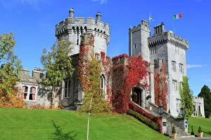
Background imageIreland Collection: Dromoland Castle, Quinn, County Clare, Munster, Republic of Ireland, Europe

Dromoland Castle, Quinn, County Clare, Munster, Republic of Ireland, Europe

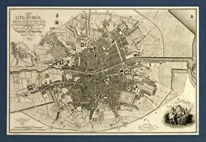
Background imageIreland Collection: Map of the City of Dublin, 1797

Map of the City of Dublin, 1797
Map of the City of Dublin, Ireland. Published in 1797, this map includes details of the canals being built at the time

Background imageIreland Collection: DUBLIN: NASSAU STREET. Yeates and Son glasses store on Nassau Street in Dublin

DUBLIN: NASSAU STREET. Yeates and Son glasses store on Nassau Street in Dublin, Ireland. Photograph, early 20th century

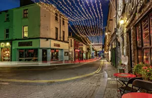
Background imageIreland Collection: Vibrant streets at dusk in downtown Galway, Ireland

Vibrant streets at dusk in downtown Galway, Ireland

Background imageIreland Collection: Northern Irish coastline with wide sandy beaches in Ballycastle

Northern Irish coastline with wide sandy beaches in Ballycastle, County Antrim, Northern Ireland, United Kingdom, Europe

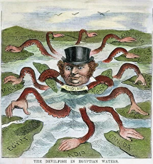
Background imageIreland Collection: The Devilfish in Egyptian Waters

The Devilfish in Egyptian Waters
IMPERIALISM CARTOON, 1882. The Devilfish in Egyptian Waters. An American cartoon from 1882 depicting John Bull (England) as the octopus of imperialism grabbing land on every continent

Background imageIreland Collection: Elizabeth I (1533-1603) Queen of England and Ireland from 1558, last Tudor monarch

Elizabeth I (1533-1603) Queen of England and Ireland from 1558, last Tudor monarch. Version of the Armarda portrait attributed to George Gower c1588

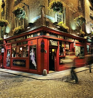
Background imageIreland Collection: The Temple Bar pub at night, Temple Bar

The Temple Bar pub at night, Temple Bar, Dublin, County Dublin, Republic of Ireland, Europe

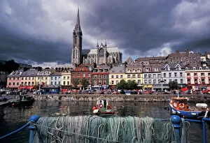
Background imageIreland Collection: Ireland, County Cork, Cobh. Harbor view and St. Colmans church

Ireland, County Cork, Cobh. Harbor view and St. Colmans church

Background imageIreland Collection: SEAN O CASEY (1800-1964). Irish playwright. Photographed in 1934

SEAN O CASEY (1800-1964). Irish playwright. Photographed in 1934

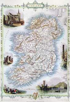
Background imageIreland Collection: MAP: IRELAND, 1851. An engraved map of Ireland, 1851

MAP: IRELAND, 1851. An engraved map of Ireland, 1851

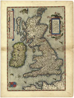
Background imageIreland Collection: 16th century map of the British Isles

16th century map of the British Isles
Map of the British Isles, in the 1570 edition of Ortelius Atlas (Theatrum Orbis Terrarum)

Background imageIreland Collection: Western Ireland, Dingle Peninsula, broad landscape with a patchwork of green pastures

Western Ireland, Dingle Peninsula, broad landscape with a patchwork of green pastures

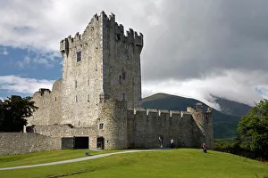
Background imageIreland Collection: Ross Castle

Ross Castle, Killarney National Park, County Kerry, Munster, Republic of Ireland, Europe

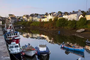
Background imageIreland Collection: Roundstone Harbour, Connemara, Co. Galway, Ireland

Roundstone Harbour, Connemara, Co. Galway, Ireland

Background imageIreland Collection: Mercy of the Sea

Mercy of the Sea
The famous Bad Eddie shipwreck on Magerclogher Strand, Bunbeg, Gweedore, Donegal, Ireland

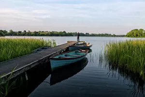
Background imageIreland Collection: Fisherman, Upper Lough Erne, Co. Fermanagh, Ulster, Northern Ireland, United Kingdom

Fisherman, Upper Lough Erne, Co. Fermanagh, Ulster, Northern Ireland, United Kingdom, Europe

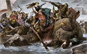
Background imageIreland Collection: Viking raid under Olaf I

Viking raid under Olaf I
Viking raid along the English Channel led by Olaf Tryggvason, 900s AD. Hand-colored woodcut of a 19th-century illustration

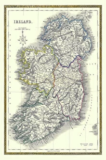
Background imageIreland Collection: Old Map of Ireland 1852 by Henry George Collins

Old Map of Ireland 1852 by Henry George Collins
This is a finely detailed map of Ireland remastered from a rare Atlas of the World published in 1852 by Henry George Collins

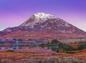
Background imageIreland Collection: Ireland, Co. Donegal, Mount Errigal at dusk

Ireland, Co. Donegal, Mount Errigal at dusk
Ireland, Co.Donegal, Mount Errigal at dusk

Background imageIreland Collection: Ireland, Co. Donegal, Glenveagh National Park, Reflection in Lough Veagh

Ireland, Co. Donegal, Glenveagh National Park, Reflection in Lough Veagh
Ireland, Co.Donegal, Glenveagh National Park, Reflection in Lough Veagh

Background imageIreland Collection: The Dark Hedges in County Antrim, Northern Ireland

The Dark Hedges in County Antrim, Northern Ireland

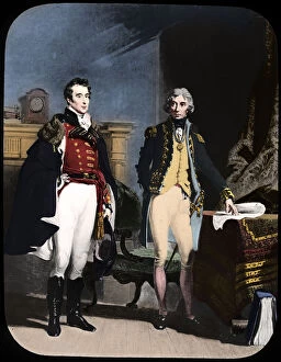
Background imageIreland Collection: The Army and Navy, Wellington and Nelson, c1805. Artist: Newton & Co

The Army and Navy, Wellington and Nelson, c1805. Artist: Newton & Co
The Army and Navy, Wellington and Nelson, c1805

Background imageIreland Collection: Bundoran Beach

Bundoran Beach
The beach at Bundoran in Donegal, Ireland on an eveing with dramatic weather and an impressive sky

Background imageIreland Collection: Dark Hedges, an avenue of Beech trees

Dark Hedges, an avenue of Beech trees, Bregagh Road near Armoy, County Antrim, Northern Ireland, Great Britain, Europe

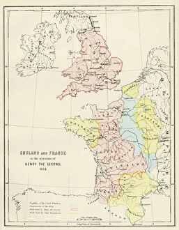
Background imageIreland Collection: Angevin kings holdings in France and Britain

Angevin kings holdings in France and Britain
British Isles and France under the Angevins, 1100s-1400s. Color lithograph reproduction of a 19th-century illustration

Background imageIreland Collection: Ireland, Dublin, Lansdowne Road Football stadium

Ireland, Dublin, Lansdowne Road Football stadium, interior panoramic view looking from the south end of the stadium

Background imageIreland Collection: Mount Errigal and Dunlewy village, County Donegal, Ulster, Republic of Ireland, Europe

Mount Errigal and Dunlewy village, County Donegal, Ulster, Republic of Ireland, Europe

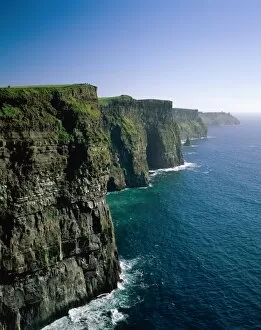
Background imageIreland Collection: Cliffs of Moher

Cliffs of Moher, County Clare, Ireland

Background imageIreland Collection: Derry (Londonderry)

Derry (Londonderry), County Derry (Londonderry), Northern Ireland, United Kingdom, Europe

Background imageIreland Collection: 'Muckross Abbey - Tree of Life'

"Muckross Abbey - Tree of Life"
The Franciscan friary of Irrelagh, known as "Muckross Abbey" was founded for the Observatine Franciscans about 1448, by Daniel McCarthy Mor

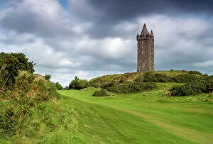
Background imageIreland Collection: Scrabo Tower, Newtownards, Co Down, Northern Ireland, UK, Europe

Scrabo Tower, Newtownards, Co Down, Northern Ireland, UK, Europe

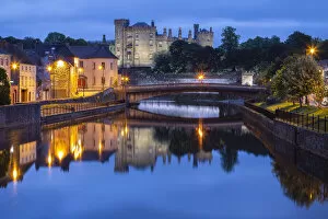
Background imageIreland Collection: View of the Kilkenny castle reflected in the Nore river. County Kilkenny, Ireland

View of the Kilkenny castle reflected in the Nore river. County Kilkenny, Ireland

Background imageIreland Collection: EyeUbiquitous_20122152

EyeUbiquitous_20122152
Ireland, County Antrim, Belfast, Queens Island, Harland and Wolff cranes Samson and Goliath

Background imageIreland Collection: EyeUbiquitous_20120996

EyeUbiquitous_20120996
Ireland, North, Belfast, The Crown Bar facade

Background imageIreland Collection: Ireland, County Fermanagh, Cuilcagh Mountain Park

Ireland, County Fermanagh, Cuilcagh Mountain Park, Legnabrocky Trail to summit of Cuilcagh Mountain

Background imageIreland Collection: Shetland ZE2 9 Map

Shetland ZE2 9 Map
Postcode Sector Map of Shetland ZE2 9

Background imageIreland Collection: Castlerock, County Antrim, Ulster region, northern Ireland, United Kingdom

Castlerock, County Antrim, Ulster region, northern Ireland, United Kingdom. Panoramic view of the city in late afternoon

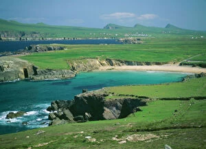
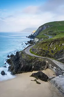
Background imageIreland Collection: Coumeenoole beach (Slea Head), Dingle peninsula, County Kerry, Munster province, Ireland

Coumeenoole beach (Slea Head), Dingle peninsula, County Kerry, Munster province, Ireland, Europe

Background imageIreland Collection: Ireland, Co. Donegal, Ramelton, River lennon at sunrise

Ireland, Co. Donegal, Ramelton, River lennon at sunrise
Ireland, Co.Donegal, Ramelton, River lennon at sunrise

Background imageIreland Collection: Galway Gossips, c1887, (c1930). Creator: Sir Ernest Albert Waterlow

Galway Gossips, c1887, (c1930). Creator: Sir Ernest Albert Waterlow
Galway Gossips, c1887, (c1930). Rural scene in the west of Ireland: a woman on a horse stops to chat to a man leaning on a low wall

Background imageIreland Collection: The Giants Causeway, County Antrim, Ulster region, Northern Ireland, United Kingdom

The Giants Causeway, County Antrim, Ulster region, Northern Ireland, United Kingdom


For sale as Licensed Images

Choose your image, Select your licence and Download the media

Discover the enchanting beauty of Ireland, a land steeped in history and natural wonders. 🍀 From the majestic Hook Head Lighthouse in County Wexford, Leinster, to the electrifying atmosphere at Ravenhill Stadium Fine Art - Ulster Rugby Union, this country will captivate your senses. Immerse yourself in the breathtaking landscapes of Mourne Mountains and Mt. Slieve Bearnagh in County Down, Northern Ireland. As you explore these stunning peaks that straddle both Ireland and Great Britain, you'll feel a sense of awe wash over you. Remembering the late Michael Collins on that fateful day of 7 November 1922 when his legacy forever shaped Irish history. The Book of Kells illustration depicting St. Matthew is a testament to Ireland's rich artistic heritage. Transport yourself back to the early 1900s with ballerina Anna Pavlova gracefully dancing across stages under Sir John Lavery's brush strokes. And don't miss Molly Malone statue proudly standing on Grafton Street in Dublin, symbolizing the vibrant spirit of Republic of Ireland. Take a glimpse into history with an old map showcasing Great Britain and Ireland from 1867 or delve even further back into time with an Ireland map from the 1870s. These artifacts remind us of how far we've come while honoring our roots. Experience true Irish hospitality as you stroll through Fisher Street in Doolin, County Clare – where traditional music fills every corner. And no visit would be complete without savoring a pint at Brazen Head pub established way back in 1198 AD. As dusk settles over downtown Galway, witness its vibrant streets come alive with energy and charm – a perfect reflection of modern-day Europe intertwined with ancient traditions. Ireland beckons adventurers seeking untamed beauty and warm-hearted locals ready to share their stories. Come lose yourself amidst its emerald landscapes and embrace all that this remarkable country has to offer.

© Copyright Media Storehouse, All Rights Reserved 2003 - 2024
Facebook     Pinterest     100% Payment Secure