
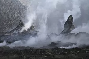
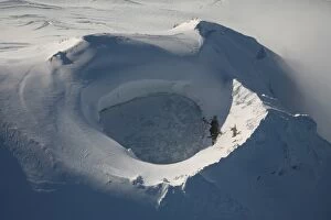
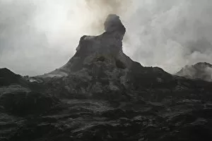
Land Feature Collection (#26)

"Journey through Time: Exploring Land Features of the 19th Century" Map of Saint Lucia

Background imageLand Feature Collection: Aerial view of glaciated Shishaldin Volcano, Unimak Island, Alaska

Aerial view of glaciated Shishaldin Volcano, Unimak Island, Alaska
September 2007 - Aerial view of glaciated Shishaldin Volcano, Unimak Island, Alaska, USA

Background imageLand Feature Collection: Erta Ale steaming Hornitos, Danakil Depression, Ethiopia

Erta Ale steaming Hornitos, Danakil Depression, Ethiopia
February 8, 2008 - Erta Ale steaming Hornitos, Danakil Depression, Ethiopia

Background imageLand Feature Collection: Aerial view of frozen lake in summit crater Mount Douglas volcano, Alaskan Peninsula

Aerial view of frozen lake in summit crater Mount Douglas volcano, Alaskan Peninsula
September 2007 - Aerial view of frozen lake in summit crater Mount Douglas volcano, Alaskan Peninsula, USA

Background imageLand Feature Collection: Erta Ale steaming Hornito, Danakil Depression, Ethiopia

Erta Ale steaming Hornito, Danakil Depression, Ethiopia
February 8, 2008 - Erta Ale steaming Hornito, Danakil Depression, Ethiopia

Background imageLand Feature Collection: Dallol geothermal area, brine hot springs, Danakil Depression, Ethiopia

Dallol geothermal area, brine hot springs, Danakil Depression, Ethiopia
February 10, 2008 - Dallol geothermal area, brine hot springs, Danakil Depression, Ethiopia

Background imageLand Feature Collection: Satellite view of the Ob and Yenisei rivers as they carry sediments into the Kara Sea

Satellite view of the Ob and Yenisei rivers as they carry sediments into the Kara Sea
June 29, 2012 - Satellite view of the Ob and Yenisei rivers as they transport tan sediments and dark brown dissolved organic material into the Kara Sea

Background imageLand Feature Collection: The view from an alien moon towards the massive planet it orbits

The view from an alien moon towards the massive planet it orbits. Four of the five moons are large enough to sustain life, and the planet at their center is a monster 3 times the mass of the Earth

Background imageLand Feature Collection: Satellite view of Los Angeles, California

Satellite view of Los Angeles, California
Two-dimensional satellite view with elevation data of Los Angeles, California

Background imageLand Feature Collection: Pollution off France

Pollution off France
March 31, 2003 - Pollution swirling above the Atlantic Ocean off the west coast of France (bottom right). At top center is the southern part of the United Kingdom, with Ireland to the west

Background imageLand Feature Collection: Satellite view of Italy

Satellite view of Italy
September 19, 2009 - Relatively few clouds mar the view of Italy. Also visible are France, Switzerland, Germany, and Austria from left to right along the snow-capped Alps

Background imageLand Feature Collection: Terragen render of Kitt Peak, Arizona, USA

Terragen render of Kitt Peak, Arizona, USA, with surreal colours

Background imageLand Feature Collection: Illustration of the peaks surrounding the Peary crater on Earths moon

Illustration of the peaks surrounding the Peary crater on Earths moon
The peaks surrounding the Peary crater near the North Pole of Earths moon have been called the Mountains of Eternal Light because the sun never sets on them

Background imageLand Feature Collection: Sea ice and icebergs floating along the Mawson Coast of East Antarctica

Sea ice and icebergs floating along the Mawson Coast of East Antarctica
March 15, 2013 - Sea ice and icebergs floating along the Mawson Coast of East Antarctica

Background imageLand Feature Collection: A sunset on a forested moon which orbits a heavily populated planet

A sunset on a forested moon which orbits a heavily populated planet
Artists concept of a sunset on a forested moon which orbits a heavily populated planet. Both the planet and moon orbit around a binary system, consisting of a G class star and a neutron star

Background imageLand Feature Collection: Haze along the Himalaya Mountains

Haze along the Himalaya Mountains
October 30, 2008 - Haze along the Himalaya Mountains obscures the satelliteas view of the ground surface along the southwestern face of the mountain range

Background imageLand Feature Collection: Aurora borealis over the glacial lagoon Jokulsarlon in Iceland

Aurora borealis over the glacial lagoon Jokulsarlon in Iceland
Spectacular aurora display over the glacier lagoon Jokulsarlon in Iceland

Background imageLand Feature Collection: Various types of sea ice congregate along the east coast of Greenland

Various types of sea ice congregate along the east coast of Greenland
March 27, 2010 - Various types of sea ice congregated along the east coast of Greenland. In the upper left quadrant of the image is the Greenland coast

Background imageLand Feature Collection: Zodiacal light and Milky Way shines brightly above towns and villages in China

Zodiacal light and Milky Way shines brightly above towns and villages in China
The zodiacal light shines brightly with the Milky Way just after sunset above the lights of towns and villages along the Yangtze river in Yunnan province of China

Background imageLand Feature Collection: The Blue Marble Next Generation Earth showing North America

The Blue Marble Next Generation Earth showing North America
The Blue Marble Next Generation data set provides a monthly global cloud-free true-color picture of the Earths landcover at a 500-meter spatial resolution

Background imageLand Feature Collection: Alaska

Alaska

Background imageLand Feature Collection: Zeta Piscium is a binary star system consisting of a red giant and a white dwarf

Zeta Piscium is a binary star system consisting of a red giant and a white dwarf. The latter is drawing in material from its companion

Background imageLand Feature Collection: A colony on an alien moon with a beautiful planet in its sky

A colony on an alien moon with a beautiful planet in its sky

Background imageLand Feature Collection: Greenland

Greenland
February 18, 2010 - Greenland

Background imageLand Feature Collection: The Brandberg Massif in Northen Namibia

The Brandberg Massif in Northen Namibia, the dominant geographic feature of the central Namib desert. This dome-shaped granite intrusion covers an area of 650 square kilmeters (250 square miles)

Background imageLand Feature Collection: A huge sun shines through dense brown clouds

A huge sun shines through dense brown clouds on this beautiful seascape

Background imageLand Feature Collection: Jupiter seen from one of its innermost moons, tiny Metis

Jupiter seen from one of its innermost moons, tiny Metis

Background imageLand Feature Collection: Dust storm blowing over the Tasman Sea towards New Zealand

Dust storm blowing over the Tasman Sea towards New Zealand
September 24, 2009 - Dense dust blowing south over the Tasman Sea towards New Zealand. The dust plume is densely concentrated in this image, attesting to the strength of the winds

Background imageLand Feature Collection: A comet lights up the landscape of Candor Chasma over Mars

A comet lights up the landscape of Candor Chasma over Mars
A comet lights up the Martian predawn over the twisted landscape of Candor Chasma. The distant mountains are several kilometres high. The planet Earth shines as a bright blue star in the sky

Background imageLand Feature Collection: Lunar mosaic of the south polar region of the moon

Lunar mosaic of the south polar region of the moon
June 3, 1996 - Lunar mosaic of ~1500 Clementine images of the south polar region of the moon. An orthographic projection centered on the south pole

Background imageLand Feature Collection: Part of the Dead Sea and parts of Israel and Jordan

Part of the Dead Sea and parts of Israel and Jordan
July 23, 2009 - Part of the Dead Sea and parts of Israel and Jordan were photographed with a digital still camera by one of the crew members aboard the Space Shuttle Endeavour

Background imageLand Feature Collection: Satellite view of Northern Mexico

Satellite view of Northern Mexico
True-color imageof northern and southern Mexico in late 2002. In northern Mexico, a high plateau known as the altiplano is centered between the eastern and western Sierra Madre Mountain Ranges

Background imageLand Feature Collection: Continent of Australia

Continent of Australia

Background imageLand Feature Collection: View of Southern United States and Mexico

View of Southern United States and Mexico

Background imageLand Feature Collection: California

California
February 2, 2009 - California

Background imageLand Feature Collection: A close-up view of the arm on NASAs Mars 2003 Rover

A close-up view of the arm on NASAs Mars 2003 Rover
This is a close-up view of the arm on the Mars 2003 Rover that contains several of the scientific instruments. The Microscopic Imager is being extended toward the rock

Background imageLand Feature Collection: Mars Valles Marineris is host to the largest canyons in the Solar System

Mars Valles Marineris is host to the largest canyons in the Solar System. The canyons are as long as the United States is wide with some parts five times deeper than the Earths Grand Canyon

Background imageLand Feature Collection: Satellite view of the Grand Erg Oriental sand dunes in the Saharan Desert

Satellite view of the Grand Erg Oriental sand dunes in the Saharan Desert
October 27, 2012 - Satellite view of the Grand Erg Oriental, a sprawling sea of sand dunes in the Saharan Desert

Background imageLand Feature Collection: Earth with clouds and sea ice from September 15, 2008

Earth with clouds and sea ice from September 15, 2008

Background imageLand Feature Collection: Satellite view of large and powerful cyclone churning over the Arctic

Satellite view of large and powerful cyclone churning over the Arctic
August 7, 2012 - Satellite view of an unusually large, long-lasting, and powerful cyclone churning over the Arctic. Two smaller systems merged on August 5 to form the storm

Background imageLand Feature Collection: Sea ice and sediment visible in Nunavut, Canada

Sea ice and sediment visible in Nunavut, Canada
June 30, 2010 - Sea ice and sediment visible in Nunavut, Canada. The Foxe Basin separates Baffin Island (right) from Nunavut Canada (left) and is separated from the Hudson Bay by Foxe Channel (bottom)

Background imageLand Feature Collection: Winter Snow Cover in the Northern Hemisphere

Winter Snow Cover in the Northern Hemisphere

Background imageLand Feature Collection: Lush tropical jungle, river systems and waterfalls on an alien planet

Lush tropical jungle, river systems and waterfalls on an alien planet
This alien planet of lush tropical jungle, river systems and waterfalls is surrounded by planetary rings

Background imageLand Feature Collection: Niagara Falls

Niagara Falls

Background imageLand Feature Collection: Moonlit scenic view of the Yangtze River in China

Moonlit scenic view of the Yangtze River in China
Moonlight on the Yangtze River in China. Yangtze River, the third longest river in the world, runs from the Qinghai-Tibet Plateau, surges southeastward until it meets the Hengduan Mountain Range

Background imageLand Feature Collection: The sun sets over the Eberswalde region of Mars

The sun sets over the Eberswalde region of Mars. This is one of the prospective landing sites for the Mars Science Laboratory rover

Background imageLand Feature Collection: Solar corona above the Ama Dablam mountain in the Himalaya range of easten Nepal

Solar corona above the Ama Dablam mountain in the Himalaya range of easten Nepal
Colorful solar corona over the Himalayas. In the foreground is the famous Himalayan mountain peak Ama Dablam (Mothers Necklace)

Background imageLand Feature Collection: North America

North America
This natural-color image of North America combines cloud-free data from over 500 Multi-angle Imaging SpectroRadiometer (MISR)

Background imageLand Feature Collection: The Blue Marble Next Generation Earth showing Europe

The Blue Marble Next Generation Earth showing Europe
The Blue Marble Next Generation data set provides a monthly global cloud-free true-color picture of the Earths landcover at a 500-meter spatial resolution


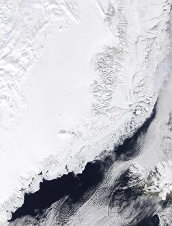
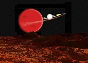
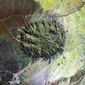
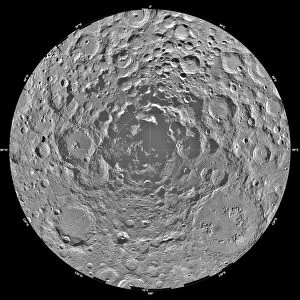
For sale as Licensed Images

Choose your image, Select your licence and Download the media

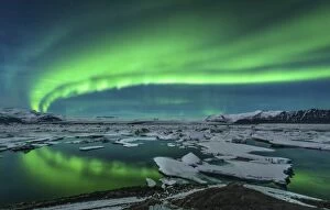
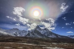
"Journey through Time: Exploring Land Features of the 19th Century" Map of Saint Lucia, 19th Century: Unveiling the hidden gems and natural wonders of this Caribbean paradise. Glen Sannox, Isle of Arran, Scotland, 19th Century: A picturesque valley nestled amidst rugged mountains and enchanting landscapes. Antique map, Isle of Man 19th Century: Tracing the footsteps of history on an island steeped in ancient tales and breathtaking beauty. Celestial sky with Sirius, Orion and Aldebaran shining above Pharilapche Peak in Nepal: Witnessing a celestial spectacle as nature's wonders unite under a starlit Nepalese peak. Portsmouth and Southampton: Coastal cities that blend historical charm with modern vibrancy along England's southern shores. The northern lights dance over the glacier lagoon in Iceland: Surrender to awe-inspiring displays as vibrant hues illuminate Iceland's icy wonderland. A gigantic scarp on the surface of Uranus moon, Miranda: Unveiling cosmic mysteries as we explore distant moons with colossal geological formations. Map of the Scilly Isles: Embark on an adventure to these remote British isles where untouched beauty meets captivating seascapes. Loch na h-Achlaise Reflections, Rannoch Moor Scotland: Immerse yourself in tranquility as mirrored reflections adorn this Scottish loch amidst serene moorlands. Map of Pamlico and Albemarle Sounds: Discovering coastal treasures within North Carolina's intricate network of sounds teeming with wildlife and rich ecosystems. Global mosaic of Mars: Journey beyond our planet to unravel Martian secrets through a mesmerizing global mosaic capturing its diverse terrain like never before seen. Antique Map Switzerland : Delving into Switzerland’s timeless allure through an antique map that unveils its majestic mountains, pristine lakes, and charming towns.