
Lithosphere Collection
The lithosphere, a dynamic layer of the Earth's crust and uppermost mantle, is responsible for shaping our planet's landscape


For sale as Licensed Images
Choose your image, Select your licence and Download the media
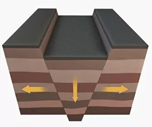
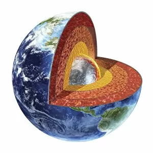
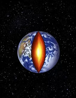
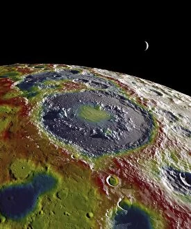
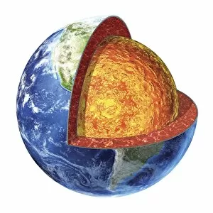
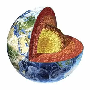
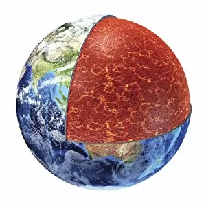
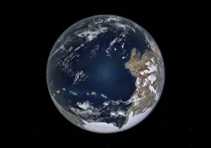
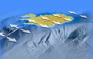
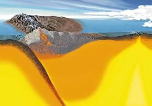
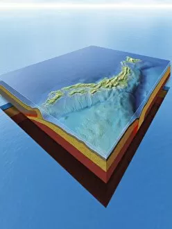
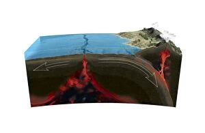
The lithosphere, a dynamic layer of the Earth's crust and uppermost mantle, is responsible for shaping our planet's landscape. Thrust faulting causes blocks of crust to stack up above one another, creating dramatic geological formations. Similarly, collapsed sections of the Earth's crust form rift valleys, showcasing the immense power beneath our feet. Folds forming in the Earth's crust are a testament to the forces at play within the lithosphere. These folds give rise to majestic mountain ranges while volcanic activity brings forth fiery eruptions from stratovolcanoes. The lithosphere holds within it various layers - mantle, asthenosphere, oceanic and continental crusts - each playing a crucial role in maintaining Earth's equilibrium. As we zoom out to view our world today, we witness how these lithospheric plates interact with one another. The Western hemisphere during the Early Jurassic period reveals an ever-changing landscape shaped by plate tectonics. Even beyond our planet lies evidence of lithospheric dynamics; GRAIL free-air gravity map showcases variations on the Moon’s surface caused by its own unique processes. Back on Earth, rising sea levels reshape coastlines as seen in North America where waters surge 330 feet above average levels. Delving deeper into our planet reveals its core through cross-sections that expose its innermost secrets. Traveling back in time to Late Cretaceous period India subcontinent unveils yet another facet of lithospheric evolution. And finally, cutting away at the center of our planet unravels its core – a mysterious realm hidden from plain sight but essential for sustaining life as we know it.