
Liverpool City Collection
Liverpool City, a treasure trove of history and heritage, is beautifully depicted through a collection of old maps that unveil its transformation over the centuries


For sale as Licensed Images
Choose your image, Select your licence and Download the media
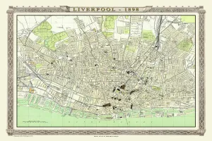
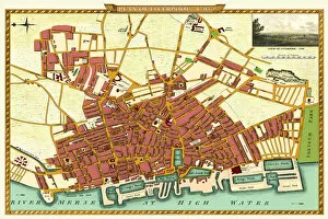
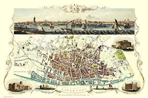
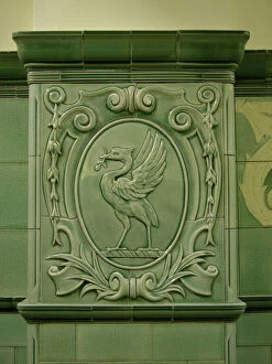
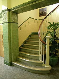
Liverpool City, a treasure trove of history and heritage, is beautifully depicted through a collection of old maps that unveil its transformation over the centuries. The Old Map of Liverpool from 1650 by Thomas Kaye takes us back to the city's early days, revealing its humble beginnings and modest layout. Fast forward to 1725, we witness an evolving landscape in the Old Map of Liverpool as new streets emerge and buildings multiply. The city continues to flourish as seen in the meticulously surveyed Old Map of Liverpool from 1785 by Charles Eyes. This map showcases the intricate network of roads and landmarks that were instrumental in shaping Liverpool's identity. By 1807, captured in Cole and Roper's Old Map of Liverpool, bustling docks become prominent features on this vibrant canvas. As time progresses into the mid-19th century, John Tallis' detailed depiction in his 1851 map highlights a thriving metropolis with grand architecture adorning its streets. Fullarton & Co. 's 1866 rendition further emphasizes this growth with an abundance of structures dotting every corner. Liverpool's maritime heritage comes alive through Liver Bird PLA01_02_121 - a symbol synonymous with the city - standing tall against picturesque waterfront views. Meanwhile, Faience tiled staircase PLA01_02_122 adds another layer to Liverpool's architectural beauty. The Royal Atlas by Bartholomew provides us with an exquisite glimpse into life during Victorian times through their meticulous mapping efforts in 1898. And finally, John Stockdale surveys Liverpool once more in his comprehensive map from 1795; showcasing how it has evolved since his previous survey. With each map serving as a window into different eras gone by, these historical treasures remind us not only of where we came from but also inspire us for what lies ahead. As we explore these old maps together, let us celebrate the rich tapestry woven within every street corner and cherish all that makes Liverpool City truly remarkable.