
Massachusetts Bay Collection
"Exploring the Historic Massachusetts Bay: A Journey Through Time" Discover the enchanting beauty and rich history of Massachusetts Bay


For sale as Licensed Images
Choose your image, Select your licence and Download the media
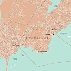
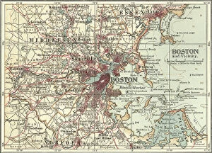
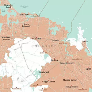
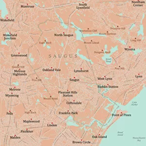
"Exploring the Historic Massachusetts Bay: A Journey Through Time" Discover the enchanting beauty and rich history of Massachusetts Bay, a region that has witnessed centuries of captivating stories. From the charming towns to the bustling city of Boston, this area offers a tapestry of fascinating landmarks and natural wonders. As you venture through Essex Swampscott, immerse yourself in its picturesque landscapes depicted on the Vector Road Map. The lush greenery and serene atmosphere make it an ideal destination for nature enthusiasts seeking tranquility. A south-east view of the great town of Boston in New England in America awaits your exploration. Marvel at its iconic skyline captured in c. 1770-80 etching titled "The Harbour in Boston, Massachusetts. " This historical artwork transports you back to a time when this vibrant city was just beginning to flourish. Embark on a journey beyond borders with "A Map of the Province of New York with part of Pennsylvania and New England. " Uncover how these regions were interconnected during significant periods in history, shaping their shared destinies. Continue your adventure along MA Plymouth Scituate's winding roads depicted on the Vector Road Map. Explore its coastal charm and learn about its role as one of America's oldest settlements, where Pilgrims first set foot on American soil. Delve into Norfolk Cohasset's hidden gems showcased on another section of our Vector Road Map collection. Discover quaint streets lined with historic homes and experience firsthand why this town is known for its maritime heritage. Unravel more treasures as you navigate through MA Essex Lynn's intricate roadways displayed on yet another Vector Road Map. Immerse yourself in Lynn's diverse culture while exploring attractions such as High Rock Tower or strolling along Nahant Beach. Marvel at Marblehead's nautical allure portrayed vividly on our detailed Vector Road Map dedicated to MA Essex Marblehead. Lose yourself amidst charming harbors adorned with sailboats bobbing gently against picturesque backdrops.