
Massachusetts Collection (page 9)
"Discover the Rich History and Natural Beauty of Massachusetts" Embark on a journey through time as we delve into the captivating story of Massachusetts


For sale as Licensed Images
Choose your image, Select your licence and Download the media
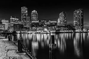
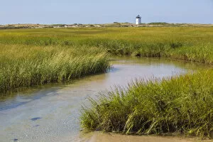
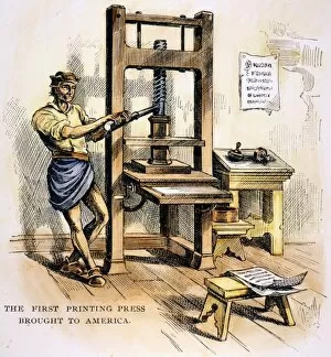
"Discover the Rich History and Natural Beauty of Massachusetts" Embark on a journey through time as we delve into the captivating story of Massachusetts. Step aboard the Mayflower, an iconic symbol of courage and determination, as it sets sail across treacherous seas in 1620. Witness the Pilgrims' arrival at Plymouth Rock, marking a pivotal moment in American history. Venture to Cape Cod, where Chatham Lighthouse stands tall against the picturesque backdrop of New England. Let your senses be captivated by the enchanting allure of Revere Beach's Wonderland, where sun-kissed sands meet crashing waves. Uncover dark chapters from our past as you explore Salem, home to infamous witch trials that shook this quaint town to its core in 1692. Marvel at Provincetown's charm on Cape Cod, where artists find inspiration amidst breathtaking landscapes. Celebrate medical breakthroughs as you learn about Massachusetts' role in pioneering anesthesia during surgery in 1846. Gaze upon Boston Harbor's Nantucket Light Ship standing steadfastly against turbulent waters. Immerse yourself in intellectual wonders within Boston Public Library's serene courtyard at Copley Square—a sanctuary for knowledge seekers throughout generations. As dusk settles over Newburyport skyline along Merrimack River, witness a mesmerizing transformation that paints the sky with vibrant hues. Finally, let your spirit soar as you witness a glorious sunset casting its golden glow over Sagamore Bridge—the gateway to Cape Cod Canal—where nature intertwines seamlessly with human ingenuity. In Massachusetts, every step unveils layers of history and natural splendor waiting to be discovered. From brave pioneers aboard Mayflower to modern-day marvels like Chatham Lighthouse and Boston Public Library—this state is an embodiment of America's rich heritage and endless possibilities.