Middle East Collection

The Middle East, a region steeped in history and rich in cultural heritage, is a captivating tapestry of civilizations

Background imageMiddle East Collection: Medieval Europe at the start of the Crusades

Medieval Europe at the start of the Crusades
Map of Europe at the time of the First Crusade, 1097 AD. Printed color lithograph of a 19th-century illustration

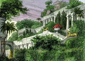
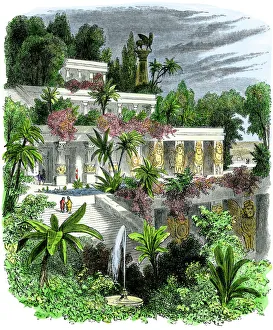
Background imageMiddle East Collection: Hanging gardens of Babylon

Hanging gardens of Babylon
Hanging Gardens of ancient Babylon. Hand-colored woodcut of a 19th-century illustration

Background imageMiddle East Collection: Jesus calming the storm on the Sea of Galilee

Jesus calming the storm on the Sea of Galilee
Jesus calms the waters among frightened disciples in a boat. Hand-colored woodcut of a 19th-century illustration

Background imageMiddle East Collection: Orteliuss map of Ottoman Empire, 1570

Orteliuss map of Ottoman Empire, 1570
Orteliuss map of the Ottoman Empire. This map is from the 1570 first edition of Theatrum orbis terrarum ( Theatre of the World )

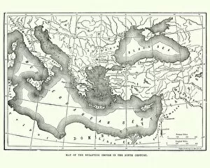
Background imageMiddle East Collection: Map of the Byzantine Empire in the 9th Century

Map of the Byzantine Empire in the 9th Century
Vintage engraving of a Map of the Byzantine Empire in the 9th Century

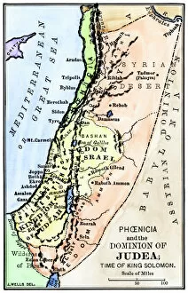
Background imageMiddle East Collection: Map of ancient Palestine kingdoms of Judah and Israel

Map of ancient Palestine kingdoms of Judah and Israel
Map of Phoenicia and Judea in the time of King Solomon, 10th century BC. Hand-colored woodcut of a 19th-century illustration

Background imageMiddle East Collection: Last Supper of Jesus and the Apostles

Last Supper of Jesus and the Apostles
Jesus offering the Disciples wine at the Last Supper. Hand-colored woodcut of a 19th-century illustration

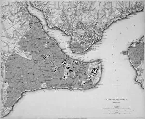
Background imageMiddle East Collection: Antique map of Constantinople, present day Istanbul

Antique map of Constantinople, present day Istanbul

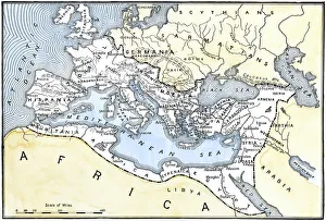
Background imageMiddle East Collection: Map of the Roman Empire

Map of the Roman Empire
Map showing the extent of the Roman Empire. Hand-colored woodcut of a 19th-century illustration

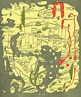
Background imageMiddle East Collection: Anglo-Saxon 10th century world map

Anglo-Saxon 10th century world map
Anglo-Saxon world map, dating from the 10th century. East is top. This map of the known world was probably produced by an Irish monk

Background imageMiddle East Collection: Hanging Gardens of Babylon

Hanging Gardens of Babylon
Babylons Hanging Gardens, one of the Seven Wonders of the ancient world. Hand-colored woodcut of a 19th-century illustration

Background imageMiddle East Collection: RF - Dapple grey Arabian stallion running in desert dunes near Dubai, United Arab

RF - Dapple grey Arabian stallion running in desert dunes near Dubai, United Arab Emirates

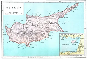
Background imageMiddle East Collection: Map of Cyprus

Map of Cyprus
Vintage 19th Century map of Cyprus in the eastern Mediterranean Sea

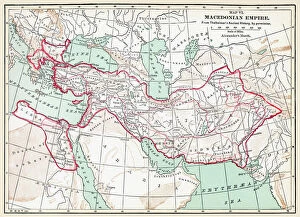
Background imageMiddle East Collection: MAP OF MACEDONIAN EMPIRE. Map of the Macedonian Empire following the conquests of Alexander

MAP OF MACEDONIAN EMPIRE. Map of the Macedonian Empire following the conquests of Alexander the Great, 4th century B.C

Background imageMiddle East Collection: Jesus at Emmaus

Jesus at Emmaus
Jesus blessing bread and wine at Emmaus. Hand-colored woodcut reproductioin of a Karl Muller painting

Background imageMiddle East Collection: Illustrated map of ancient Assyrian empire

Illustrated map of ancient Assyrian empire

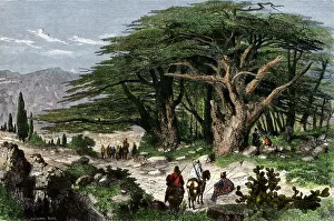
Background imageMiddle East Collection: Cedars of Lebanon

Cedars of Lebanon
Travelers stopping to rest among a grove of cedars in Lebanon. Hand-colored woodcut of a 19th-century illustration

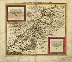
Background imageMiddle East Collection: Map of Palestine, 1588

Map of Palestine, 1588
16th century map of Palestine. North is towards upper right. Published in 1588, this German map shows the geography of Palestine, centred on the area that later become the state of Israel

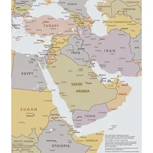
Background imageMiddle East Collection: Political map of The Middle East

Political map of The Middle East
Vector illustration of the policital map of The Middle East Reference map was created by the US Central Intelligence Agency

Background imageMiddle East Collection: U. S. Air Force C-17 Globemasters in flight

U. S. Air Force C-17 Globemasters in flight
U.S. Air Force C-17 Globemasters like these provided intra-theater heavy airlift support, helping to sustain operations throughout Afghanistan, Iraq and the Horn of Africa

Background imageMiddle East Collection: A British Army Foden 6x6 heavy recovery vehicle

A British Army Foden 6x6 heavy recovery vehicle

Background imageMiddle East Collection: Jews crossing the Jordan River with the Ark of the Covenant

Jews crossing the Jordan River with the Ark of the Covenant
Hebrews carrying the Ark of the Covenant across the Jordan River into the Promised Land. Hand-colored woodcut of a 19th-century illustration

Background imageMiddle East Collection: Pyramid and Great Sphinx in Giza, Egypt

Pyramid and Great Sphinx in Giza, Egypt

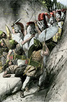
Background imageMiddle East Collection: Ancient Greeks holding the pass of Thermopylae, 480 BC

Ancient Greeks holding the pass of Thermopylae, 480 BC
Greeks under Leonidas holding off the Persian invasion at Thermopylae, 480 BC. Hand-colored halftone reproduction of a 19th-century illustration

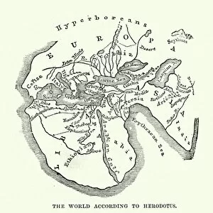
Background imageMiddle East Collection: Map of the Ancient World according to Herodotus

Map of the Ancient World according to Herodotus
Vintage engraving of a Map of the Ancient World according to Herodotus. Herodotus was a Greek historian who was born in Halicarnassus, Caria and lived in the fifth century BC

Background imageMiddle East Collection: RFA Diligence During a Counter Piracy Boarding Exercise

RFA Diligence During a Counter Piracy Boarding Exercise
RFA Diligence is the target in a boarding training exercise conducted by teams from HMS Somerset and RFA Fort Victoria. Each ship took turns to close in on the target vessel

Background imageMiddle East Collection: Christ Angel John the Baptist Head Golden Icon Saint Georges Greek Orthodox

Christ Angel John the Baptist Head Golden Icon Saint Georges Greek Orthodox Church Madaba Jordan. Church was created in the late 1800s and houses many famous mosaics

Background imageMiddle East Collection: Saint Michael Angels Golden Icon Saint Georges Greek Orthodox Church Madaba Jordan

Saint Michael Angels Golden Icon Saint Georges Greek Orthodox Church Madaba Jordan. Church was created in the late 1800s and houses many famous mosaics

Background imageMiddle East Collection: Africa Political Map

Africa Political Map
Antique illustration of a Africa Political Map from 1893

Background imageMiddle East Collection: Flamingo flock, Ras al Khor Sanctuary, Dubai

Flamingo flock, Ras al Khor Sanctuary, Dubai
Ras Al Khor wildlife Sanctuary. Rakws is located at the head of the 14Km long watercourse known as Dubai Creek, and covers an area of 620 hectares featuring sabkhas saline flats

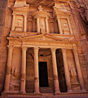
Background imageMiddle East Collection: Al Khazneh (The Treasury), Petra, Jordan

Al Khazneh (The Treasury), Petra, Jordan
This little wonder measures 82 feet (25 meters) wide and 128 feet (39 meters) high. Its an absolute stunner and the first thing you see after walking through the canyon

Background imageMiddle East Collection: Mideast map during the Crusades

Mideast map during the Crusades
Map of the Middle East at the time of the Crusades. Printed color lithograph

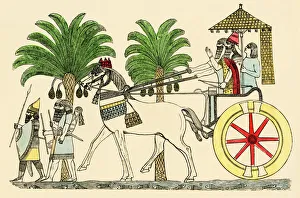
Background imageMiddle East Collection: Assyrian king in his chariot

Assyrian king in his chariot returning from battle. Color lithograph reproduction of a bas-relief sculpture from Nineveh

Background imageMiddle East Collection: Jewish high priest and Levite in ancient Israel

Jewish high priest and Levite in ancient Israel
Jewish high priest and Levite conducting a ceremony, ancient Israel. Antique hand-colored woodcut

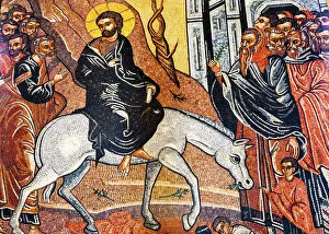
Background imageMiddle East Collection: Jesus Christ Palm Sunday Donkey Mosaic Saint Georges Greek Orthodox Church Madaba Jordan

Jesus Christ Palm Sunday Donkey Mosaic Saint Georges Greek Orthodox Church Madaba Jordan. Church was created in the late 1800s and houses many famous mosaics

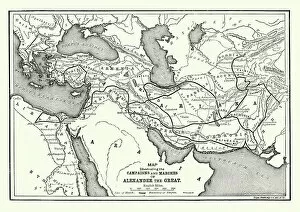
Background imageMiddle East Collection: Ancient History - Map of Alexander the Great Campaigns

Ancient History - Map of Alexander the Great Campaigns
Vintage engraving of a map of the campaigns and marches of Alexander the Great

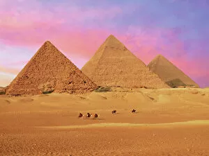
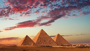
Background imageMiddle East Collection: Egypt, Cairo, Giza, View of all three Great Pyramids at sunset

Egypt, Cairo, Giza, View of all three Great Pyramids at sunset

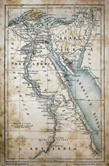
Background imageMiddle East Collection: Map of Egypt

Map of Egypt
Illustration of a Map of Egypt

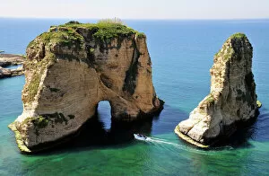
Background imageMiddle East Collection: Excursion boat off the Pigeons Rock, Grotte aux Pigeons, limestone rocks eroded by wind

Excursion boat off the Pigeons Rock, Grotte aux Pigeons, limestone rocks eroded by wind and weather in the Raouche district, Beirut, Lebanon, Middle East, Asia

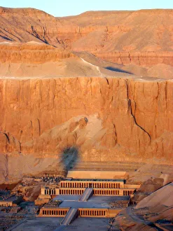
Background imageMiddle East Collection: Queen Hatshepsuts Temple, Luxor, Egypt

Queen Hatshepsuts Temple, Luxor, Egypt
Aerial view from hot air balloon of Queen Hatsheputs Temple, Valley of the Queens

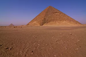
Background imageMiddle East Collection: The Red Pyramid

The Red Pyramid
View of the Red Pyramid at Dahshur necropolis near Cairo, Egypt

Background imageMiddle East Collection: Sunset at the Pyramids, Giza, Cairo, Egypt

Sunset at the Pyramids, Giza, Cairo, Egypt
A sunset from the Pyramids at Giza, Cairo, Egypt

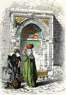
Background imageMiddle East Collection: Palestinian women in Jerusalem, 1800s

Palestinian women in Jerusalem, 1800s
Arab women getting water from a fountain in Jerusalem, 1800s. Hand-colored engraving of a 19th-century illustration

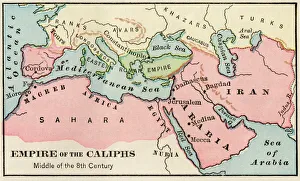
Background imageMiddle East Collection: Arab empire, mid-700s

Arab empire, mid-700s
Empire of the Arab Caliphs, middle of the 8th century. Printed color lithograph

Background imageMiddle East Collection: Jesus Praying in the Garden

Jesus Praying in the Garden
Vintage engraving from the 1870 of a scene from the New Testament by Gustave Dore showing Jesus Praying in the Garden

Background imageMiddle East Collection: Mary Jesus Icon Greek Orthodox Church of the Nativity Altar Nave Bethlehem West Bank Palestine

Mary Jesus Icon Greek Orthodox Church of the Nativity Altar Nave Bethlehem West Bank Palestine. Chruch located above cave/grotto where Jesus was born

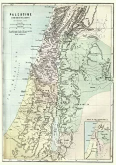
Background imageMiddle East Collection: Map of Palestine in the time of Jesus Christ

Map of Palestine in the time of Jesus Christ
Vintage engraving of Map of Palestine in the time of Jesus Christ

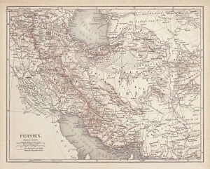
Background imageMiddle East Collection: Ancient map of Persia, lithograph, published in 1877

Ancient map of Persia, lithograph, published in 1877
Ancient map of Persia. Lithograph, published in 1877

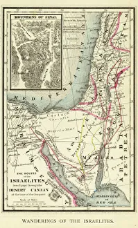
Background imageMiddle East Collection: Wanderings of the Israelites Map Engraving

Wanderings of the Israelites Map Engraving
Engraved illustration of Wanderings of the Israelites Map Engraving from The Popular Pictorial Bible, Containing the Old and New Testaments, Published in 1862. Copyright has expired on this artwork

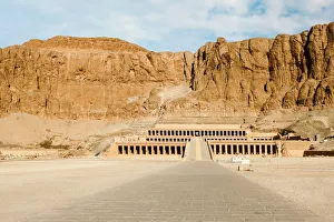
Background imageMiddle East Collection: Mortuary Temple of Hatshepsut, Luxor, Egypt

Mortuary Temple of Hatshepsut, Luxor, Egypt
Mortuary Temple of Hatshepsut, Deir el-Bahari, Theban Necropolis (UNESCO World Heritage List, 1979), Luxor, Egypt. Egyptian civilisation, New Kingdom, Dynasty XVIII

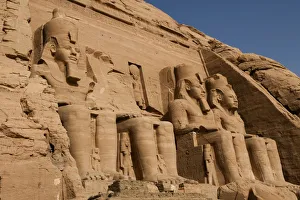
Background imageMiddle East Collection: Abu Simbel temple

Abu Simbel temple
View of the massive rock Sun Temple Of Ramses II at Abu Simbel situated on the western bank of Lake Nasser

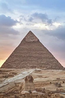
Background imageMiddle East Collection: Sunset, Sphinx (foreground), The Pyramid of Chephren (background), The Pyramids of Giza

Sunset, Sphinx (foreground), The Pyramid of Chephren (background), The Pyramids of Giza
Giza, Egypt

Background imageMiddle East Collection: Persian pharmacy, 13th century artwork

Persian pharmacy, 13th century artwork
Persian pharmacy. 13th century Arabic artwork entitled The Preparation of Medicine from Honey. This image was produced in Baghdad, Iraq, whilst it was still part of the Persian Empire

Background imageMiddle East Collection: Persian Royal Palace in Teheran, 1800s

Persian Royal Palace in Teheran, 1800s
Anderoon, the womens apartment in the Persian Royal Palace, Teheran, Iran, 1800s. Hand-colored woodcut of a 19th-century illustration

Background imageMiddle East Collection: Arabs fighting tigers in the desert

Arabs fighting tigers in the desert
Tigers attacking an Arab caravan in the desert. Color lithograph reproduction of a 19th-century illustration

Background imageMiddle East Collection: Church of the Holy Sepulcher in Jerusalem

Church of the Holy Sepulcher in Jerusalem
Marketplace in Jerusalem at the Church of the Holy Sepulcher, 1800s. Hand-colored woodcut of a 19th-century illustration

Background imageMiddle East Collection: Seljuk Turks defeated at Dorylaeum, First Crusade

Seljuk Turks defeated at Dorylaeum, First Crusade
Crusaders under Godfrey of Bouillon, defeating Muslim forces of Sultan Kilij Arslan at Dorylaeum in Asia Minor, 1097. Hand-colored woodcut of a 19th-century illustration

Background imageMiddle East Collection: PANC2A-00003

PANC2A-00003
Map of the empire of Alexander the Great in 323 BC. Printed color lithograph of a 19th-century illustration

Background imageMiddle East Collection: Alexanders army prepares to destroy Persepolis

Alexanders army prepares to destroy Persepolis
Thais suggests that Alexander burn Persepolis, capitol of Persia, in 331 BC. Hand-colored halftone ireproduction of a 19th-century llustration

Background imageMiddle East Collection: Extent of the Persian empire

Extent of the Persian empire
Map of the ancient Persian empire. Printed color lithograph of a 19th-century illustration

Background imageMiddle East Collection: Ancient Mesopotamia

Ancient Mesopotamia
Map of the ancient Tigris and Euphrates region. Printed color 19th-century illustration

Background imageMiddle East Collection: Southern Palestine in ancient times

Southern Palestine in ancient times
Map of southern Palestine in ancient times. Printed color lithograph of a 19th-century illustration

Background imageMiddle East Collection: Roman Empire, circa 200 AD

Roman Empire, circa 200 AD
Map of the Roman Empire in the third century. Printed color lithograph of a 19th-century illustration

Background imageMiddle East Collection: Israel, Jerusalem, Dome of the Rock

Israel, Jerusalem, Dome of the Rock

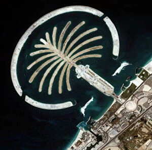
Background imageMiddle East Collection: Palm Islands construction, Dubai

Palm Islands construction, Dubai
Luxury island construction, Dubai. Ikonos satellite image of an artificial palm tree-shaped island created in the Persian Gulf, off the coast of Dubai. This is the Jumeirah Palm resort

Background imageMiddle East Collection: Syrian Desert, satellite image

Syrian Desert, satellite image. North is at top. Vegetation is red and dark green, while arid areas of sand and rock are light green and light blue. Water is blue

Background imageMiddle East Collection: Saudi Arabian desert

Saudi Arabian desert. Combined infrared and visible satellite image of the Jabal Tuwayq ridge (down centre) in the rocky desert region of Najd in central Saudi Arabia. North is at top

Background imageMiddle East Collection: Egyptian Locust - adult

Egyptian Locust - adult
PPG-1704 Egyptian Locust - adult. Anacridium aegyptum Pascal Goetgheluck Please note that prints are for personal display purposes only and may not be reproduced in any way

Background imageMiddle East Collection: Jaw of a 4 metre tiger shark, replaceable teeth in 9 rows Egypt Red Sea

Jaw of a 4 metre tiger shark, replaceable teeth in 9 rows Egypt Red Sea
KA-516 Jaw of a 4 metre tiger shark, replaceable teeth in 9 rows Egypt Red Sea Kurt Amsler Please note that prints are for personal display purposes only and may not be reproduced in any way

Background imageMiddle East Collection: Deir al-Bahri, Hatshepsut

Deir al-Bahri, Hatshepsut
Dayr el-Bahari or Dayr el-Bahri is a complex of temples and tombs on the west bank of the Nile. The complex is part of UNESCO World Heritage Sites

Background imageMiddle East Collection: Monumental Arch, Palmyra, Syria

Monumental Arch, Palmyra, Syria
Sunset at the Unesco World heritage Site. Before the Syrian conflict started in 2011, more than 150, 000 tourists visited the city of Palmyra every year

Background imageMiddle East Collection: Deserted alleyway with Israeli flag hanging from a window above an archway, Muslim Quarter

Deserted alleyway with Israeli flag hanging from a window above an archway, Muslim Quarter, Old City, Jerusalem, Middle East

Background imageMiddle East Collection: Plan of the old city Alexandria 1895

Plan of the old city Alexandria 1895
Meyers Konversations-Lexikon. Ein Nachschlagewerk des allgemeinen Wissens, 5th edition 17 volumes Bibliographisches Institut - Leipzig 1895-1897

Background imageMiddle East Collection: Persepolis ancient columns at sunset, Iran

Persepolis ancient columns at sunset, Iran
Persepolis was the ceremonial capital of the Achaemenid Empire (ca. 550 u2013330 BC). It is situated 60 km northeast of the city of Shiraz in Fars Province, Iran

Background imageMiddle East Collection: Israel, Massada. RUins of Massada

Israel, Massada. RUins of Massada

Background imageMiddle East Collection: Middle East, Israel, Nazareth, Jersualem tote bag for sale in market

Middle East, Israel, Nazareth, Jersualem tote bag for sale in market

Background imageMiddle East Collection: Christmas star as planetary conjunction

Christmas star as planetary conjunction. Artwork of a possible Christmas Star in the night sky of the year 7 BC. Traces of the planetary conjunction of Jupiter

Background imageMiddle East Collection: Earth from space, artwork

Earth from space, artwork. View of the Earth centred on 165 degrees East, showing Russia (top left), Southeast Asia (centre left), China and Japan (upper left), Australia (lower left)

Background imageMiddle East Collection: GMDE2A-00054

GMDE2A-00054
Map of Arabia, 1870s. Printed color lithograph, 19th century

Background imageMiddle East Collection: Africa, Ethiopia

Africa, Ethiopia
Jordan, Madaba. Mosiac portrait of Jesus Christ in sanctuary of Greek Orthodox Church of St. George, Madaba, Jordan

Background imageMiddle East Collection: The Burj Dubai the worlds tallest building in Dubai

The Burj Dubai the worlds tallest building in Dubai
Ashley Cooper / SpecialistStock

Background imageMiddle East Collection: Phoenician ship in the Mediterranean

Phoenician ship in the Mediterranean
Phoenician galley passing the Rock of Gibraltar. Hand-colored woodcut of a 19th-century illustration

Background imageMiddle East Collection: Xerxes bridge of boats across the Hellespont, 480 BC

Xerxes bridge of boats across the Hellespont, 480 BC
Bridge of boats built by Xerxes Persian army across the Hellespont to invade Greek territory, 480 BC. Hand-colored woodcut of a 19th-century illustration

Background imageMiddle East Collection: Head portrait of grey Arabian stallion running in desert dunes near Dubai, United

Head portrait of grey Arabian stallion running in desert dunes near Dubai, United Arab Emirates


For sale as Licensed Images

Choose your image, Select your licence and Download the media

The Middle East, a region steeped in history and rich in cultural heritage, is a captivating tapestry of civilizations. From the Hanging Gardens of Babylon to the Map of the Byzantine Empire in the 9th Century, this land has witnessed countless wonders. In biblical tales, we find Jesus calming the storm on the Sea of Galilee, showcasing his divine power over nature's elements. As Medieval Europe embarked on its Crusades, maps depicted its intricate connections with this enigmatic realm. Ancient Palestine kingdoms of Judah and Israel come alive through an ancient map that unveils their boundaries and historical significance. The Anglo-Saxon 10th-century world map reveals how knowledge about this region spread across continents during those times. Orteliuss' map from 1570 showcases the vast Ottoman Empire at its zenith—a testament to its dominance over lands stretching far beyond our imagination. Meanwhile, a glimpse into history unfolds as we explore maps depicting both Roman Empire's expanse and Cyprus' strategic location. The Last Supper immortalizes Jesus and his apostles sharing their final meal together—an event forever etched into religious consciousness. And who can forget the mighty Assyrian king commanding his chariot with unparalleled might? Finally, we delve into Alexander the Great's conquests through a detailed map displaying Macedonia's empire—truly awe-inspiring feats achieved by one man. These hints offer just a glimpse into what makes the Middle East so fascinating—the convergence of empires, religions, cultures that have shaped it throughout millennia, and is a treasure trove awaiting exploration for those captivated by history's allure.

© Copyright Media Storehouse, All Rights Reserved 2003 - 2024
Facebook     Pinterest     Card Payments