
National Border Collection (#2)
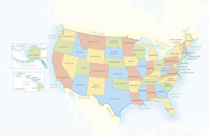
"Tracing the Boundaries: A Journey through National Borders" Exploring the vastness of America with a highly detailed USA Road Map


For sale as Licensed Images
Choose your image, Select your licence and Download the media
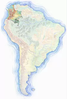
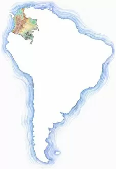
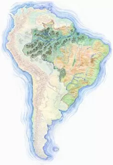
"Tracing the Boundaries: A Journey through National Borders" Exploring the vastness of America with a highly detailed USA Road Map, where state lines define unity and diversity. Unveiling history's secrets with an old map of Europe, witnessing how national borders have evolved over time. Stepping back in time to Western Europe in 1883, as borders shifted like tides on a captivating antique map. Delving into European history further with a glimpse at Western Europe in 1867, tracing the intricate boundaries that shaped nations. Hand-drawn precision unveils Brazil's place within South America on a highly detailed map adorned with compass rose and equator. Embarking on an Italian journey through time, from the elegant streets of 1855 to the changing borders of 1863 and even back to Napoleon's era in 1812. Marveling at an exquisite Antique Map of Persia and Arabia from 1730, reminding us that national borders transcend continents and centuries. Discovering Central Europe's rich tapestry through an old map that reveals its diverse countries intertwined by shared histories yet distinct identities. Rewinding to Europe in 1829 when empires clashed but also gave birth to new nations; witness how borders became both barriers and bridges between cultures. Admiring an Antique Map of Italy as it captures not only geographical details but also echoes tales of ancient civilizations shaping this enchanting land. In these maps lie stories untold—of conquests won or lost, alliances forged or broken—and they remind us that they are more than mere lines.