
Old Map Of The World Collection

"Journey through Time

Background imageOld Map Of The World Collection: Old Map of the World 1980

Old Map of the World 1980
WMY1980

Background imageOld Map Of The World Collection: Old Map of the World 1963

Old Map of the World 1963
WMY1963

Background imageOld Map Of The World Collection: Old Map of the World 1914

Old Map of the World 1914
WMY1914

Background imageOld Map Of The World Collection: Old Map of the World 1988

Old Map of the World 1988
WMY1988

Background imageOld Map Of The World Collection: Old Map of The World 1881

Old Map of The World 1881
Irish Land War (1879-1882); home rule movement led by Parnell. End of First Boer War (1880-1881). French establish a protectorate in Tunisia

Background imageOld Map Of The World Collection: Old Map of the World 1982

Old Map of the World 1982
WMY1982

Background imageOld Map Of The World Collection: Old Map of the World on Mercators Projection 1851 Showing the Voyages of Captain Cook by John Tallis

Old Map of the World on Mercators Projection 1851 Showing the Voyages of Captain Cook by John Tallis
A fine facimile artworked from an antique original map of The World on Mercators Projection Showing the Voyages of Capatain Cook

Background imageOld Map Of The World Collection: Old Map of the World 1945

Old Map of the World 1945
WMY1945

Background imageOld Map Of The World Collection: Old Map of the World 1940

Old Map of the World 1940
WMY1940

Background imageOld Map Of The World Collection: Old Map of the World 1958

Old Map of the World 1958
WMY1958

Background imageOld Map Of The World Collection: Old Map of the World 1966

Old Map of the World 1966
WMY1966

Background imageOld Map Of The World Collection: Old Map of the World 1939

Old Map of the World 1939
WMY1939

Background imageOld Map Of The World Collection: Old Map of the World 1970

Old Map of the World 1970
WMY1970

Background imageOld Map Of The World Collection: Old Map of the World 1965

Old Map of the World 1965
WMY1965

Background imageOld Map Of The World Collection: Old Map of the World 1950

Old Map of the World 1950
WMY1950

Background imageOld Map Of The World Collection: Old Map of the World 1908

Old Map of the World 1908
WMY1908

Background imageOld Map Of The World Collection: Old Map of the World 1871

Old Map of the World 1871
THE WORLD THAT WAS 1871 - End of Franco-Prussian War; Germany unified, and Empire formed; Third Republic in France; suppression of the Paris Commune. British Columbia joins Canada. Chicago fires

Background imageOld Map Of The World Collection: Old Map of The World 1879

Old Map of The World 1879
THE WORLD THAT WAS 1878 - Irish Land War (1879-1882). Second Afghan War gives Britain control over Afghanistan. Dual Alliance between Germany and Austria-Hungary. Anglo-Zulu War

Background imageOld Map Of The World Collection: Old Map of the World 1896

Old Map of the World 1896
WMY1896

Background imageOld Map Of The World Collection: Old Map of the World 1981

Old Map of the World 1981
WMY1981

Background imageOld Map Of The World Collection: Old Map of The World 1864

Old Map of The World 1864
THE WORLD THAT WAS 1864 - American Civil War (1861-1865). Prussia defeats Denmark. Russia suppresses Polish revolt. Taiping Rebellion in China (1851-1864), the second most destructive war in history

Background imageOld Map Of The World Collection: Old Map of the World 1959

Old Map of the World 1959
WMY1959

Background imageOld Map Of The World Collection: Old Map of the World 1906

Old Map of the World 1906
WMY1906

Background imageOld Map Of The World Collection: Old Map of the World 1973

Old Map of the World 1973
WMY1973

Background imageOld Map Of The World Collection: Old Map of the World 1900

Old Map of the World 1900
WMY1900

Background imageOld Map Of The World Collection: Old Map of the World 1875

Old Map of the World 1875
THE WORLD THAT WAS 1875 - Britain under Disraeli buys the Suez Canal to protect the sea route to India. USA expands settlement into Oregon. Egyptian invasion of Ethiopia

Background imageOld Map Of The World Collection: Map of The British Empire by Fullarton & Co 1850

Map of The British Empire by Fullarton & Co 1850
Fine reproduction of the attractive World Map showing the British Empire. Mapmaker John Bartholomew and publishers Fullarton were then the first to use red or pink to indicate British possessions

Background imageOld Map Of The World Collection: Old Map of the World 1957

Old Map of the World 1957
WMY1957

Background imageOld Map Of The World Collection: Old Map of the World 1893

Old Map of the World 1893
WMY1893

Background imageOld Map Of The World Collection: Old Map of the World 1951

Old Map of the World 1951
WMY1951

Background imageOld Map Of The World Collection: Old Map of the World 1931

Old Map of the World 1931
WMY1931

Background imageOld Map Of The World Collection: Old Map of the World 1942

Old Map of the World 1942
WMY1942

Background imageOld Map Of The World Collection: The World on Mercators Projection 1851

The World on Mercators Projection 1851
A fine facimile artworked from an antique original map of The World on Mercators Projection, issued as part of the 1851 edition of John Tallis and Companys " The Illustrated Atlas


For sale as Licensed Images

Choose your image, Select your licence and Download the media

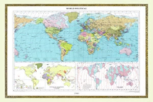
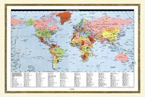
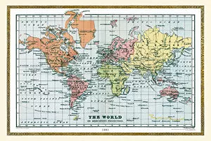
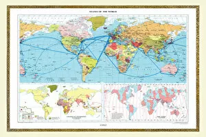
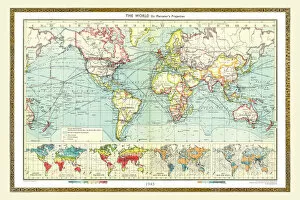
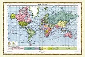
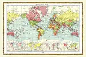
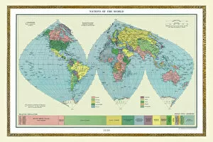
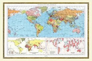
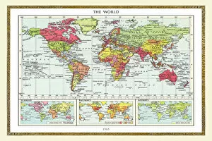
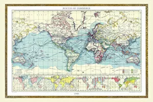
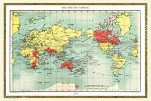
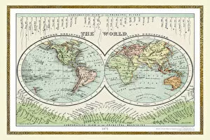
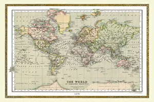
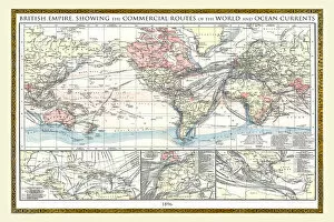
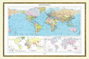
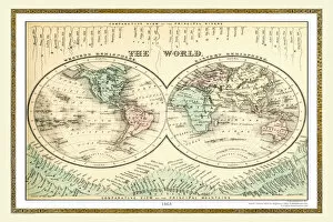
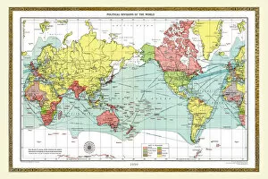
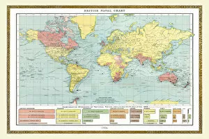
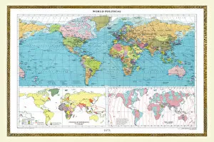
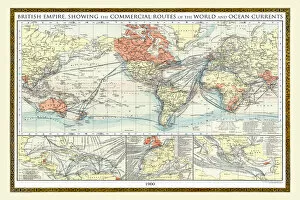
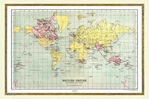
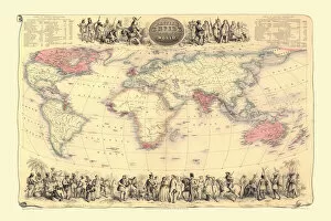
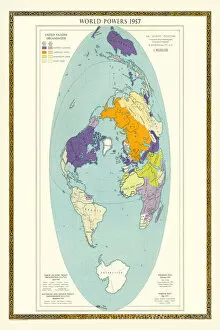
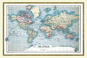
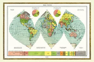
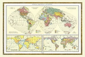
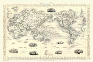
"Journey through Time: Exploring the Fascinating Old Maps of the World" Step back in time and embark on a captivating voyage as we delve into the enchanting world of old maps. These remarkable artifacts offer glimpses into bygone eras, showcasing how our understanding of the world has evolved over centuries. From 1980 to 1881, let's unravel the secrets held within these vintage cartographic treasures. In 1980, an "Old Map of the World" emerged, capturing a snapshot of global boundaries during that era. Fast forward to 1914; another map reveals a world on the brink of cataclysmic change as tensions mount before World War I. Traveling further back in time to 1963, witness geopolitical shifts amidst Cold War rivalries and decolonization movements. Meanwhile, John Tallis' masterpiece from 1851 showcases Captain Cook's legendary voyages across uncharted waters—an ode to exploration and discovery. The year 1945 marks a pivotal moment with borders redrawn after World War II—a testament to humanity's resilience amid chaos. The subsequent decades bring us closer to modern times—1970 presents an evolving geopolitical landscape while 1965 captures nations grappling with new challenges emerging from post-colonial independence. Venturing deeper into history, we encounter an exquisite depiction from 1950—a glimpse at mid-century aspirations for progress and unity amidst lingering divisions. Rewinding further still brings us face-to-face with a mesmerizing map dating back to1908—an era marked by imperial ambitions and technological advancements shaping our perception of Earth itself. As we approach1871—the dawn of industrialization—we witness Europe transforming under its influence while colonial empires reach their zeniths worldwide. Finally, journeying towards recent pasts unveils maps from1988 and1881—showcasing shifting alliances during turbulent periods in global politics. These old maps are not mere ink on paper.