
Ortelius Abraham Collection
Abraham Ortelius, a renowned cartographer of the 16th century, left an indelible mark on the world with his exceptional maps and engravings


For sale as Licensed Images
Choose your image, Select your licence and Download the media
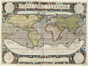
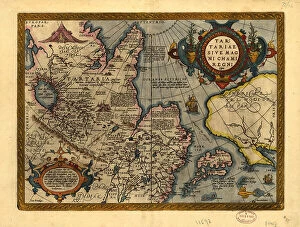
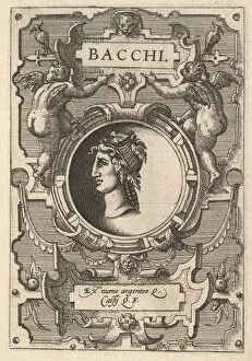
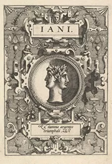
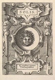
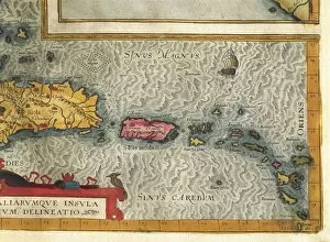
Abraham Ortelius, a renowned cartographer of the 16th century, left an indelible mark on the world with his exceptional maps and engravings. One such masterpiece is his Map of Mediterranean Islands from 1570, which showcases his meticulous attention to detail and artistic flair. In this map, we can see a fascinating Detail of Zerbi that captivates our imagination. Ortelius's talent extended beyond cartography as he also delved into the realm of mythology. His series Deorum dearumque features stunning busts surrounded by intricate strapwork. Among them are Busts of Bacchus, Janus, and Sol - each exuding their own unique aura. The Theatrum Orbis Terrarum by Ortelius provides us with invaluable insights into various regions during that era. Piedmont and Western Liguria Regions come alive in vibrant copper engravings from 1528-1598 edition. Similarly, the Duchy of Milan and neighboring regions are meticulously depicted in a map by Giovanni Giorgio Settala from the same publication. Jan Baptist Vrients' contribution to Theatrum Orbis Terrarum cannot be overlooked either; his Copper engraving presents The Republic of Genoa in all its glory in 1608. Moreover, Ortelius's Map of Island Hispaniola takes us on a journey through Santo Domingo, Puerto Rico, and part of Antilles - showcasing not only geographical accuracy but also cultural richness. Lastly, Giacomo Gastaldi's Lombardy and Piedmont Regions map adds another layer to Ortelius's legacy with its detailed copper engraving featured in later editions. Abraham Ortelius was truly a visionary whose works continue to inspire awe even today.