
Portulan Collection
"Exploring the World: The Fascinating Portulan Charts of Joan Martines" Step back in time and immerse yourself in the intricate world charts

For sale as Licensed Images
Choose your image, Select your licence and Download the media
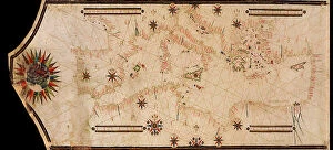
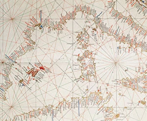
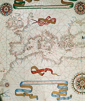
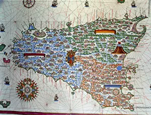
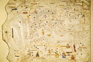
"Exploring the World: The Fascinating Portulan Charts of Joan Martines" Step back in time and immerse yourself in the intricate world charts, meticulously crafted maps that guided sailors across vast oceans. Dating back to the 16th century, these cartographic masterpieces provided invaluable navigation tools for seafarers venturing into uncharted territories. One such remarkable example is the Map of Europe and coasts of North Africa from 1587. This detailed portrayal showcases the intricate coastlines, highlighting major ports and landmarks along the way. Similarly, the Catalan Atlas (1375) offers a glimpse into Spain and North Africa's geographical intricacies during this era. Joan Martines' Atlas takes us on an extraordinary journey through different continents. His Portulan chart of Sicily reveals its coastal features with utmost precision, while his depiction of South America captures Panama's essence as a pivotal point between two great oceans. Venturing further westward, Martines presents a captivating Portulan chart showcasing Central America and Caribbean islands – essential references for explorers seeking new trade routes or conquests. Meanwhile, his West Coast chart unveils Peru's mystique as part of an emerging New World. The Mediterranean Sea comes alive in another one of Martines' creations – a mesmerizing Portulan chart displaying its numerous islands in exquisite detail. From Corsica to Crete, each island is carefully outlined alongside vital navigational information. Not forgetting Africa's western shores; Martines provides insight into their contours through yet another striking Portulan chart. These maps were indispensable for traders navigating treacherous waters en route to rich African markets. Lastly, we encounter a stunning depiction capturing the allure of Canary Islands and Madeira archipelagos – crucial stopovers for European ships embarking on transatlantic voyages towards newfound lands across the Atlantic Ocean.