
Ptolemaeus Collection
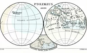
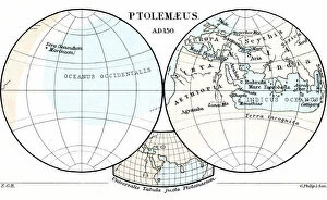
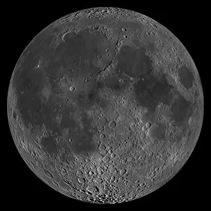
Ptolemaeus, also known as Claudius Ptolemaeus, was a prominent figure in ancient geography and cartography


For sale as Licensed Images
Choose your image, Select your licence and Download the media
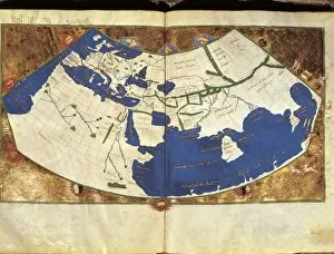
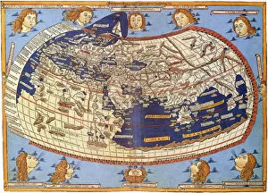
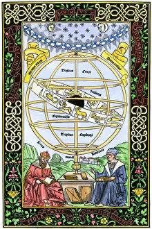
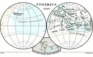
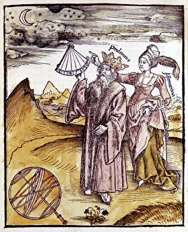
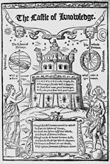
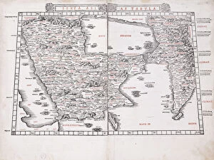
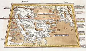
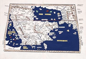
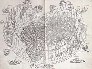
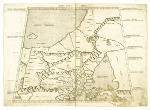
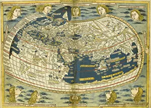
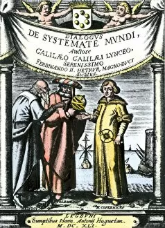
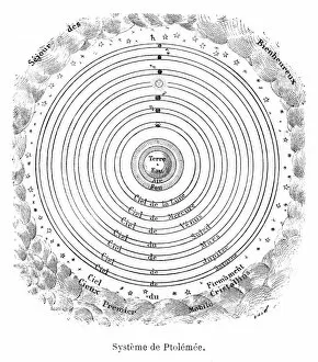
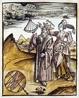
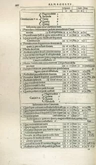
Ptolemaeus, also known as Claudius Ptolemaeus, was a prominent figure in ancient geography and cartography. Born around AD 100, his contributions to the field of mapmaking have had a lasting impact on our understanding of the world. One of Ptolemy's most famous works is the Ptolemy World Map from 1467. This intricate map showcased his knowledge of various regions and their geographical features. It served as a foundation for future explorations and discoveries. In 1556, Robert Recorde featured Ptolemy's work in "The Castle of Knowledge. " The frontispiece depicted Ptolemy surrounded by symbols representing different branches of science, highlighting his influence on multiple disciplines. Ptolemy's maps continued to be reproduced throughout history. The Sexta Asiae Tabula from 1511 and its hand-colored counterpart from 1541 demonstrated the enduring popularity and relevance of his cartographic techniques. His expertise extended beyond Asia; he also created maps depicting Arabia, the Persian Gulf, Indian Sea, Europe (Octava Europe Tabula), Muscovy (Map of Muscovy by Ptolemy), and even an overall Map of the World in 1511. These detailed representations provided invaluable information for navigators and explorers during that era. Another significant collaboration involving Ptolemy was with Boethius when they worked together on an atlas commissioned by Borso d'Este around 1466-1467. Germanus Nicolaus played a crucial role in illustrating this atlas based on their combined knowledge. Ptolemys' legacy lives on through these historical artifacts that showcase both his skill as a geographer and his dedication to advancing scientific knowledge.