Satellite View Collection

"Exploring the Beauty of Earth: A Captivating Satellite View" Witnessing the breathtaking sunrise over Australia from space

Background imageSatellite View Collection: Sunrise over Australia from space

Sunrise over Australia from space with city lights visible.The globe is a composite of 3 images. Earth map images courtesy of NASA

Background imageSatellite View Collection: Northern Ireland, United Kingdom, Relief Map

Northern Ireland, United Kingdom, Relief Map
Relief map of Northern Ireland, United Kingdom. This image was compiled from data acquired by LANDSAT 5 & 7 satellites combined with elevation data

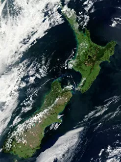
Background imageSatellite View Collection: Satellite view of New Zealand

Satellite view of New Zealand
October 23, 2002 - This stunning true-color image provides a rare, cloud-free look at the island nation of New Zealand, including most of its North and South Islands

Background imageSatellite View Collection: Fully lit Earth centered on the North Pole

Fully lit Earth centered on the North Pole

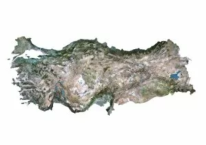
Background imageSatellite View Collection: Turkey, Satellite Image

Turkey, Satellite Image
Satellite view of Turkey. This image was compiled from data acquired by LANDSAT satellite

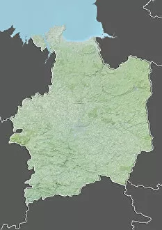
Background imageSatellite View Collection: Departement of Ille-et-Vilaine, France, Relief Map

Departement of Ille-et-Vilaine, France, Relief Map
Relief map of the departement of Ille-et-Vilaine, France. It is bordered by the English Channel to the north. This image was compiled from data acquired by LANDSAT 5 & 7 satellites combined with

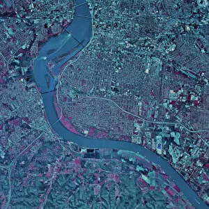
Background imageSatellite View Collection: Satellite view of Louisville, Kentucky

Satellite view of Louisville, Kentucky

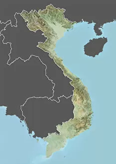
Background imageSatellite View Collection: Vietnam, Relief Map with Border and Mask

Vietnam, Relief Map with Border and Mask
Relief map of Vietnam (with border and mask). This image was compiled from data acquired by landsat 5 & 7 satellites combined with elevation data

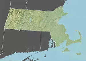
Background imageSatellite View Collection: State of Massachusetts, United States, Relief Map

State of Massachusetts, United States, Relief Map
Relief map of the State of Massachusetts, United States. This image was compiled from data acquired by LANDSAT 5 & 7 satellites combined with elevation data

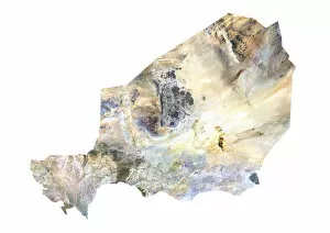
Background imageSatellite View Collection: Niger, Satellite Image

Niger, Satellite Image
Satellite view of Niger. This image was compiled from data acquired by LANDSAT satellite

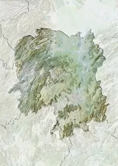
Background imageSatellite View Collection: Province of Hunan, China, Relief Map

Province of Hunan, China, Relief Map
Relief map of the province of Hunan, China. This image was compiled from data acquired by LANDSAT 5 & 7 satellites combined with elevation data

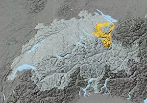
Background imageSatellite View Collection: Canton of Appenzell Ausserrhoden, Switzerland, Relief Map

Canton of Appenzell Ausserrhoden, Switzerland, Relief Map
Relief map of the canton of Appenzell Ausserrhoden, Switzerland. This image was compiled from data acquired by LANDSAT 5 & 7 satellites combined with elevation data

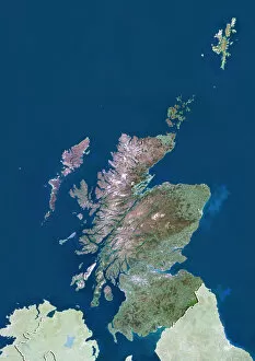
Background imageSatellite View Collection: Scotland with Shetland, United Kingdom, True Colour Satellite Image

Scotland with Shetland, United Kingdom, True Colour Satellite Image
Satellite view of Scotland including Shetland, United Kingdom. This image was compiled from data acquired by LANDSAT 5 & 7 satellites

Background imageSatellite View Collection: Middle East, Relief Map

Middle East, Relief Map Relief map of the Middle East. This map was processed from elevation data.

Background imageSatellite View Collection: Venice, Italy

Venice, Italy
Color satellite image of Venice, Italy. Image collected on August 27, 2019 by Sentinel-2 satellites

Background imageSatellite View Collection: Solnova Solar Power Station, Spain

Solnova Solar Power Station, Spain
Color satellite image of Solnova Solar Power Station, located west of Seville, Spain. Image collected on June 22, 2020 by Sentinel-2 satellites

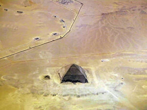
Background imageSatellite View Collection: Satellite view of the Bent Pyramid, Egypt

Satellite view of the Bent Pyramid, Egypt
3507795 Satellite view of the Bent Pyramid, Egypt; (add.info.: Satellite view of the Bent Pyramid, Egypt. This distinctive shaped ancient Egyptian pyramid is located at the royal necropolis of)

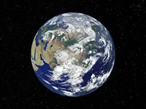
Background imageSatellite View Collection: Planet Earth

Planet Earth
africa, usa, arctic, continents, earth, global, globe, hemisphere, ice, land, nobody, north america, ocean, planet, south america, satellite view, Space, 82047893

Background imageSatellite View Collection: Marioupol, Ukraine

Marioupol, Ukraine
Color satellite image of Marioupol, Ukraine. Mariupol is a city of regional significance in south eastern Ukraine, situated on the north coast of the Sea of Azov

Background imageSatellite View Collection: Deforestation in Para, Brazil

Deforestation in Para, Brazil
Color satellite image of deforestation inthe State of Para, Brazil, around the town Ruropolis. Image collected on August 14, 2020 by Sentinel-2 satellites

Background imageSatellite View Collection: Crop Circles in the Desert, Saudi Arabia

Crop Circles in the Desert, Saudi Arabia
Color satellite image of crop circles in the desert in the Wadi As-Sirhan Basin, in Northern Saudi Arabia. Image collected on July 08, 2020 by Sentinel-2 satellites

Background imageSatellite View Collection: Washington, D. C. Capital City of the United States

Washington, D. C. Capital City of the United States
Color satellite image of Washington, D.C. Capital city of the United States. Image collected on June 09, 2020 by Sentinel-2 satellites

Background imageSatellite View Collection: Prudhoe Bay Oil Field, Alaska, United States

Prudhoe Bay Oil Field, Alaska, United States
Color satellite image of Prudhoe Bay Oil Field, Alaska, United States. Image collected on July 02, 2020 by Sentinel-2 satellites

Background imageSatellite View Collection: Galaxy, Glowing, Illuminated, Luminosity, Nobody, Satellite View, Space, Star, magellanic cloud

Galaxy, Glowing, Illuminated, Luminosity, Nobody, Satellite View, Space, Star, magellanic cloud
Galaxy, Glowing, Illuminated, Luminosity, Nobody, Satellite View, Spac, 78364161

Background imageSatellite View Collection: topography, satellite view, nobody, alpen, alpes, alps, austria, europe, france, mountains

topography, satellite view, nobody, alpen, alpes, alps, austria, europe, france, mountains
topography, satellite view, nobody, alpen, alpes, alps, austria, europe, 82047884

Background imageSatellite View Collection: Koufra oasis in 1984 and 2022

Koufra oasis in 1984 and 2022
Color satellite image of Koufra oasis in 1984 and 2022

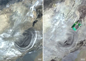
Background imageSatellite View Collection: Lob Nor in 1987 and 2020

Lob Nor in 1987 and 2020
Color satellite image of Lob Nor in 1987 and 2020

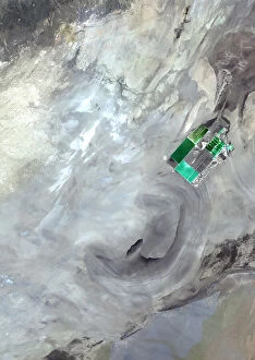
Background imageSatellite View Collection: Lob Nor in 2020

Lob Nor in 2020
Color satellite image of Lob Nor in 2020

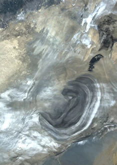
Background imageSatellite View Collection: Lob Nor in 1987

Lob Nor in 1987
Color satellite image of Lob Nor in 1987

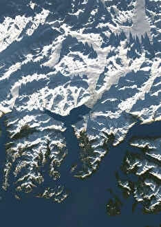
Background imageSatellite View Collection: Columbia glacier in 2022

Columbia glacier in 2022
Color satellite image of Columbia glacier in 2022

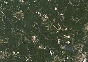
Background imageSatellite View Collection: Coal Mines in Southern West Virginia, USA in 2022

Coal Mines in Southern West Virginia, USA in 2022
Color satellite image of coal mines in southern West Virginia, USA in 2022

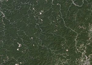
Background imageSatellite View Collection: Coal Mines in Southern West Virginia, USA in 1984

Coal Mines in Southern West Virginia, USA in 1984
Color satellite image of coal mines in Southern West Virginia, USA in 1984

Background imageSatellite View Collection: Koufra oasis in 1984

Koufra oasis in 1984
Color satellite image of Koufra oasis in 1984

Background imageSatellite View Collection: Koufra oasis in 2022

Koufra oasis in 2022
Color satellite image of Koufra oasis in 2022

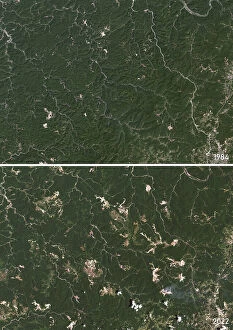
Background imageSatellite View Collection: Coal Mines in Southern West Virginia, USA in 1984 and 2022

Coal Mines in Southern West Virginia, USA in 1984 and 2022
Color satellite image of coal mines in Southern West Virginia, USA in 1984 and 2022

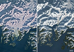
Background imageSatellite View Collection: Columbia glacier in 1986 and 2022

Columbia glacier in 1986 and 2022
Color satellite image of Columbia glacier in 1986 and 2022

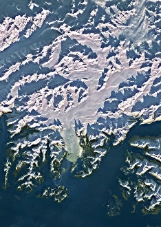
Background imageSatellite View Collection: Columbia glacier in 1986

Columbia glacier in 1986
Color satellite image of Columbia glacier in 1986

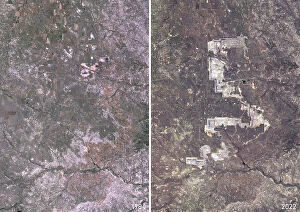
Background imageSatellite View Collection: North Antelope Rochelle coal mine in 1984 and 2022

North Antelope Rochelle coal mine in 1984 and 2022
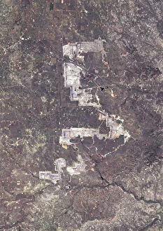
Color satellite image of North Antelope Rochelle Mine in 1984 and 2022. Located in Campbell County, Wyoming, USA, it is the largest coal mine in the world

Background imageSatellite View Collection: North Antelope Rochelle Mine, Wyoming, USA in 2022

North Antelope Rochelle Mine, Wyoming, USA in 2022
Color satellite image of North Antelope Rochelle Mine in 2022. Located in Campbell County, Wyoming, USA, it is the largest coal mine in the world

Background imageSatellite View Collection: North Antelope Rochelle coal mine in 1984

North Antelope Rochelle coal mine in 1984
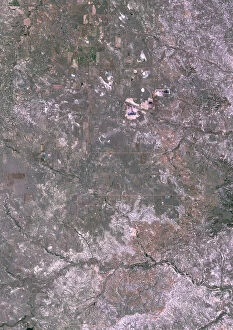
Color satellite image of Campbell County, Wyoming, USA in 1984. The image shows the area at the beginning of the North Antelope Mine which opened in 1983, and the Rochelle Mine which opened in 1984

Background imageSatellite View Collection: Fort McKay, Alberta, Canada in 1984 and 2022 Before and After Tar Sands

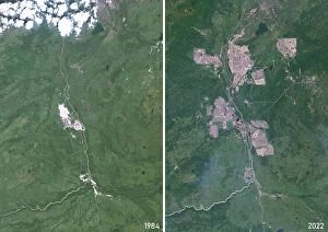
Fort McKay, Alberta, Canada in 1984 and 2022 Before and After Tar Sands
Color satellite image of Fort McKay, Alberta, Canada in 1984 and 2022, before and after tar sands, or oil sands, exploitation

Background imageSatellite View Collection: Chuquicatama Copper Mine, Chile in 2023

Chuquicatama Copper Mine, Chile in 2023
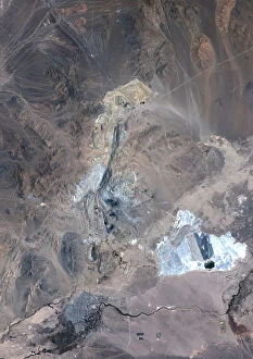
Color satellite image of Chuquicatama copper mine in Chile in 2023. Chuquicamata, also called Chuqui is the largest open pit copper mine in terms of excavated volume in the world

Background imageSatellite View Collection: Fort McKay, Alberta, Canada in 1984 Before Tar Sands Exploitation

Fort McKay, Alberta, Canada in 1984 Before Tar Sands Exploitation
Color satellite image of Fort McKay, Alberta, Canada in 1984, before tar sands, or oil sands, exploitation

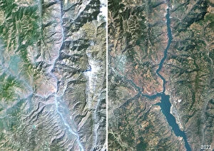
Background imageSatellite View Collection: Before and After the Construction of the Baihetan Dam in China in 1987 and 2022

Before and After the Construction of the Baihetan Dam in China in 1987 and 2022
Color satellite image of the Jinsha River in 1987 and 2022, before and after the construction of the Baihetan Dam. The image shows the Jinsha River

Background imageSatellite View Collection: Yangtze River, China in 1987 before the Three Gorges Dam

Yangtze River, China in 1987 before the Three Gorges Dam
Color satellite image of the Yangtze River in 1987 before the construction of the Three Gorges Dam in the Hubei province in central China

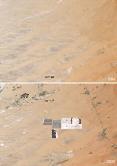
Background imageSatellite View Collection: Solar Park in the Emirate of Abu Dhabi between 1984 and 2022

Solar Park in the Emirate of Abu Dhabi between 1984 and 2022
Color satellite image showing a desert area in the Emirate of Abu Dhabi in 1984 and 2022, before and after the installation of Noor Energy 1 Solar Park

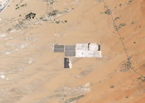
Background imageSatellite View Collection: Solar Park in the Emirate of Abu Dhabi in 2022

Solar Park in the Emirate of Abu Dhabi in 2022
Color satellite image of Noor Energy 1 Solar Park in the Emirate of Abu Dhabi in 2022

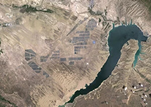
Background imageSatellite View Collection: Longyangxia Dam Solar Park, China in 2022

Longyangxia Dam Solar Park, China in 2022
Color satellite image of Longyangxia Dam Solar Park, in China's western province of Qinghai in 2022

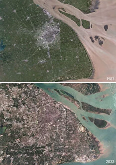
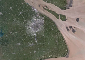
Background imageSatellite View Collection: Shanghai, China in 1987 and 2022

Shanghai, China in 1987 and 2022
Color satellite image of Shanghai, China in 1987 and 2022

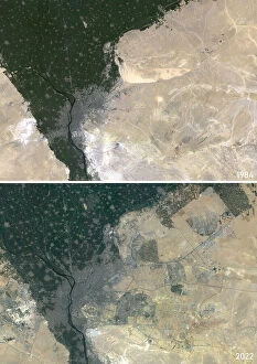
Background imageSatellite View Collection: Cairo, Egypt in 1984 and 2022

Cairo, Egypt in 1984 and 2022
Color satellite image of Cairo, Egypt in 1984 and 2022. The image from 2022 includes the newly built Cairo City

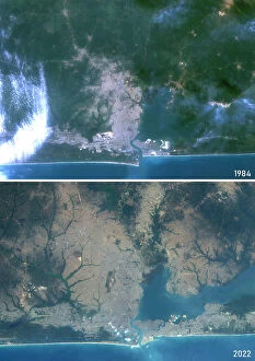
Background imageSatellite View Collection: Lagos, Nigeria in 1984 and 2022

Lagos, Nigeria in 1984 and 2022
Color satellite image of Lagos, Nigeria in 1984 and 2022

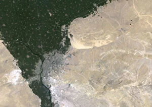
Background imageSatellite View Collection: Cairo and New Cairo City, Egypt in 2022

Cairo and New Cairo City, Egypt in 2022
Color satellite image of Cairo and New Cairo City, Egypt in 2022

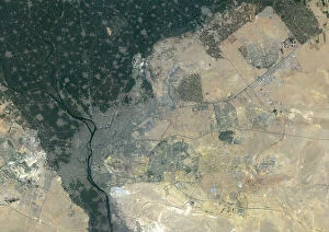
Background imageSatellite View Collection: Cairo, Egypt in 1984

Cairo, Egypt in 1984
Color satellite image of Cairo, Egypt in 1984

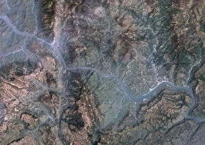
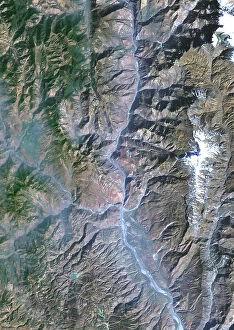
Background imageSatellite View Collection: Jinsha River, China in 1987 before the Construction of the Baihetan Dam

Jinsha River, China in 1987 before the Construction of the Baihetan Dam
Color satellite image of the Jinsha River in 1987, before the construction of the Baihetan Dam. The image shows the Jinsha River

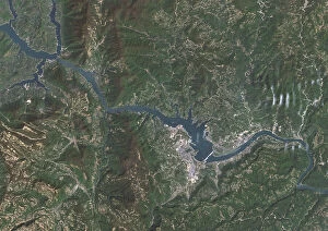
Background imageSatellite View Collection: The Three Gorges Dam on the Yangtze River in China in 2022

The Three Gorges Dam on the Yangtze River in China in 2022
Color satellite image of the Three Gorges Dam on the Yangtze River in 2022. The dam is located in the Hubei province in central China

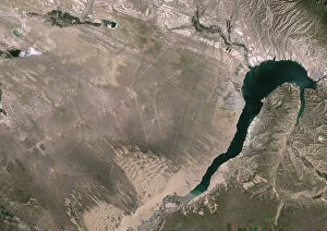
Background imageSatellite View Collection: Longyangxia Dam Reservoir in 1987

Longyangxia Dam Reservoir in 1987
Color satellite image of Longyangxia Dam Reservoir in China's western province of Qinghai in 1987. This image was taken before the construction of Longyangxia Dam Solar Park north of the reservoir

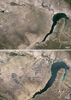
Background imageSatellite View Collection: Longyangxia Dam Reservoir and Solar Park, China in 1987 and 2022

Longyangxia Dam Reservoir and Solar Park, China in 1987 and 2022
Color satellite image of Longyangxia Dam Reservoir in 1987 and Longyangxia Dam Solar Park in 2022 that has rapidly grown north of the reservoir. The site is in China's western province of Qinghai

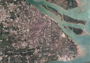
Background imageSatellite View Collection: Shanghai, China in 2022

Shanghai, China in 2022
Color satellite image of Shanghai, China in 2022

Background imageSatellite View Collection: Shanghai, China in 1987

Shanghai, China in 1987
Color satellite image of Shanghai, China in 1987

Background imageSatellite View Collection: Lagos, Nigeria in 2022

Lagos, Nigeria in 2022
Color satellite image of Lagos, the most populous city in Nigeria, in 2022

Background imageSatellite View Collection: Lagos in 1984

Lagos in 1984
Color satellite image of Lagos, Nigeria, in 1984

Background imageSatellite View Collection: Oil Palm Plantation in North Sumatra in 1989 and 2021

Oil Palm Plantation in North Sumatra in 1989 and 2021
Color satellite image of oil palm plantation in North Sumatra in 1989 and 2021

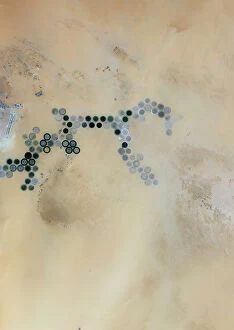
Background imageSatellite View Collection: Agricultural Fields in Wadi As-Sirhan Basin, Saudi Arabia in 2022

Agricultural Fields in Wadi As-Sirhan Basin, Saudi Arabia in 2022
Color satellite image of agricultural fields in the Wadi As-Sirhan Basin, Saudi Arabia in 2022. The fields are irrigated by water pumped from underground aquifers

Background imageSatellite View Collection: Chuquicatama Copper Mine, Chile in 1985 and 2023

Chuquicatama Copper Mine, Chile in 1985 and 2023
Color satellite image of Chuquicatama copper mine in Chile in 1985 and 2023. Chuquicamata, also called Chuqui is the largest open pit copper mine in terms of excavated volume in the world

Background imageSatellite View Collection: Oil Palm Plantation in North Sumatra in 2021

Oil Palm Plantation in North Sumatra in 2021
Color satellite image of oil palm plantation in North Sumatra in 2021

Background imageSatellite View Collection: Chuquicatama Copper Mine, Chile in 1985

Chuquicatama Copper Mine, Chile in 1985
Color satellite image of Chuquicatama copper mine in Chile in 1985

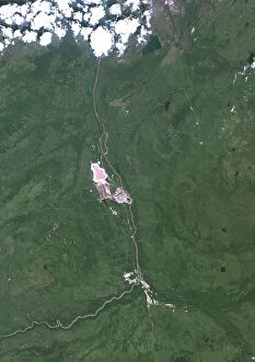
Background imageSatellite View Collection: Tar Sands Exploitation in Fort McKay, Alberta, Canada in 2022

Tar Sands Exploitation in Fort McKay, Alberta, Canada in 2022
Color satellite image of tar sands, or oil sands, exploitation in Fort McKay, Alberta, Canada in 2022

Background imageSatellite View Collection: Yangtze River, China in 1987 and 2022, Before and After the Three Gorges Dam

Yangtze River, China in 1987 and 2022, Before and After the Three Gorges Dam
Color satellite image of the Yangtze River in 1987 and 2022, before and after the construction of the Three Gorges Dam. The dam is located in the Hubei province in central China

Background imageSatellite View Collection: Baihetan Dam on the Jinsha River in China in 2022

Baihetan Dam on the Jinsha River in China in 2022
Color satellite image of the Baihetan Dam in 2022 on the Jinsha River, an upper stretch of the Yangtze River in Sichuan and Yunnan provinces, in southwest China

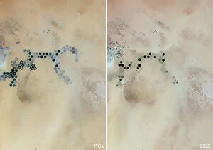
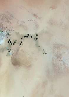
Background imageSatellite View Collection: Agricultural Development in Wadi As-Sirhan Basin, Saudi Arabia between 1984 and 2022

Agricultural Development in Wadi As-Sirhan Basin, Saudi Arabia between 1984 and 2022
Color satellite image of the Wadi As-Sirhan Basin, Saudi Arabia in 1984 and 2022, showing how agricultural activity has developed in the midst of a barren desert

Background imageSatellite View Collection: Intensive Farming in Almeria, Spain between 1986 and 2022

Intensive Farming in Almeria, Spain between 1986 and 2022
Color satellite image of intensive farming in Almeria, Spain between 1986 and 2022. The images show how the "plastic sea" formed by greenhouses has expanded

Background imageSatellite View Collection: Intensive Farming in Almeria, Spain in 2022

Intensive Farming in Almeria, Spain in 2022
Color satellite image of intensive farming in Almeria, Spain in 2022. The image shows the "plastic sea" formed by greenhouses

Background imageSatellite View Collection: Aral Sea in 1990, 2000, 2010 and 2020

Aral Sea in 1990, 2000, 2010 and 2020
Color satellite image of the shrinking of the Aral Sea in 1990, 2000, 2010 and 2020

Background imageSatellite View Collection: The Shrinking of the Aral Sea in 2000

The Shrinking of the Aral Sea in 2000
Color satellite image of the shrinking of the Aral Sea in 2000

Background imageSatellite View Collection: The Shrinking of the Aral Sea in 1990

The Shrinking of the Aral Sea in 1990
Color satellite image of the shrinking of the Aral Sea in 1990

Background imageSatellite View Collection: The Shrinking of the Aral Sea between 1986 and 2022

The Shrinking of the Aral Sea between 1986 and 2022
Color satellite image of the shrinking of the Aral Sea between 1986 and 2022

Background imageSatellite View Collection: Aral Sea in 1986

Aral Sea in 1986
Color satellite image of the Aral Sea in 1986

Background imageSatellite View Collection: Dongtai Salt Lakes, Qinghai, China in 1986

Dongtai Salt Lakes, Qinghai, China in 1986
Color satellite image of Dongtai Salt Lakes, Qinghai, China in 1986, before lithium extraction began

Background imageSatellite View Collection: Malaspina Glacier, Alaska in 1986 and 2022

Malaspina Glacier, Alaska in 1986 and 2022
Color satellite image of Malaspina Glacier, Alaska in 1986 and 2022, showing how the glacier has been melting over the years

Background imageSatellite View Collection: Upsala Glacier, Argentina in 2021

Upsala Glacier, Argentina in 2021
Color satellite image of Upsala Glacier in Argentina's Los Glaciares National Park in 2021. It has experienced significant retreat over the past century

Background imageSatellite View Collection: Upsala Glacier, Argentina in 2001

Upsala Glacier, Argentina in 2001
Color satellite image of Upsala Glacier in Argentina's Los Glaciares National Park in 2001. It has experienced significant retreat over the past century

Background imageSatellite View Collection: Vatnajokull Glacier, Iceland in 1986

Vatnajokull Glacier, Iceland in 1986
Color satellite image of Vatnajokull Glacier, Iceland in 1986. It is the largest and most voluminous ice cap in Iceland, and the second largest in area in Europe

Background imageSatellite View Collection: Malaspina Glacier, Alaska in 2022

Malaspina Glacier, Alaska in 2022
Color satellite image of Malaspina Glacier, Alaska in 2022


For sale as Licensed Images

Choose your image, Select your licence and Download the media

"Exploring the Beauty of Earth: A Captivating Satellite View" Witnessing the breathtaking sunrise over Australia from space, one can't help but marvel at the wonders of our planet. With a black background serving as a canvas for this celestial spectacle, the satellite view offers an awe-inspiring glimpse into astronomy's grandeur. In this captivating image, devoid of any human presence, we are presented with a cut-out copy space that allows us to focus solely on Planet Earth. From New Zealand to Louisville, Kentucky and even Departement of Ille-et-Vilaine in France - each location is beautifully captured by satellites orbiting high above. The satellite view takes us on an extraordinary journey across continents and countries. We get a bird's eye perspective of Niger's vast landscapes through its detailed satellite image while Washington D. C. 's iconic landmarks come alive in stunning clarity. Scotland with Shetland Islands appears like a true masterpiece in this United Kingdom satellite image where vibrant colors showcase nature's splendor. Turkey too reveals its diverse terrain through another striking satellite image that highlights its unique features. Belgium unveils itself through an intricate vector map created using satellite data, providing valuable insights into urban planning and navigation systems. Meanwhile, Arctic regions captivate us with their ethereal beauty - combining elements of astronomy and exploration against a colorful city backdrop. Lastly, North America mesmerizes viewers with its day-and-night composite captured by satellites circling our planet. This single frame encapsulates both natural beauty and human activity harmoniously coexisting on Earth. Through these remarkable glimpses offered by satellite views, we gain appreciation for our world's diversity and interconnectedness. It reminds us that despite our differences or geographical distances, we all share this magnificent home called Planet Earth – urging us to protect it for generations to come.

© Copyright Media Storehouse, All Rights Reserved 2003 - 2024
Facebook     Pinterest     Card Payments