Sciences Collection (#33)

"Exploring the Wonders of Sciences: From Whole Earth to Beyond" Witness the breathtaking beauty of our planet with the iconic Blue Marble 2000 image

Background imageSciences Collection: Benelux countries

Benelux countries, satellite image. North is at top. The Benelux Economic Union was established in 1958 in order to promote trade between the three member nations

Background imageSciences Collection: Denmark from space

Denmark from space
Photograph taken from space of Denmark. Along the west coast a line of off-shore sand-bars is clearly visible. Beyond the Jutland peninsula are the islands of Fyn

Background imageSciences Collection: Digital world, artwork

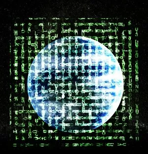
Digital world, artwork
Digital world. Composite artwork of the Earth superimposed with alphanumeric digits

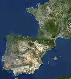
Background imageSciences Collection: Spain and Portugal

Spain and Portugal. True-colour satellite image of the Iberian Peninsula of Spain and Portugal. North is at top. Water is blue, dense vegetation is green

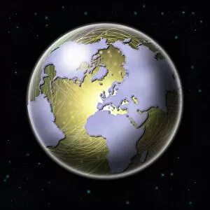
Background imageSciences Collection: Connected Earth

Connected Earth. Conceptual computer artwork of Earth with its continents linked by a network of lines, representing global connections

Background imageSciences Collection: Americas at night

Americas at night. Computer artwork of the Earth at night, centred on the Americas. North America is at top, South America is at bottom right. Urban areas are shown by clusters of bright lights

Background imageSciences Collection: The Netherlands, satellite image

The Netherlands, satellite image
Benelux coutries, satellite image. North is at top. The Benelux Economic Union was established in 1958 in order to promote trade between the three member nations

Background imageSciences Collection: Satellite picture of the world at night

Satellite picture of the world at night
Satellite image of the world at night. The white areas correspond to city lights, thus providing an accurate indicator of urbanisation from region to region

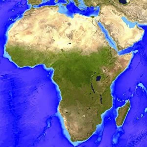
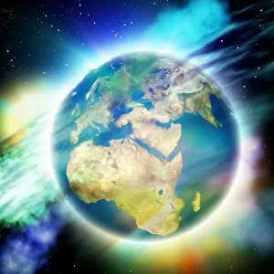
Background imageSciences Collection: Africa

Africa. Computer artwork, based on a satellite image, of Africa. North is at top. Water is blue, vegetation is green and desert is yellow

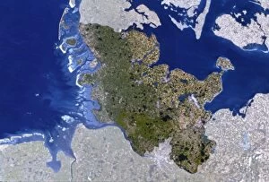
Background imageSciences Collection: Satellite image of Schleswig-Holstein, Germany

Satellite image of Schleswig-Holstein, Germany

Background imageSciences Collection: Earths limb

Earths limb
View of Earth from the Soviet Salyut-6 space station. Space shuttle wing is visible

Background imageSciences Collection: Austria

Austria. True-colour satellite image of Austria. North is at top. Vegetation is green, snow is white and water is blue. Austria (darker in colour) is surrounded by Germany (north-west)

Background imageSciences Collection: Southeast Asia, satellite image

Southeast Asia, satellite image. North is at top. Southeast Asia is a sub region of Asia, lying south of China and east of India

Background imageSciences Collection: True-colour satellite image of northern Scotland

True-colour satellite image of northern Scotland
Northern Scotland. Satellite image of northern Scotland. The colours approximate to natural tones. North is at top. The city of Inverness is at lower right
Background imageSciences Collection: Sunset from space

Sunset from space
Earth and Sun. Computer artwork of the Sun seen at the Earths limb

Background imageSciences Collection: Pluto and Charon

Pluto and Charon. Artwork of the planet Pluto and its moon Charon (right) seen from space. Pluto is the most distant planet from the Sun

Background imageSciences Collection: France

France. True-colour satellite image of France (darker colours). North is at top. Water is blue, vegetation green and snow white

Background imageSciences Collection: Storm system over Europe

Storm system over Europe

Background imageSciences Collection: Satellite image centred on Indian Ocean

Satellite image centred on Indian Ocean
False-colour satellite image of the Earth, centered on the Indian Ocean. The outline of the whole east coast of Africa may be seen, with the island of Madagascar lower left of centre

Background imageSciences Collection: Lands End, UK, aerial image

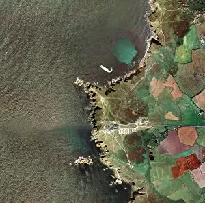
Lands End, UK, aerial image
Lands End, UK, aerial photograph. This headland is the westernmost point of mainland Great Britain. The site features several tourist attractions based around this feature

Background imageSciences Collection: Middle East, satellite image

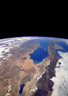
Middle East, satellite image
Middle East, satellite photograph. North is at top. The Middle East subcontinent is the cultural and geographical region of countries that occupy the divide between Eurasia and North Africa

Background imageSciences Collection: Mexico from space

Mexico from space
Mexico seen from space. North is at bottom. The large blue inlet at centre is the Gulf of California, also called the Sea of Cortez

Background imageSciences Collection: The Earth held by a human hand

The Earth held by a human hand
Earth held by a human hand. Conceptual composite image of the control humans have over the Earth

Background imageSciences Collection: Whole Earth, showing Antartica, Africa and Arabia

Whole Earth, showing Antartica, Africa and Arabia
The classic photograph of the whole Earth, taken from the Apollo 17 spacecraft in December 1972. It shows Antarctica, Africa & Arabia

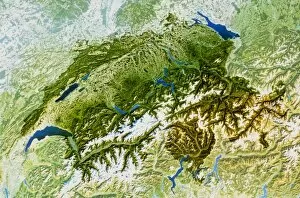
Background imageSciences Collection: Switzerland

Switzerland. True-colour satellite image of Switz- erland. North is at top. Water is blue, snow white and vegetation green

Background imageSciences Collection: True-colour satellite image of Hampshire

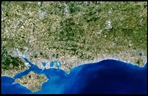
True-colour satellite image of Hampshire
Southern England. True-colour satellite image of southern England, showing the Isle of Wight (at bottom left), and the counties of Hampshire (at left)

Background imageSciences Collection: GOES image of Hurricane Elena over Florida

GOES image of Hurricane Elena over Florida
Composite image of the Earths cloud patterns on 1 September, 1985, showing Hurricane Elena over the American state of Florida

Background imageSciences Collection: Denmark, satellite image

Denmark, satellite image. North is at top. Denmark is located in northern Europe. Its only land border is with Germany in the south (shaded). Mainland Denmark is known as Jutland

Background imageSciences Collection: North-eastern Europe

North-eastern Europe. True-colour satellite image of north-eastern Europe. North is at top. Water is blue, vegetation is green and snow is white

Background imageSciences Collection: False-colour IR weather map, Europe & N. Atlantic

False-colour IR weather map, Europe & N. Atlantic
False-colour IR weather map, Europe & N.Atlantic

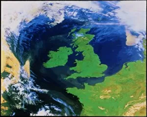
Background imageSciences Collection: British Isles from space

British Isles from space
False-colour satellite image of the British Isles and north-west Europe captured on a relatively cloud-free day. The whole of the UK and Ireland is visible, as is part of France

Background imageSciences Collection: Earth and nebulae

Earth and nebulae. Computer artwork of the Earth with a nebula behind it. A nebula is a large cloud of gas and dust in space. They are often many light years across

Background imageSciences Collection: Spain and France

Spain and France

Background imageSciences Collection: Earth

Earth. Computer artwork, based on a satellite image, of Earth from space centred on North America. Water is blue, vegetation is green, desert is yellow and ice is white

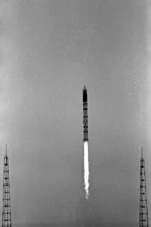
Background imageSciences Collection: Launch of Bhaskara-2 satellite

Launch of Bhaskara-2 satellite
Launch of Bhaskara-2. A Cosmos-3M rocket blasts off from Kapustin Yar in Russia, carrying the Bhaskara-2 satellite. Bhaskara-2 was Indias second Earth observation satellite

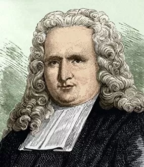
Background imageSciences Collection: Petrus Van Musschenbroek (1692 - 1761)

Petrus Van Musschenbroek (1692 - 1761)
PETRUS VAN MUSSCHENBROEK Petrus Van Musschenbroek, Dutch mathematician and physicist (Leiden, 1692 - 1761). Inventor of the Leyden bottle, the first electric capacitor

Background imageSciences Collection: Nikolai Semyonov, Soviet chemist

Nikolai Semyonov, Soviet chemist
Nikolai Nikolayevich Semyonov (1896-1986), Russian-Soviet chemist Nobel Laureate. Semyonov was born at Saratov and educated at the University of Petrograd

Background imageSciences Collection: French Academy of Sciences, 17th century

French Academy of Sciences, 17th century
French Academy of Sciences. Scientists gathered in one of the collection rooms (cabinets) of the French Royal Academy of Sciences in the Louvre, Paris

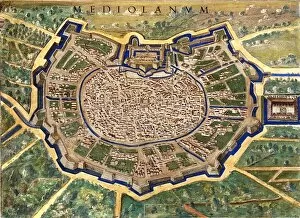
Background imageSciences Collection: 16th Century Plan of Milan

16th Century Plan of Milan
16th century plan of Milan. Details from the map of

Background imageSciences Collection: 16th Century Galleon

16th Century Galleon
16th century galleon in the Gulf of Porto. Detail from a map of Corsica in the Gallery of Maps in the Vatican Museum. These maps were commissioned between 1578

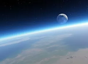
Background imageSciences Collection: Crescent Moon from Earth orbit, artwork

Crescent Moon from Earth orbit, artwork
Crescent Moon from Earth orbit, computer artwork. The non-sunlit Earth-facing parts of the Moon are being illuminated by sunlight reflected from the Earth, a phenomenon known as Earthshine

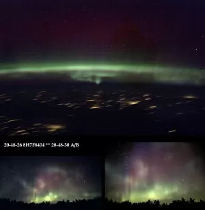
Background imageSciences Collection: Aurora Borealis from Earth and space

Aurora Borealis from Earth and space
Aurora borealis from Earth and space. Two images of the aurora borealis (northern lights) taken in Finland (bottom left and right), and one taken from the International Space Station (ISS, top)

Background imageSciences Collection: Scientific calculator

Scientific calculator. This electronic device can be used to carry out advanced mathematical calculations, and can also be programmed to carry out series of calculations

Background imageSciences Collection: Avalanche defences, Switzerland

Avalanche defences, Switzerland
Avalanche defences (horizontal dark lines) on a mountainside in eastern Switzerland. The barriers are designed to reduce the strength of avalanches

Background imageSciences Collection: The Royal Albert Hall, London, 1867

The Royal Albert Hall, London, 1867
Engraving showing the exterior of a design for the Royal Albert Hall of Arts and Sciences, London, 1867

Background imageSciences Collection: The Opening of the Royal Albert Hall, London, 1871

The Opening of the Royal Albert Hall, London, 1871
Engraving showing the exterior of the Royal Albert Hall of Arts and Sciences on the day that it was opened by Queen Victoria, March 1871

Background imageSciences Collection: Science Exhibition 1930

Science Exhibition 1930
LIEGE, BELGIUM Exhibition of Grande Industrie, Sciences & Applications


For sale as Licensed Images

Choose your image, Select your licence and Download the media

"Exploring the Wonders of Sciences: From Whole Earth to Beyond" Witness the breathtaking beauty of our planet with the iconic Blue Marble 2000 image, capturing the entirety of Earth in one mesmerizing view. Apollo 17's photograph of our whole earth from space reminds us of humanity's small yet significant place in the vastness of the universe. Discover a bird's-eye perspective with a satellite image showcasing the stunning British Isles, highlighting their unique geographical features and natural splendor. Unveil ancient wisdom through The Emerald Tablet, also known as Smaragdine Table or Tabula Smaragdina, an enigmatic text that holds secrets about alchemy and metaphysics. Journey back in time with Durer's world map from 1515, marveling at how early cartographers envisioned our planet before modern scientific advancements. Explore Science Allegorised, where art meets knowledge as intricate illustrations depict various branches of science and their interconnectedness. Experience awe-inspiring moments like never before with Earthrise - a captivating sight witnessed by astronauts above the moon's surface that forever changed our perception of home. Immerse yourself in history through a 16th-century plan of Florence, offering insights into both urban development and scientific progress during Renaissance times. Illuminate your nightscape curiosity with a satellite image revealing North America glowing under city lights – showcasing human activity across this vast continent after sunset. Travel through time and geography with a meticulously detailed 17th-century map depicting Europe’s diverse regions while reflecting evolving political boundaries and cultural identities. Dive into nature's wonders as you explore northwest Scotland through a true-color satellite image – unveiling its rugged landscapes, pristine lochs, and untamed beauty from above. Study topography like never before using an intricately crafted relief map showcasing United Kingdom and Eire – a tangible representation of the land's elevations and features.