Severe Storm Collection (#2)

"Nature's Fury Unleashed: Witness the Power of Severe Storms" A Supercell Thunderstorm Engulfs Kansas

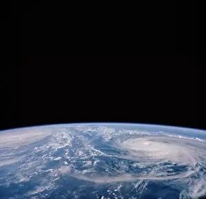
Background imageSevere Storm Collection: Eye of hurricane Isabel

Eye of hurricane Isabel. This image was taken from the International Space Station on 13th September 2003. At this time, the hurricane had not made landfall, and was classed as category 5

Background imageSevere Storm Collection: Coloured satellite image of Hurricane Pauline

Coloured satellite image of Hurricane Pauline
Hurricane Pauline. Coloured computer three- dimensional reconstruction, based on satellite data, of Hurricane Pauline off the coast of Mexico (green). North is towards top

Background imageSevere Storm Collection: Perspective view of Hurricane Allen from space

Perspective view of Hurricane Allen from space
Computer-generated perspective view of Hurricane Allen, seen over the Gulf of Mexico on 8 August 1980. The image was produced from two TIROS-N satellite images, one taken in visible light

Background imageSevere Storm Collection: Hurricane Emily, 14th July 2005

Hurricane Emily, 14th July 2005
Hurricane Emily in the Caribbean Sea, at 19:15 GMT (20:15 BST) on 14th July 2005. At this stage Emily was a category four hurricane, the second strongest level

Background imageSevere Storm Collection: Hurricane Floyd

Hurricane Floyd. Coloured three-dimensional computer image, based on satellite data, of Hurricane Floyd. The hurricane is the white swirl of clouds in the Atlantic Ocean off the coast of Florida

Background imageSevere Storm Collection: Hurricane Isabel, 15th September 2003

Hurricane Isabel, 15th September 2003
Hurricane Isabel in the Caribbean Sea on 15th September 2003. The islands of Hispaniola (lower centre) and the eastern tip of Cuba (lower left) are seen

Background imageSevere Storm Collection: Tropical Cyclone Hary

Tropical Cyclone Hary. Satellite image of Tropical Cyclone Hary approaching the coast of Madagascar. The storm affected the northern and eastern shores of Madagascar

Background imageSevere Storm Collection: Hurricane Florence from space shuttle

Hurricane Florence from space shuttle
Hurricane Florence. Photograph of the clouds associated with Hurricane Florence, taken from Space Shuttle Atlantis during Mission STS-66 of 3- 14 November 1994

Background imageSevere Storm Collection: Tornado

Tornado. Computer illustration of a tornado on a road with associated lightning. A tornado is a violent, rotating column of air characterised by a funnel-shaped cloud

Background imageSevere Storm Collection: Hurricane Isabel, 17th September 2003

Hurricane Isabel, 17th September 2003
Hurricane Isabel approaching the east coast of the USA on 17th September 2003. At upper right is the hook-shaped Cape Cod peninsula, with the Florida peninsula at lower left

Background imageSevere Storm Collection: Cyclone Rita over S. E. Asia showing the eye

Cyclone Rita over S. E. Asia showing the eye
Cyclone from space. Optical image of a tropical cyclone, a violent storm, from space. The cyclone is the swirl of clouds surrounding the dark hole (the " eye", at upper centre)

Background imageSevere Storm Collection: Hurricane Dean, 21 August 2007

Hurricane Dean, 21 August 2007
Hurricane Dean, satellite image. North is at top. Image obtained at 15:05 local time on 21 August 2007 as the hurricane passed over Mexicos Yucatan peninsula

Background imageSevere Storm Collection: Typhoons Odessa and Pat, seen from Shuttle 51-I

Typhoons Odessa and Pat, seen from Shuttle 51-I
Tropical typhoons over the western Pacific, photographed by the crew of space shuttle Discovery during Mission 51-I (27 August to 3 September, 1985). The typhoons are Odessa (far left) and Pat

Background imageSevere Storm Collection: Vapour spout

Vapour spout. This type of weak localized vortex may occur over water near a lava flow that has reached the coast. Lava pouring into the sea boils the water, causing local cloud formation (top left)

Background imageSevere Storm Collection: Tropical Cyclone Erica

Tropical Cyclone Erica (22P), satellite image, on 13 March 2003. North is at top. Erica peaked as a powerful Category 5 cyclone on 12 March 2003

Background imageSevere Storm Collection: European severe storm, isobar diagram

European severe storm, isobar diagram. The isobars (white lines) connect areas of equal pressure, and are used on meteorological maps to help predict future weather patterns

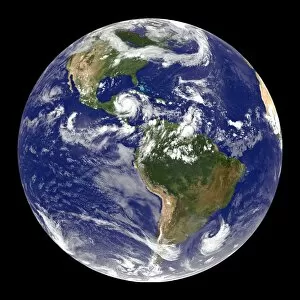
Background imageSevere Storm Collection: Earth and Hurricane Dean, 20 August 2007

Earth and Hurricane Dean, 20 August 2007
Earth and Hurricane Dean, satellite image. North is at top. Hurricane Dean is the large rotating cloud system (white) at upper left, in the western Caribbean, to the east of Mexico


For sale as Licensed Images

Choose your image, Select your licence and Download the media

"Nature's Fury Unleashed: Witness the Power of Severe Storms" A Supercell Thunderstorm Engulfs Kansas, USA C017 / 8422: Brace yourself for a breathtaking display of nature's might as this colossal storm system takes over the skies. Coloured Satellite Image of Hurricane Hugo: Behold the swirling vortex of destruction as Hurricane Hugo wreaks havoc on its path, leaving a trail of devastation in its wake. Hurricane Mitch - Nature's Wrath Unleashed: This powerful hurricane demonstrates the sheer force and intensity that Mother Nature can unleash upon us, reminding us to always respect her power. Coloured Satellite Image of Hurricane Linda: Marvel at the mesmerizing beauty and terrifying strength captured in this satellite image, showcasing Hurricane Linda at its peak intensity. Lightning Strikes from a Supercell Thunderstorm: Feel your heart race as bolts of lightning illuminate the darkened sky during an electrifying supercell thunderstorm – a true spectacle to behold. Thundercloud Forming Over Wheat Field: Watch in awe as towering thunderclouds take shape above vast wheat fields, heralding an imminent onslaught from nature's wrathful forces. Pop N Drop - The Dance of Destruction Begins: Witness the birth pangs of chaos as ominous clouds gather momentum before unleashing their fury with torrential rain, fierce winds, and relentless lightning strikes. Mammatus Lit Up by Lightning Crosses Highway: A surreal scene unfolds before your eyes as eerie mammatus clouds are illuminated by dazzling streaks of lightning while crossing a desolate highway. Severe Thunderstorm Developing Over Country Road: Experience the raw energy building up within an approaching severe thunderstorm – watch out for pounding raindrops and deafening claps of thunder. Computer Illustration Reveals Tornado Terror.