
Sir Henry Montagu Hozier Collection (#2)

"Sir Henry Montagu Hozier

Background imageSir Henry Montagu Hozier Collection: Strasburg, c1872. Creator: A Willmore

Strasburg, c1872. Creator: A Willmore
Strasburg, c1872. View of Strasbourg Cathedral and the River Ill. The city of Strasbourg was captured by the Prussians during the Franco-Prussian War of 1870-1871

Background imageSir Henry Montagu Hozier Collection: Heidelberg, c1872. Creator: E I Roberts

Heidelberg, c1872. Creator: E I Roberts
Heidelberg, c1872. View of the town of Heidelberg in Germany, with boats in the foreground, and the Old Bridge over the River Neckar beyond

Background imageSir Henry Montagu Hozier Collection: Speier, c1872. Creator: W. H. Capon

Speier, c1872. Creator: W. H. Capon
Speier, c1872. View of the town of Speyer in Germany. In the foreground is a bridge over a tributary of the River Rhine, with Speyer Cathedral, which dates from the 11th century, beyond

Background imageSir Henry Montagu Hozier Collection: Basle, c1872. Creator: E I Roberts

Basle, c1872. Creator: E I Roberts
Basle, c1872. View of the city of Basel in Switzerland. In the centre is the Middle Bridge over the River Rhine, with Basel Minster beyond

Background imageSir Henry Montagu Hozier Collection: Freiburg, c1872. Creator: A Willmore

Freiburg, c1872. Creator: A Willmore
Freiburg, c1872. View of a ford on the Dreisam river and the city of Freiburg im Breisgau, Germany. From " The Franco-Prussian War: its causes, incidents and consequences", Volume II

Background imageSir Henry Montagu Hozier Collection: Laufenburg, c1872. Creator: E I Roberts

Laufenburg, c1872. Creator: E I Roberts
Laufenburg, c1872. View of the town of Laufenburg, Switzerland, with a covered bridge over the River Rhine on the left, and the parish church tower and ruined castle on the right

Background imageSir Henry Montagu Hozier Collection: Eglisau, c1872. Creator: Samuel Bradshaw

Eglisau, c1872. Creator: Samuel Bradshaw
Eglisau, c1872. View of the town of Eglisau in Switzerland, with the covered bridge over the River Rhine. From " The Franco-Prussian War: its causes, incidents and consequences", Volume II

Background imageSir Henry Montagu Hozier Collection: Schaffhausen, c1872. Creator: E I Roberts

Schaffhausen, c1872. Creator: E I Roberts
Schaffhausen, c1872. View of the town of Schaffhausen in Switzerland, showing the bridge over the High Rhine and the Munot, a 16th century fortress

Background imageSir Henry Montagu Hozier Collection: Map of the Battle of Vionville, 16 August 1870, (c1872). Creator: R. Walker

Map of the Battle of Vionville, 16 August 1870, (c1872). Creator: R. Walker
Map of the Battle of Vionville, 16 August 1870, (c1872). Map: Drawn under the Superintendance of Captain Hozier, showing the enemy positions

Background imageSir Henry Montagu Hozier Collection: Map of the Battle of Courcelles, 14 August 1870, (c1872). Creator: R. Walker

Map of the Battle of Courcelles, 14 August 1870, (c1872). Creator: R. Walker
Map of the Battle of Courcelles, 14 August 1870, (c1872). Map: Drawn under the Superintendance of Captain Hozier, showing the enemy positions

Background imageSir Henry Montagu Hozier Collection: Rhine Falls, Schaffhausen, c1872. Creator: A Willmore

Rhine Falls, Schaffhausen, c1872. Creator: A Willmore
Rhine Falls, Schaffhausen, c1872. View of Europes largest waterfall on the High Rhine, near the town of Schaffhausen in Switzerland

Background imageSir Henry Montagu Hozier Collection: Rheinfelden, c1872. Creator: E I Roberts

Rheinfelden, c1872. Creator: E I Roberts
Rheinfelden, c1872. View of the town of Rheinfelden, Switzerland, with the covered bridge over the High Rhine and the parish church

Background imageSir Henry Montagu Hozier Collection: Bregenz, c1872. Creator: E I Roberts

Bregenz, c1872. Creator: E I Roberts
Bregenz, c1872. View of the town of Bregenz on the eastern shores of Lake Constance, Austria, with boats in the foreground

Background imageSir Henry Montagu Hozier Collection: Friedrichshafen, c1872. Creator: Edward Paxman Brandard

Friedrichshafen, c1872. Creator: Edward Paxman Brandard
Friedrichshafen, c1872. Boats on Lake Constance at Friedrichshafen in southern Germany. From " The Franco-Prussian War: its causes, incidents and consequences", Volume II

Background imageSir Henry Montagu Hozier Collection: Thiers, c1872. Creator: William Holl

Thiers, c1872. Creator: William Holl
Thiers, c1872. Portrait of French statesman and historian Louis Adolphe Thiers(1797-1877), the first President of the French Third Republic

Background imageSir Henry Montagu Hozier Collection: Lake of Constanz, c1872. Creator: A Willmore

Lake of Constanz, c1872. Creator: A Willmore
Lake of Constanz, and the islands of Mainau and Reichenau, c1872. View of Lake Constance through which the Rhine flows, situated where Germany, Switzerland, and Austria meet

Background imageSir Henry Montagu Hozier Collection: General Von Werder, c1872. Creator: Cook

General Von Werder, c1872. Creator: Cook
General Von Werder, c1872. Portrait of Prussian general Karl Wilhelm Friedrich August Leopold Graf von Werder (1808-1887)

Background imageSir Henry Montagu Hozier Collection: Map to Illustrate Operations in the East of France 1870-71, c1872. Creator: R. Walker

Map to Illustrate Operations in the East of France 1870-71, c1872. Creator: R. Walker
Map to Illustrate Operations in the East of France 1870-71, (c1872). Map: Drawn under the Superintendence of Captain Hozier, showing the towns of Dijon and Besancon

Background imageSir Henry Montagu Hozier Collection: Map of the Battle of Belfort, 15 January 1871, (c1872). Creator: R. Walker

Map of the Battle of Belfort, 15 January 1871, (c1872). Creator: R. Walker
Map of the Battle of Belfort, 15 January 1871, (c1872). Map: Drawn under the Superintendence of Captain Hozier, showing the enemy positions

Background imageSir Henry Montagu Hozier Collection: Map of the Battle of Le Mans, 11 January 1871, (c1872). Creator: R. Walker

Map of the Battle of Le Mans, 11 January 1871, (c1872). Creator: R. Walker
Map of the Battle of Le Mans, 11 January 1871, (c1872). Map: Drawn under the Superintendence of Captain Hozier, showing the enemy positions

Background imageSir Henry Montagu Hozier Collection: Map to Illustrate General Faidherbes Campaign 1870-71, c1872. Creator: R. Walker

Map to Illustrate General Faidherbes Campaign 1870-71, c1872. Creator: R. Walker
Map to Illustrate General Faidherbes Campaign 1870-71, (c1872). Map of northern France: Drawn under the Superintendance of Captain Hozier, showing the towns of Amiens, Cambrai, St Quentin and Laon

Background imageSir Henry Montagu Hozier Collection: Manteuffel, c1872. Creator: H. Crickmore

Manteuffel, c1872. Creator: H. Crickmore
Manteuffel, c1872. Portrait of Edwin Freiherr von Manteuffel (1809-1885), German military commander noted for his victories in the Franco-Prussian War

Background imageSir Henry Montagu Hozier Collection: General Bourbaki, c1872. Creator: Unknown

General Bourbaki, c1872. Creator: Unknown
General Bourbaki, c1872. Portrait of French general Charles Denis Sauter Bourbaki (1816-1897). From " The Franco-Prussian War: its causes, incidents and consequences", Volume II

Background imageSir Henry Montagu Hozier Collection: Gambetta, c1872. Creator: William Holl

Gambetta, c1872. Creator: William Holl
Gambetta, c1872. Portrait of French politician Leon Gambetta (1838-1882), an opponent of the French Second Empire. In 1870 he proclaimed the Third Republic after Napoleon III was captured by

Background imageSir Henry Montagu Hozier Collection: Garibaldi, c1872. Creator: William Holl

Garibaldi, c1872. Creator: William Holl
Garibaldi, c1872. Portrait of Italian general, politician and nationalist Guiseppe Garibaldi (1807-1882). Leading his 1, 000 Red Shirts, Garibaldi conquered Sicily and Naples

Background imageSir Henry Montagu Hozier Collection: Map of the Siege of Strasbourg, 1870, (c1872). Creator: R. Walker

Map of the Siege of Strasbourg, 1870, (c1872). Creator: R. Walker
Map of the Siege of Strasbourg, 1870, (c1872). Drawn under the Superintendence of Captain Hozier. The city of Strasbourg (in France) underwent bombardment from Prussian general August von Werder

Background imageSir Henry Montagu Hozier Collection: The Rt. Hon. William Ewart Gladstone, M. P. c1872. Creator: William Holl

The Rt. Hon. William Ewart Gladstone, M. P. c1872. Creator: William Holl
The Rt. Hon. William Ewart Gladstone, M.P. c1872. Portrait of British Liberal politician William Ewart Gladstone (1809-1898) who served as Prime Minister four times

Background imageSir Henry Montagu Hozier Collection: Map to Illustrate Operations by Orleans, (c1872). Creator: R. Walker

Map to Illustrate Operations by Orleans, (c1872). Creator: R. Walker
Map to Illustrate Operations by Orleans, (c1872). Map: Drawn under the Superintendence of Captain Hozier, showing the enemy positions

Background imageSir Henry Montagu Hozier Collection: Eugenie, Empress Regent of France, c1872. Creator: Francis Holl

Eugenie, Empress Regent of France, c1872. Creator: Francis Holl
Eugenie, Empress Regent of France, c1872. Portrait of Spanish-born Empress Eugenie (1826-1920). She became Empress Consort after she married Emperor Napoleon III of France in 1853

Background imageSir Henry Montagu Hozier Collection: Map of the Battle of Carignan, 30 August 1870, (c1872). Creator: R. Walker

Map of the Battle of Carignan, 30 August 1870, (c1872). Creator: R. Walker
Map of the Battle of Carignan, 30 August 1870, (c1872). Map: Drawn under the Superintendence of Captain Hozier, showing the enemy positions


For sale as Licensed Images

Choose your image, Select your licence and Download the media

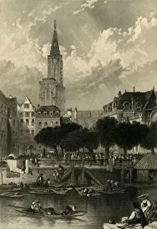
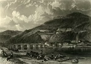
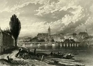
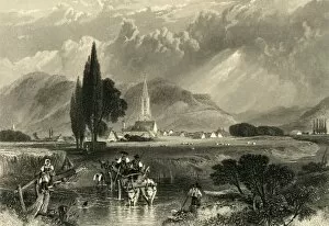
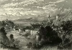
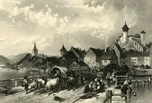
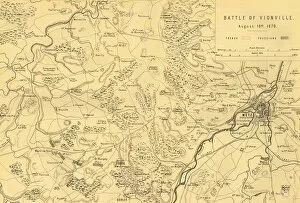
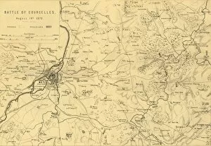
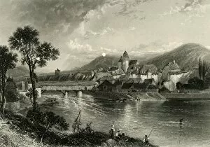
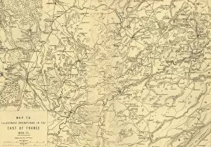
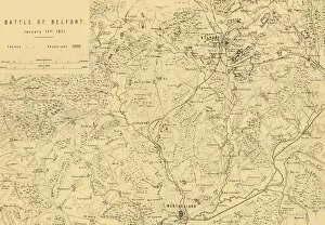
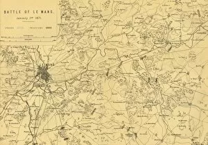
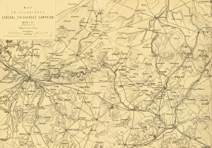
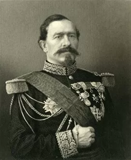
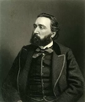
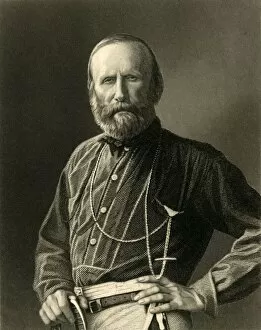
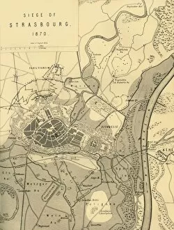
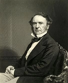
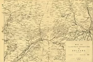
"Sir Henry Montagu Hozier: Exploring the Weapons and Battles of the 19th Century" Step back in time to c1872 as we delve into the fascinating world of Sir Henry Montagu Hozier, a man who dedicated his life to understanding the military history of Prussia. In this captivating collection, we embark on a journey through maps, weaponry, and significant battles that shaped an era. The first map transports us to Prussia, offering a glimpse into its intricate landscape during this period. Created by an unknown artist, it serves as our guide to unraveling the secrets hidden within its borders. Next, Oppenheim comes alive before our eyes with another masterpiece by E I Roberts. The town's rich history unfolds as we immerse ourselves in its streets filled with stories waiting to be discovered. But what is war without weapons? A barrel of Gatling gun catches our attention - a powerful symbol of technological advancement during those times. Crafted by an anonymous creator, it reminds us of how innovation can shape the course of conflicts. Speaking of formidable firepower, Krupps 1000-Pounder Gun demands admiration for its sheer size and strength. Its mysterious origin adds an air of intrigue that leaves us yearning for more knowledge about this mighty weapon. Maps become windows into pivotal moments in history; one such example is the Battle of Sedan on September 1st, 1870. R. Walker's creation allows us to visualize troop movements and strategic decisions made on that fateful day when destinies were forever altered. Marshal Macmahon steps forward from William Holl's artwork - his presence commanding respect and authority. As a key figure in French military history during this era, he played a crucial role in shaping events that unfolded across Europe. Another battle etched onto paper is Woerth on August 6th, 1870 - meticulously depicted by R. Walker once again.