
Smith Street Collection (#2)

Smith Street is a name that resonates across various locations, both near and far

Background imageSmith Street Collection: South Tyneside NE33 5 Map

South Tyneside NE33 5 Map
Postcode Sector Map of South Tyneside NE33 5

Background imageSmith Street Collection: Mansfield NG18 3 Map

Mansfield NG18 3 Map
Postcode Sector Map of Mansfield NG18 3

Background imageSmith Street Collection: Tameside M34 6 Map

Tameside M34 6 Map
Postcode Sector Map of Tameside M34 6

Background imageSmith Street Collection: Knowsley L34 5 Map

Knowsley L34 5 Map
Postcode Sector Map of Knowsley L34 5

Background imageSmith Street Collection: Gwynedd LL49 9 Map

Gwynedd LL49 9 Map
Postcode Sector Map of Gwynedd LL49 9

Background imageSmith Street Collection: Wrexham LL14 1 Map

Wrexham LL14 1 Map
Postcode Sector Map of Wrexham LL14 1

Background imageSmith Street Collection: Lincoln LN5 7 Map

Lincoln LN5 7 Map
Postcode Sector Map of Lincoln LN5 7

Background imageSmith Street Collection: Kinross-Shire KY13 8 Map

Kinross-Shire KY13 8 Map
Postcode Sector Map of Kinross-Shire KY13 8

Background imageSmith Street Collection: Liverpool L5 2 Map

Liverpool L5 2 Map
Postcode Sector Map of Liverpool L5 2

Background imageSmith Street Collection: Kingston upon Thames KT5 8 Map

Kingston upon Thames KT5 8 Map
Postcode Sector Map of Kingston upon Thames KT5 8

Background imageSmith Street Collection: North Ayrshire KA24 5 Map

North Ayrshire KA24 5 Map
Postcode Sector Map of North Ayrshire KA24 5

Background imageSmith Street Collection: South Ayrshire KA7 1 Map

South Ayrshire KA7 1 Map
Postcode Sector Map of South Ayrshire KA7 1

Background imageSmith Street Collection: Moray IV30 6 Map

Moray IV30 6 Map
Postcode Sector Map of Moray IV30 6

Background imageSmith Street Collection: South Ayrshire KA9 1 Map

South Ayrshire KA9 1 Map
Postcode Sector Map of South Ayrshire KA9 1

Background imageSmith Street Collection: Falkirk FK2 7 Map

Falkirk FK2 7 Map
Postcode Sector Map of Falkirk FK2 7

Background imageSmith Street Collection: Glasgow G14 0 Map

Glasgow G14 0 Map
Postcode Sector Map of Glasgow G14 0

Background imageSmith Street Collection: Dudley DY2 8 Map

Dudley DY2 8 Map
Postcode Sector Map of Dudley DY2 8

Background imageSmith Street Collection: North East Lincolnshire DN31 3 Map

North East Lincolnshire DN31 3 Map
Postcode Sector Map of North East Lincolnshire DN31 3

Background imageSmith Street Collection: North Lincolnshire DN15 7 Map

North Lincolnshire DN15 7 Map
Postcode Sector Map of North Lincolnshire DN15 7

Background imageSmith Street Collection: Doncaster DN4 0 Map

Doncaster DN4 0 Map
Postcode Sector Map of Doncaster DN4 0

Background imageSmith Street Collection: County Durham DL13 4 Map

County Durham DL13 4 Map
Postcode Sector Map of County Durham DL13 4

Background imageSmith Street Collection: Warwick CV31 1 Map

Warwick CV31 1 Map
Postcode Sector Map of Warwick CV31 1

Background imageSmith Street Collection: Warwick CV34 4 Map

Warwick CV34 4 Map
Postcode Sector Map of Warwick CV34 4

Background imageSmith Street Collection: Nuneaton & Bedworth CV12 0 Map

Nuneaton & Bedworth CV12 0 Map
Postcode Sector Map of Nuneaton & Bedworth CV12 0

Background imageSmith Street Collection: North Warwickshire CV9 2 Map

North Warwickshire CV9 2 Map
Postcode Sector Map of North Warwickshire CV9 2

Background imageSmith Street Collection: Dundee DD3 8 Map

Dundee DD3 8 Map
Postcode Sector Map of Dundee DD3 8

Background imageSmith Street Collection: Cambridge CB23 4 Map

Cambridge CB23 4 Map
Postcode Sector Map of Cambridge CB23 4

Background imageSmith Street Collection: Rhondda Cynon Taf CF41 7 Map

Rhondda Cynon Taf CF41 7 Map
Postcode Sector Map of Rhondda Cynon Taf CF41 7

Background imageSmith Street Collection: Bridgend CF34 9 Map

Bridgend CF34 9 Map
Postcode Sector Map of Bridgend CF34 9

Background imageSmith Street Collection: Bingley BD16 1 Map

Bingley BD16 1 Map
Postcode Sector Map of Bingley BD16 1

Background imageSmith Street Collection: BL Bolton, BL0 9

BL Bolton, BL0 9
BL0 9

Background imageSmith Street Collection: Bradford BD21 2 Map

Bradford BD21 2 Map
Postcode Sector Map of Bradford BD21 2

Background imageSmith Street Collection: Bradford BD1 2 Map

Bradford BD1 2 Map
Postcode Sector Map of Bradford BD1 2

Background imageSmith Street Collection: BB Blackburn, BB18 5

BB Blackburn, BB18 5
BB18 5

Background imageSmith Street Collection: Burnley BB12 0 Map

Burnley BB12 0 Map
Postcode Sector Map of Burnley BB12 0

Background imageSmith Street Collection: Burnley BB10 3 Map

Burnley BB10 3 Map
Postcode Sector Map of Burnley BB10 3

Background imageSmith Street Collection: BB Blackburn, BB9 9

BB Blackburn, BB9 9
BB9 9

Background imageSmith Street Collection: Pendle BB8 9 Map

Pendle BB8 9 Map
Postcode Sector Map of Pendle BB8 9

Background imageSmith Street Collection: Bradford BD4 6 Map

Bradford BD4 6 Map
Postcode Sector Map of Bradford BD4 6

Background imageSmith Street Collection: Birmingham B19 3 Map

Birmingham B19 3 Map
Postcode Sector Map of Birmingham B19 3

Background imageSmith Street Collection: Plate 31: Bounded by Richards Street, Partition Street, Dwight Street, Bush Street

Plate 31: Bounded by Richards Street, Partition Street, Dwight Street, Bush Street, Columbia Street, Centre Street, Hicks Street, Luquer Street, Henry Street, Nelson Street, Hamilton Avenue

Background imageSmith Street Collection: Plate 32: Map bounded by Degraw Street, Smith Street, Third Place, Clinton Street

Plate 32: Map bounded by Degraw Street, Smith Street, Third Place, Clinton Street. 1855, William Perris, Brooklyn, New York, N.Y. USA

Background imageSmith Street Collection: Plate 33: Map bounded by Third Place, Smith Street, Bush Street, Clinton Street

Plate 33: Map bounded by Third Place, Smith Street, Bush Street, Clinton Street, Hamilton Avenue, Henry Street. 1855, William Perris, Brooklyn, New York, N.Y. USA

Background imageSmith Street Collection: Plate 29: Map bounded by Joralemon Street, Fulton Street, Smith Street, Atlantic Avenue

Plate 29: Map bounded by Joralemon Street, Fulton Street, Smith Street, Atlantic Avenue, Hoyt Street, Bergen Street, Court Street. 1855, William Perris, Brooklyn, New York, N.Y. USA

Background imageSmith Street Collection: Plate 2: Map bounded by South 8th Street, 1st Street, Division Street, Devoe Street

Plate 2: Map bounded by South 8th Street, 1st Street, Division Street, Devoe Street, Union Avenue, Ainslie Street, 1st Street, 9th Street, Smith Street, Messerole Street, Scholl Street

Background imageSmith Street Collection: USA, New York, New York City, Brooklyn: Cobble Hill, Outdoor Cafe Tables / Smith Street

USA, New York, New York City, Brooklyn: Cobble Hill, Outdoor Cafe Tables / Smith Street

Background imageSmith Street Collection: Busy traffic on Smith Street

Busy traffic on Smith Street, Brooklyn, New York, New York State, United States of America, North America


For sale as Licensed Images

Choose your image, Select your licence and Download the media

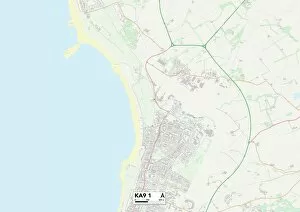
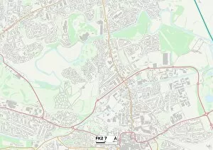
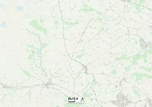
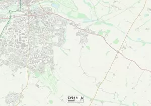
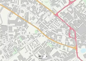
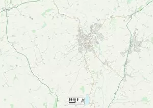
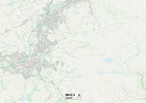
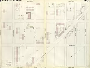
Smith Street is a name that resonates across various locations, both near and far. From the bustling streets of Wigan in England (WN7 2 Map) to the charming lanes of Wiltshire (SN14 7 Map) they can be found weaving its way through different towns and cities. In Barnsley (S73 0 Map), Smith Street stands as a testament to history, with its old-world charm blending seamlessly with modern developments. Meanwhile, in Chorley (PR7 3 Map) and Chorley PR6 7 Map), this street serves as a vibrant hub for locals and visitors alike, offering an array of shops, cafes, and cultural attractions. Across the pond in New York City's Brooklyn neighborhood, Smith Street takes on a whole new persona. Cobble Hill's Smith Street is renowned for its trendy boutiques, eclectic eateries, and lively nightlife scene - truly capturing the essence of urban cool. But it doesn't stop there; Smith Street stretches even further across continents. In Durban, South Africa (b/w photo), this historic street showcases architectural wonders like the Royal Hotel while exuding an air of nostalgia. Back in England once more, Wolverhampton's Smith Street (WV14 0 Map) offers a mix of residential areas and local businesses catering to all needs. Similarly diverse is Stockton-on-Tees' interpretation (TS18 2 Map), where community spirit thrives alongside commercial ventures. Further north lies Warrington's rendition (WA1 2 Map). Here you'll find everything from quaint independent stores to well-known chains - making it an ideal destination for retail therapy enthusiasts. Lastly but not leastly resides Watford's own slice magic (WD18 OMap). This thriving area boasts an abundance of amenities ranging from shopping centers to recreational spaces – ensuring residents have everything they need right on their doorstep.