
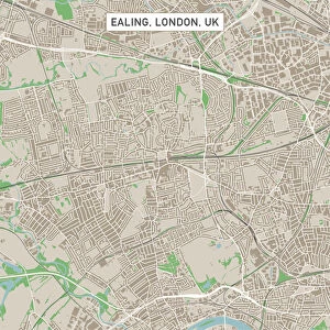
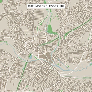
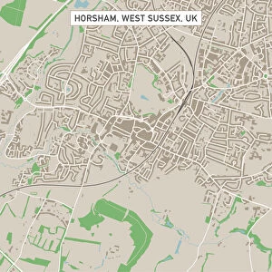
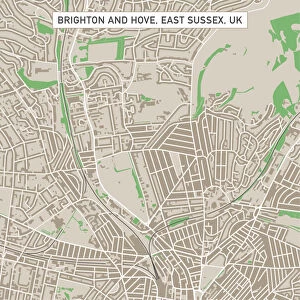
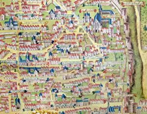
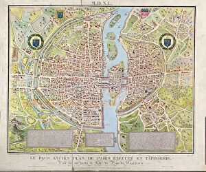
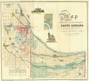
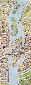
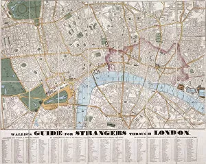
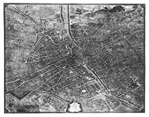
Street Map Collection (page 2)

"Exploring the urban maze: Unveiling the secrets of city streets through street maps" San Francisco City Map

Background imageStreet Map Collection: Dover Kent UK City Street Map

Dover Kent UK City Street Map
Vector Illustration of a City Street Map of Dover, Kent, UK. Included files are EPS (v10) and Hi-Res JPG. Data courtesy from Ordnance Survey: VectorMap District https

Background imageStreet Map Collection: Folkestone Kent UK City Street Map

Folkestone Kent UK City Street Map
Vector Illustration of a City Street Map of Folkestone, Kent, UK. Included files are EPS (v10) and Hi-Res JPG. Data courtesy from Ordnance Survey: VectorMap District https

Background imageStreet Map Collection: Ashford Kent UK City Street Map

Ashford Kent UK City Street Map
Vector Illustration of a City Street Map of Ashford, Kent, UK. Included files are EPS (v10) and Hi-Res JPG. Data courtesy from Ordnance Survey: VectorMap District https

Background imageStreet Map Collection: Hastings East Sussex UK City Street Map

Hastings East Sussex UK City Street Map
Vector Illustration of a City Street Map of Hastings, East Sussex, UK. Included files are EPS (v10) and Hi-Res JPG. Data courtesy from Ordnance Survey: VectorMap District https

Background imageStreet Map Collection: Royal Tunbridge Wells Kent UK City Street Map

Royal Tunbridge Wells Kent UK City Street Map
Vector Illustration of a City Street Map of Royal Tunbridge Wells, Kent, UK. Included files are EPS (v10) and Hi-Res JPG. Data courtesy from Ordnance Survey: VectorMap District https

Background imageStreet Map Collection: Ealing London UK City Street Map

Ealing London UK City Street Map
Vector Illustration of a City Street Map of Ealing, London, UK. Included files are EPS (v10) and Hi-Res JPG. Data courtesy from Ordnance Survey: VectorMap District https

Background imageStreet Map Collection: Felixstowe Suffolk UK City Street Map

Felixstowe Suffolk UK City Street Map
Vector Illustration of a City Street Map of Felixstowe, Suffolk, UK. Included files are EPS (v10) and Hi-Res JPG. Data courtesy from Ordnance Survey: VectorMap District https

Background imageStreet Map Collection: Clacton-on-Sea Essex UK City Street Map

Clacton-on-Sea Essex UK City Street Map
Vector Illustration of a City Street Map of Clacton-on-Sea, Essex, UK. Included files are EPS (v10) and Hi-Res JPG. Data courtesy from Ordnance Survey: VectorMap District https

Background imageStreet Map Collection: Braintree Essex UK City Street Map

Braintree Essex UK City Street Map
Vector Illustration of a City Street Map of Braintree, Essex, UK. Included files are EPS (v10) and Hi-Res JPG. Data courtesy from Ordnance Survey: VectorMap District https

Background imageStreet Map Collection: Chelmsford Essex UK City Street Map

Chelmsford Essex UK City Street Map
Vector Illustration of a City Street Map of Chelmsford, Essex, UK. Included files are EPS (v10) and Hi-Res JPG. Data courtesy from Ordnance Survey: VectorMap District https

Background imageStreet Map Collection: Hemel Hempstead Hertfordshire UK City Street Map

Hemel Hempstead Hertfordshire UK City Street Map
Vector Illustration of a City Street Map of Hemel Hempstead, Hertfordshire, UK. Included files are EPS (v10) and Hi-Res JPG

Background imageStreet Map Collection: Burgess Hill West Sussex UK City Street Map

Burgess Hill West Sussex UK City Street Map
Vector Illustration of a City Street Map of Burgess Hill, West Sussex, UK. Included files are EPS (v10) and Hi-Res JPG. Data courtesy from Ordnance Survey: VectorMap District https

Background imageStreet Map Collection: Horsham West Sussex UK City Street Map

Horsham West Sussex UK City Street Map
Vector Illustration of a City Street Map of Horsham, West Sussex, UK. Included files are EPS (v10) and Hi-Res JPG. Data courtesy from Ordnance Survey: VectorMap District https

Background imageStreet Map Collection: Eastbourne East Sussex UK City Street Map

Eastbourne East Sussex UK City Street Map
Vector Illustration of a City Street Map of Eastbourne, East Sussex, UK. Included files are EPS (v10) and Hi-Res JPG. Data courtesy from Ordnance Survey: VectorMap District https

Background imageStreet Map Collection: Wimbledon London UK City Street Map

Wimbledon London UK City Street Map
Vector Illustration of a City Street Map of Wimbledon, London, UK. Included files are EPS (v10) and Hi-Res JPG. Data courtesy from Ordnance Survey: VectorMap District https

Background imageStreet Map Collection: Brighton And Hove East Sussex UK City Street Map

Brighton And Hove East Sussex UK City Street Map
Vector Illustration of a City Street Map of Brighton And Hove, East Sussex, UK. Included files are EPS (v10) and Hi-Res JPG

Background imageStreet Map Collection: Paris City Centre Street Map

Paris City Centre Street Map
A detailed street level map of central Paris. Covers from La Chapelle in the north to Montparnasse Cemetery in the south and to Parc des Buttes-Chamont in the east to Pont de Grenelle in the west

Background imageStreet Map Collection: Lisbon City Centre Street Map

Lisbon City Centre Street Map
A detailed street level map of central Lisbon. Covers from the airport in the north to Rio Tejo in the south and from Parque das Nacoes in the east to Carnide in the west. All labels are in Portuguese

Background imageStreet Map Collection: Chicago City Map

Chicago City Map
A street level map of central Chicago based on USGS topo map data. Covers from North Center in the north to Back of the Yards in the south

Background imageStreet Map Collection: Dereham Norfolk UK City Street Map

Dereham Norfolk UK City Street Map
Vector Illustration of a City Street Map of Dereham, Norfolk, UK. Included files are EPS (v10) and Hi-Res JPG. Data courtesy from Ordnance Survey: VectorMap District https

Background imageStreet Map Collection: Caister-on-Sea Norfolk UK City Street Map

Caister-on-Sea Norfolk UK City Street Map
Vector Illustration of a City Street Map of Caister-on-Sea, Norfolk, UK. Included files are EPS (v10) and Hi-Res JPG. Data courtesy from Ordnance Survey: VectorMap District https

Background imageStreet Map Collection: Peterborough Cambridgeshire UK City Street Map

Peterborough Cambridgeshire UK City Street Map
Vector Illustration of a City Street Map of Peterborough, Cambridgeshire, UK. Included files are EPS (v10) and Hi-Res JPG

Background imageStreet Map Collection: Hatfield Hertfordshire UK City Street Map

Hatfield Hertfordshire UK City Street Map
Vector Illustration of a City Street Map of Hatfield, Hertfordshire, UK. Included files are EPS (v10) and Hi-Res JPG. Data courtesy from Ordnance Survey: VectorMap District https

Background imageStreet Map Collection: Canterbury Kent UK City Street Map

Canterbury Kent UK City Street Map
Vector Illustration of a City Street Map of Canterbury, Kent, UK. Included files are EPS (v10) and Hi-Res JPG. Data courtesy from Ordnance Survey: VectorMap District https

Background imageStreet Map Collection: Bromley London UK City Street Map

Bromley London UK City Street Map
Vector Illustration of a City Street Map of Bromley, London, UK. Included files are EPS (v10) and Hi-Res JPG

Background imageStreet Map Collection: Scottsdale Arizona US City Street Map

Scottsdale Arizona US City Street Map
Vector Illustration of a City Street Map of Scottsdale, Arizona, USA. Scale 1:60, 000. All source data is in the public domain. U.S

Background imageStreet Map Collection: Tucson Arizona US City Street Map

Tucson Arizona US City Street Map
Vector Illustration of a City Street Map of Tucson, Arizona, USA. Scale 1:60, 000. All source data is in the public domain. U.S

Background imageStreet Map Collection: Long Beach California US City Street Map

Long Beach California US City Street Map
Vector Illustration of a City Street Map of Long Beach, California, USA. Scale 1:60, 000. All source data is in the public domain. U.S

Background imageStreet Map Collection: Lake Havasu City Arizona US City Street Map

Lake Havasu City Arizona US City Street Map
Vector Illustration of a City Street Map of Lake Havasu City, Arizona, USA. Scale 1:60, 000. All source data is in the public domain. U.S

Background imageStreet Map Collection: Yuma Arizona US City Street Map

Yuma Arizona US City Street Map
Vector Illustration of a City Street Map of Yuma, Arizona, USA. Scale 1:60, 000. All source data is in the public domain. U.S

Background imageStreet Map Collection: Croydon London UK City Street Map

Croydon London UK City Street Map
Vector Illustration of a City Street Map of Croydon, London, UK. Included files are EPS (v10) and Hi-Res JPG. Data courtesy from Ordnance Survey: VectorMap District https

Background imageStreet Map Collection: Colding, from Civitates Orbis Terrarum by Georg Braun (1541-1622

Colding, from Civitates Orbis Terrarum by Georg Braun (1541-1622
STC138998 Colding, from Civitates Orbis Terrarum by Georg Braun (1541-1622) and Frans Hogenburg (1535-90), c.1572 (coloured engraving) by Hoefnagel

Background imageStreet Map Collection: Detail of the Right Bank, from the map of Paris c. 1540

Detail of the Right Bank, from the map of Paris c. 1540
617394 Detail of the Right Bank, from the map of Paris c. 1540, known as the Plan de la Tapisserie, made as a tapestry c. 1570, 1818 (colour engraving) by Naudet

Background imageStreet Map Collection: Antique Map of Lower Manhattan and Central Park, 1892 (colour litho)

Antique Map of Lower Manhattan and Central Park, 1892 (colour litho)
2630128 Antique Map of Lower Manhattan and Central Park, 1892 (colour litho) by American School, (19th century); Private Collection; (add.info.: Antique map of lower Manhattan and Central Park)

Background imageStreet Map Collection: Map of Illinois Central Railroad Companys depot grounds and buildings in Chicago

Map of Illinois Central Railroad Companys depot grounds and buildings in Chicago
NBY332294 Map of Illinois Central Railroad Companys depot grounds and buildings in Chicago, 1855 (litho) by Mendel, Edward (1827-84); Newberry Library, Chicago, Illinois

Background imageStreet Map Collection: The Montagne Sainte-Genevieve, detail from the plan of Paris made c

The Montagne Sainte-Genevieve, detail from the plan of Paris made c
CHT163105 The Montagne Sainte-Genevieve, detail from the plan of Paris made c.1540, called Plan de la Gouache, c.1860 (coloured engraving) by French School

Background imageStreet Map Collection: Map of Paris c. 1540, known as the Plan de la Tapisserie, made as a tapestry c

Map of Paris c. 1540, known as the Plan de la Tapisserie, made as a tapestry c
CHT163104 Map of Paris c.1540, known as the Plan de la Tapisserie, made as a tapestry c.1571, 1818 (colour engraving) by Naudet, Caroline (1775-1839); Bibliotheque Historique de la Ville de Paris

Background imageStreet Map Collection: Redraft of The Castello Plan, New Amsterdam in 1660, 1916

Redraft of The Castello Plan, New Amsterdam in 1660, 1916
NYH192074 Redraft of The Castello Plan, New Amsterdam in 1660, 1916 by Adams, John Wolcott (1874-1925); Collection of the New-York Historical Society

Background imageStreet Map Collection: Map of South Chicago, 1871 (colour litho)

Map of South Chicago, 1871 (colour litho)
NBY332282 Map of South Chicago, 1871 (colour litho) by American School, (19th century); Newberry Library, Chicago, Illinois, USA; (add.info.: Lake County, Calumet, Thornton)

Background imageStreet Map Collection: Plan of the Cities of London and Westminster and Borough of Southwark

Plan of the Cities of London and Westminster and Borough of Southwark
GHL276290 Plan of the Cities of London and Westminster and Borough of Southwark, engraved by John Tinney, pub. 1746 (engraving) by Rocque, John (d.1762) (after); London Metropolitan Archives

Background imageStreet Map Collection: Detail of the Ile de la Cite, from the map of Paris c. 1540

Detail of the Ile de la Cite, from the map of Paris c. 1540
617396 Detail of the Ile de la CitA©, from the map of Paris c. 1540, known as the Plan de la Tapisserie, made as a tapestry c.1570, 1818 (colour engraving) by Naudet

Background imageStreet Map Collection: Plan of New Orleans, 1738 (w / c on paper)

Plan of New Orleans, 1738 (w / c on paper)
XDT219664 Plan of New Orleans, 1738 (w/c on paper) by French School, (18th century); Min. Defense - Service Historique de l Armee de Terre, France; French, out of copyright

Background imageStreet Map Collection: Metz, Wurtzburg, and Sittensen, from Civitates Orbis Terrarum

Metz, Wurtzburg, and Sittensen, from Civitates Orbis Terrarum
STC213499 Metz, Wurtzburg, and Sittensen, from Civitates Orbis Terrarum by Georg Braun (1541-1622) and Frans Hogenburg (1535-90), c.1572 (coloured engraving) by Hoefnagel

Background imageStreet Map Collection: West Cheap as it appeared in the year 1585, engraved by Bartholemew Howlett (1767-1827

West Cheap as it appeared in the year 1585, engraved by Bartholemew Howlett (1767-1827
STC192768 West Cheap as it appeared in the year 1585, engraved by Bartholemew Howlett (1767-1827) published 1814 (engraving) by Treswell

Background imageStreet Map Collection: Detail of the Left Bank, from the map of Paris c. 1540, known as the

Detail of the Left Bank, from the map of Paris c. 1540, known as the
617395 Detail of the Left Bank, from the map of Paris c. 1540, known as the Plan de la Tapisserie, made as a tapestry c.1570, 1818 (colour engraving) by Naudet

Background imageStreet Map Collection: Boston and Bunker Hill, 1781 (litho)

Boston and Bunker Hill, 1781 (litho)
PNP332815 Boston and Bunker Hill, 1781 (litho) by American School, (18th century); Private Collection; (add.info.: British victory at Battle of Bunker Hill, 17 June 1775)

Background imageStreet Map Collection: Walliss Guide for Strangers Through London, 1841 (colour litho)

Walliss Guide for Strangers Through London, 1841 (colour litho)
STC221896 Walliss Guide for Strangers Through London, 1841 (colour litho) by Wallis, Edward (fl.1841); Private Collection; (add.info)

Background imageStreet Map Collection: Plan of Paris, known as the Plan de Turgot, engraved by Claude Lucas

Plan of Paris, known as the Plan de Turgot, engraved by Claude Lucas
XIR180001 Plan of Paris, known as the Plan de Turgot, engraved by Claude Lucas, 1734-39 (engraving) (b/w photo) by Bretez, Louis (18th century) (after); Private Collection; French, out of copyright


For sale as Licensed Images

Choose your image, Select your licence and Download the media

"Exploring the urban maze: Unveiling the secrets of city streets through street maps" San Francisco City Map: Navigate the vibrant streets of San Francisco and uncover hidden gems in this iconic city. Washington DC City Map: Discover the heart of American history as you wander through the streets of Washington DC, home to famous landmarks and political powerhouses. Dublin City Centre Street Map: Immerse yourself in Irish culture as you explore Dublin's bustling city center, filled with lively pubs, historic sites, and charming cobblestone streets. Milwaukee, Wisconsin Area Street Map: Get lost in the charm of Milwaukee's neighborhoods and experience Midwestern hospitality at its finest. Ipswich Suffolk UK City Street Map: Dive into English heritage as you stroll along Ipswich's picturesque streets lined with medieval architecture and quaint shops. Madrid City Centre Street Map: Embark on a journey through Spain's capital city, Madrid, where grand boulevards meet narrow alleyways leading to vibrant plazas brimming with life. Margate Kent UK City Street Map: Explore Margate's coastal charm as you meander along its scenic promenade or lose yourself amidst its artistic community thriving within colorful lanes. Los Angeles City Map: Experience the glitz and glamour of Hollywood while navigating through Los Angeles' sprawling metropolis dotted with palm-lined avenues and world-famous attractions. Rome City Centre Street Map: Step back in time to ancient Rome by wandering through its enchanting cobbled alleys that lead to awe-inspiring historical sites like the Colosseum or Vatican City. Lowestoft Suffolk UK City Street Map: Delight in Lowestoft's seaside allure as you follow winding paths that reveal stunning beaches, charming cafes, and a rich maritime heritage. Bury St Edmunds Suffolk UKCityStreetMap .