
Terra Australis Collection
"Terra Australis: Unveiling the Mysteries of the Southern Land" In the 16th century, explorers and cartographers embarked on a quest to map the world


For sale as Licensed Images
Choose your image, Select your licence and Download the media
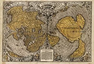
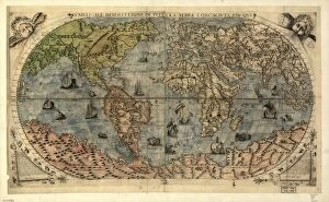
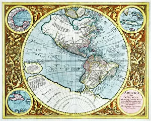
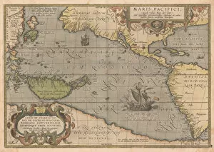
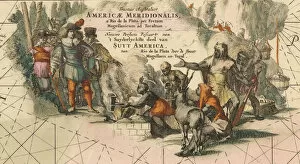
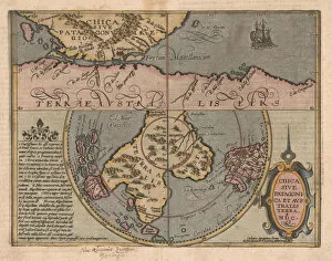
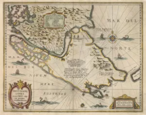
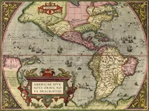
"Terra Australis: Unveiling the Mysteries of the Southern Land" In the 16th century, explorers and cartographers embarked on a quest to map the world, uncovering new lands and expanding our understanding of Earth. One such discovery was Terra Australis, a mythical continent believed to exist in the southern hemisphere. The enigma surrounding this uncharted territory captivated minds and inspired numerous maps. Oronce Fine's intricate world map from 1531 showcased his interpretation of Terra Australis, depicting it as an expansive landmass stretching across vast oceans. This imaginative representation fueled curiosity about what lay beyond known shores. The 17th-century map of the New World by Abraham Ortelius presented America sive India Nova, revealing snippets of information about Terra Australis alongside other newly discovered regions. It served as a testament to ongoing exploration efforts during that era. Frederik de Wit's Tractus australior Americae Meridionalis depicted a route from Rio de la Plata through Magellan Strait to Toraltum, providing insights into potential connections between South America and Terra Australis. Matthias Quad's Chica sive Patagonica et Australis Terra offered glimpses into both Patagonia and Australia, shedding light on these mysterious lands with detailed illustrations capturing their unique features. Jodocus Hondius' Freti Magellanici ac novi freti vulgo Le Maire exactissima delineatio provided an accurate depiction of Magellan Strait and Le Maire Strait – crucial passageways for early explorers venturing towards Terra Australis. Pedro Fernandez de Queiros' works further contributed to our knowledge about this elusive landmass. His Relation memorialized his encounters with unknown territories while his Voyages chronicled his expeditions in search of Terra Australis. These accounts were widely disseminated through Italian editions, leaving lasting impressions on future generations.