Topographic Map Collection (page 3)

"Journey through Time

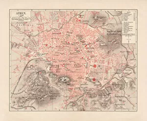
Background imageTopographic Map Collection: City map of Athens, lithograph, published in 1881

City map of Athens, lithograph, published in 1881
City map of Athens. Lithograph, published in 1881

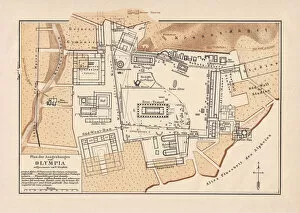
Background imageTopographic Map Collection: Excavations of Olympia, lithograph, published in 1880

Excavations of Olympia, lithograph, published in 1880
Old map of the plan of the excavations of Olympia. Lithograph, published in 1880

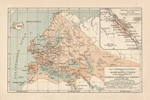
Background imageTopographic Map Collection: Pestilence in Europe, mid-14th century, lithograph, published in 1880

Pestilence in Europe, mid-14th century, lithograph, published in 1880
Ancient map of the area of pestilence in Europe, Western Asia, and North Africa in the years 1346 - 1351. Lithograph, published in 1880

Background imageTopographic Map Collection: United States of America, States on Mississippi river, lithograph published 1878

United States of America, States on Mississippi river, lithograph published 1878
United States of America, States on the Mississippi river. Lithograph, published in 1878

Background imageTopographic Map Collection: United States of America, Atlantic coast, lithograph, published in 1878

United States of America, Atlantic coast, lithograph, published in 1878
United States of America, Atlantic coast. Lithograph, published in 1878

Background imageTopographic Map Collection: United States of America, Mexico and Central America, published in 1878

United States of America, Mexico and Central America, published in 1878
United States of America, Mexico and Central America. Lithograph, published in 1878

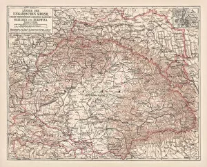
Background imageTopographic Map Collection: Hungary, lithograph, published in 1878

Hungary, lithograph, published in 1878
Ancient map of Hungarian Monarchy, Galicia and Bukovina. Lithograph, published in 1878

Background imageTopographic Map Collection: Tirol, Vorarlberg and Salzburg in Austria, lithograph, published in 1878

Tirol, Vorarlberg and Salzburg in Austria, lithograph, published in 1878
Ancient map of Tirol, Vorarlberg and Salzburg in Austria. Lithograph, published in 1878

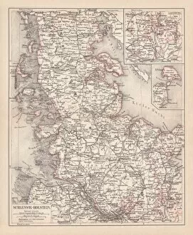
Background imageTopographic Map Collection: Schleswig-Holstein, lithograph, published in 1878

Schleswig-Holstein, lithograph, published in 1878
Map of Schleswig-Holstein. Lithograph, published in 1878

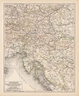
Background imageTopographic Map Collection: Styria, lithograph, published in 1878

Styria, lithograph, published in 1878
Ancient map of Styria: Carinthia, Carniola, GradiAaka, Croatia, Istria, Triest. Lithograph, published in 1878

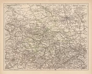
Background imageTopographic Map Collection: Province of Saxony, lithograph, published in 1878

Province of Saxony, lithograph, published in 1878
Province of Saxony, former territory of Prussia from 1816 to 1945. Lithograph, published in 1878

Background imageTopographic Map Collection: Prussia, lithograph, lithograph, published in 1878

Prussia, lithograph, lithograph, published in 1878
The Kingdom of Prussia at its greatest extent, after 1866. Lithograph, published in 1878

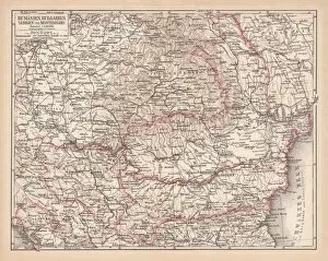
Background imageTopographic Map Collection: Balkan States, lithograph, published in 1878

Balkan States, lithograph, published in 1878
Ancient map of the Balkan States: Romania, Bulgaria, Serbia and Montenegro. Lithograph, published in 1878

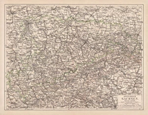
Background imageTopographic Map Collection: Kingdom of Saxony, lithograph, published in 1878

Kingdom of Saxony, lithograph, published in 1878
Kingdom of Saxony. Lithograph, published in 1878

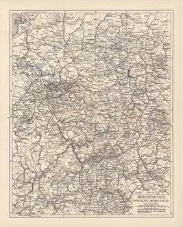
Background imageTopographic Map Collection: Prussian provinces, lithograph, published in 1878

Prussian provinces, lithograph, published in 1878
Prussian provinces: Rhineland, Westphalia, and Hesse-Nassau. Lithograph, published in 1878

Background imageTopographic Map Collection: Pomerania, lithograph, lithograph, published in 1878

Pomerania, lithograph, lithograph, published in 1878
Pomerania, former territory of the German Empire. Lithograph, published in 1878

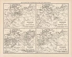
Background imageTopographic Map Collection: Historical development of Prussia, lithograph, published in 1878

Historical development of Prussia, lithograph, published in 1878
Ancient maps of the historical development of Prussia, 17th - 19th century. Lithograph, published in 1878

Background imageTopographic Map Collection: Upper Austria, lithograph, published in 1877

Upper Austria, lithograph, published in 1877
Upper Austria (Austria above the Enns, A-sterreich ob der Enns). Lithograph, published in 1877

Background imageTopographic Map Collection: Ancient map of Mecklenburg, lithograph, published in 1877

Ancient map of Mecklenburg, lithograph, published in 1877
Ancient map of Mecklenburg, Germany. Lithograph, published in 1877

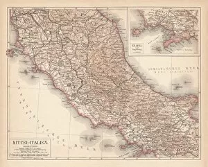
Background imageTopographic Map Collection: Map of Central Italy, lithograph, puplished in 1876

Map of Central Italy, lithograph, puplished in 1876
Map of Central Italy. Lithograph, published in 1876

Background imageTopographic Map Collection: Map of Italy, lithograph, published in 1876

Map of Italy, lithograph, published in 1876
Map of Italy. Lithograph, published in 1876

Background imageTopographic Map Collection: Map of Denmark and Iceland, lithograph, published in 1875

Map of Denmark and Iceland, lithograph, published in 1875
Map of Denmark and Iceland. Lithograph, published in 1875

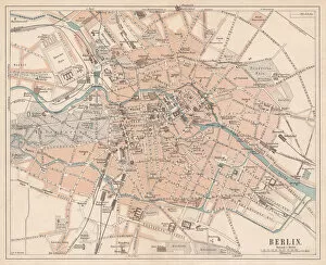
Background imageTopographic Map Collection: Berlin, city map, lithograph, published in 1874

Berlin, city map, lithograph, published in 1874
Historic city map of Berlin, Germany. Lithograph, published in 1874

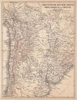
Background imageTopographic Map Collection: Argentina, Bolivia, Chile, Paraguay and Uruguay, lithograph, published in 1874

Argentina, Bolivia, Chile, Paraguay and Uruguay, lithograph, published in 1874
South American countries: Argentina, Bolivia, Chile, Paraguay and Uruguay. Lithograph, published in 1874

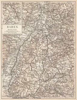
Background imageTopographic Map Collection: Historical German territory of Baden, lithograph, published in 1874

Historical German territory of Baden, lithograph, published in 1874
Map of Baden - a historical German territory (today Baden-Wurttemberg). Lithograph, published in 1874

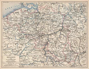
Background imageTopographic Map Collection: Belgium and Luxembourg, lithograph, published in 1874

Belgium and Luxembourg, lithograph, published in 1874
Antique map of Belgium and Luxembourg. Lithograph, published in 1874

Background imageTopographic Map Collection: Map of Palestine, steel engraving, published in 1836

Map of Palestine, steel engraving, published in 1836
Topographic Map of Palestine, 1832. Steel engraving by J. Zipter, published in 1836

Background imageTopographic Map Collection: Map of Denmark and Iceland, lithograph, published in 1881

Map of Denmark and Iceland, lithograph, published in 1881
Topographic map of Denmark and Iceland. Facsimile, published in 1881

Background imageTopographic Map Collection: Map of Genoa 1898

Map of Genoa 1898

Background imageTopographic Map Collection: Konigsberg

Konigsberg
Antique map of Konigsberg

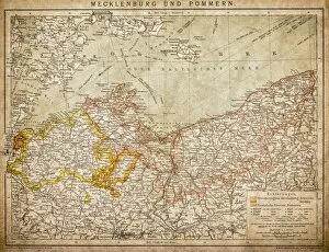
Background imageTopographic Map Collection: Mecklenburg and Pomerania

Mecklenburg and Pomerania
Ancient map of Mecklenburg and Pomerania

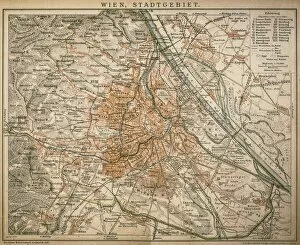
Background imageTopographic Map Collection: Vienna, city landscape 1898

Vienna, city landscape 1898
Antique illustration of Vienna, city landscape

Background imageTopographic Map Collection: Budapest

Budapest, capital of Hungary from 1898

Background imageTopographic Map Collection: Tunnelling current amplifier, artwork C017 / 3618

Tunnelling current amplifier, artwork C017 / 3618
Tunnelling current amplifier, computer artwork. Tunnelling current amplifiers are used in scanning tunnelling spectroscopy

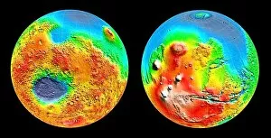
Background imageTopographic Map Collection: Martian topography

Martian topography. Three-dimensional map of the topography of Mars. Elevation is colour-coded, from white (highest) through red, yellow and green to blue (lowest)

Background imageTopographic Map Collection: 3-D topography of Mars

3-D topography of Mars
Mars global topography. Three-dimensional map of Mars showing the topography of the entire planet. The south pole is at the bottom of the left image, with the north pole at the top of the right one

Background imageTopographic Map Collection: Global topographic map of Venus

Global topographic map of Venus
Colour-coded topographic map of the surface of Venus, compiled from radar data recorded by the Pioneer-Venus spacecraft. The smooth circle at top marks the north pole


For sale as Licensed Images

Choose your image, Select your licence and Download the media

"Journey through Time: Exploring the World with Topographic Maps" Step back in time and embark on a captivating journey as we delve into the fascinating world of topographic maps. These intricate works of art, meticulously crafted centuries ago, offer us a glimpse into the landscapes and cities of yesteryears. Let's start our adventure in 1880, where we find ourselves traversing the enchanting island of Cyprus. This topographic map showcases its diverse terrain, from rugged mountains to serene coastlines, inviting us to explore its hidden treasures. Next, we stumble upon a historical city map of Heidelberg in Baden-Württemberg, Germany. Published in 1897 as a lithograph masterpiece, it reveals the architectural marvels that have stood tall for generations within this picturesque town. As our voyage continues, we encounter an intricately detailed map of the Netherlands published in 1877. Its lithograph craftsmanship allows us to appreciate every canal and windmill that dots this iconic landscape. Moving southward towards Italy's eternal city, Rome beckons us with its rich history depicted on a lithograph from 1878. This stunning piece captures Rome's grandeur during ancient times while showcasing its timeless landmarks such as the Colosseum and Pantheon. Our exploration takes an imperial turn as we uncover an Austro-Hungarian Empire map dating back to 1877. A testament to Habsburg Monarchy's vast dominion across Central Europe at that time – it offers insights into their expansive territories and cultural diversity. The Panama Canal Project comes alive before our eyes through an intriguing lithograph published in 1880. Witness how human ingenuity transformed this narrow strip between two continents into one of mankind's greatest engineering feats. Venturing further eastwards brings us to Beirut - Lebanon’s historic gem captured beautifully on wood engraving from 1897. Explore winding streets filled with tales untold and discover the city's vibrant past through this captivating piece of art.