
Topographical Collection (#32)
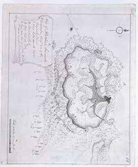
"Exploring the World's Topographical Wonders: From Florence to Mars" "Step back in time with the Carta della Catena, a mesmerizing view of Florence in 1490


For sale as Licensed Images
Choose your image, Select your licence and Download the media
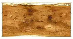
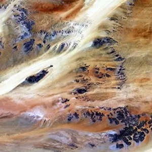
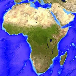
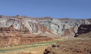
"Exploring the World's Topographical Wonders: From Florence to Mars" "Step back in time with the Carta della Catena, a mesmerizing view of Florence in 1490, revealing its topographical beauty. " "Witness history unfold as Old Bill kneels before the Cenotaph in Whitehall, a poignant reminder of sacrifice and an iconic part of London's topography. " "Immerse yourself in Welsh culture as three women don traditional costumes, showcasing their rich heritage against the backdrop of Wales' stunning topography. " "March to the beat of history with the 1st Battalion Cheshire Regiment's regimental drum, symbolizing their presence across diverse landscapes throughout time. " "Uncover Martinique's hidden treasures through a detailed map that unveils its captivating Caribbean island topography from centuries ago. " "Experience poetic inspiration through Rob W Service's 'The Quitter, ' where words paint vivid pictures mirroring nature’s ever-changing topography within our souls. " "Relive the intensity of tank battles on the Somme as British MkIV and German A7V tanks clash amidst war-torn landscapes and shifting topographies. " "Dive into uncharted depths beneath ocean waves with Mariana Trench sea floor topography – an awe-inspiring glimpse into Earth’s mysterious abysses. " "Discover Gwrych Castle's majestic allure nestled within North Wales' enchanting landscape – a testament to architectural grandeur harmonizing with natural topography. " "Marvel at St Michaels Mount - an island sanctuary rising majestically from Cornwall’s shores, blending medieval charm with breathtaking coastal scenery. " “Embark on a visual journey through Venice circa 1500; let this woodcut transport you to canals intertwining seamlessly amidst Venetian architectural marvels. ”