
Western Part Collection
Discover the wonders of the Western part of the Roman Empire as depicted on this ancient map


For sale as Licensed Images
Choose your image, Select your licence and Download the media
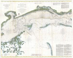
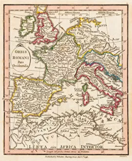
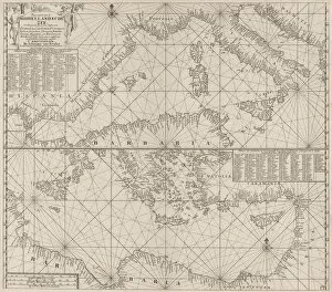
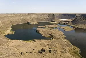
Discover the wonders of the Western part of the Roman Empire as depicted on this ancient map. From the sun-kissed shores of the Mediterranean Sea, where the eastern and western parts meet, to the rugged cliffs of the Aegean Sea coast, explore the rich history and culture that once thrived in this region. Travel back in time with a passport to the Western part of the Roman Empire, where Heidelberg Castle stands majestically in the distance, as seen in this 1820 painting. Wander through the halls of power and beauty, where art, literature, and philosophy flourished. But the Western part of the Roman Empire was not just a land of grand castles and ancient ruins. It was also a land of natural wonders, like the awe-inspiring waterfall scar at Dry Falls in Grand Coulee, Washington. Created by the breaching of Lake Missoulas ice dam at the end of the Ice Age, this 120m high and 5km wide wonder is a testament to the power of nature. Navigate the Western part of the United States of America with this 1866 US Coast Survey Chart of the Mississippi Sound. From its topography to its hidden treasures, this map invites you to explore the wonders of the Western part of the Roman Empire and the United States of America.