Home > Europe > United Kingdom > England > Birmingham > Area > Bournbrook
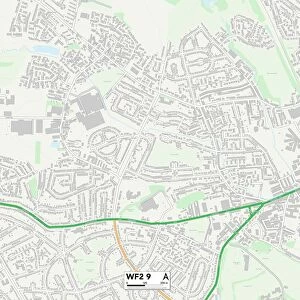
Birmingham B29 7 Map

![]()
Wall Art and Photo Gifts from Map Marketing
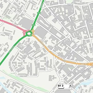
Birmingham B29 7 Map
Postcode Sector Map of Birmingham B29 7
Media ID 19965383
Alton Road Birkdale Grove Birmingham Cecil Road Coronation Road Croydon Road Dawlish Road Eastern Road First Avenue Fourth Avenue Greenland Road Harrow Road Holly Avenue Kensington Road Kitchener Road Lantern Close Luton Road Milner Road Oakfield Road Park Corner Pershore Road Priory Avenue Ribblesdale Road Riverside Drive Rookery Road Second Avenue Serpentine Road Seymour Close St Edwards Road Teignmouth Road The Nursery The Stables Third Avenue Tiverton Road Union Place Upland Road Wallace Road Westminster Road Woodside Road
FEATURES IN THESE COLLECTIONS
> Arts
> Artists
> H
> John Hillers
> Arts
> Artists
> H
> John Hills
> Europe
> United Kingdom
> England
> Birmingham
> Area
> Bournbrook
> Europe
> United Kingdom
> England
> Birmingham
> Area
> Selly Park
> Europe
> United Kingdom
> England
> London
> Boroughs
> Croydon
> Europe
> United Kingdom
> England
> London
> Boroughs
> Harrow
> Europe
> United Kingdom
> England
> London
> Sights
> Kensington Gardens
> Europe
> United Kingdom
> England
> London
> Sights
> Serpentine
> Europe
> United Kingdom
> Scotland
> Highlands
> Wick
> Map Marketing
> Postcode Sector Maps
> B - Birmingham
> Maps and Charts
> Related Images
MADE IN THE USA
Safe Shipping with 30 Day Money Back Guarantee
FREE PERSONALISATION*
We are proud to offer a range of customisation features including Personalised Captions, Color Filters and Picture Zoom Tools
SECURE PAYMENTS
We happily accept a wide range of payment options so you can pay for the things you need in the way that is most convenient for you
* Options may vary by product and licensing agreement. Zoomed Pictures can be adjusted in the Cart.