Home > Europe > United Kingdom > England > London > Boroughs > Bromley
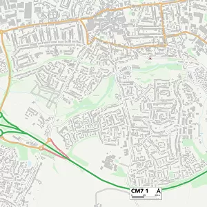
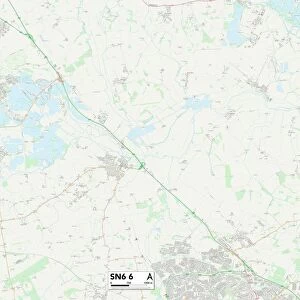
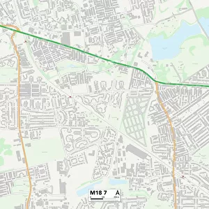
Bromley BR7 6 Map

![]()
Wall Art and Photo Gifts from Map Marketing
Bromley BR7 6 Map
Postcode Sector Map of Bromley BR7 6
Media ID 19966387
Acorn Close Adelaide Road Albany Road Alexander Road Barham Close Barham Road Barnard Close Belmont Road Bromley Bromley Lane Buckingham Drive Bull Lane Cardinal Close Church Lane Church Row Cranmore Road Dickens Drive Edgehill Road Edward Road Fenton Close Fosters Close Green Lane Greenway Hallam Close Hanover Drive Heathfield Hill Close Hillview Road Holt Close Imperial Way Loop Road Manor Park Road Marlowe Close Marsham Close Mead Road Meadow Close Oakdene Avenue Paddock Way Park Road Perry Street Radnor Close Red Hill Royal Parade Southfield Road St Peters Close Stewart Close The Drive The Meadow Victoria Road Walden Avenue Walnut Tree Close Windsor Close Woodside Avenue Laneside White Horse Hill
FEATURES IN THESE COLLECTIONS
> Animals
> Mammals
> Muridae
> Peters Mouse
> Europe
> United Kingdom
> England
> London
> Boroughs
> Bromley
> Europe
> United Kingdom
> England
> London
> Sights
> Victoria Park
> Europe
> United Kingdom
> Wales
> Powys
> Old Radnor
> Map Marketing
> Postcode Sector Maps
> BR - Bromley
> Maps and Charts
> Related Images
MADE IN THE USA
Safe Shipping with 30 Day Money Back Guarantee
FREE PERSONALISATION*
We are proud to offer a range of customisation features including Personalised Captions, Color Filters and Picture Zoom Tools
SECURE PAYMENTS
We happily accept a wide range of payment options so you can pay for the things you need in the way that is most convenient for you
* Options may vary by product and licensing agreement. Zoomed Pictures can be adjusted in the Cart.