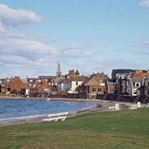
Home > Europe > United Kingdom > Wales > South Glamorgan > Llantwit Major
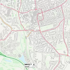
Vale of Glamorgan CF61 1 Map

![]()
Wall Art and Photo Gifts from Map Marketing
Vale of Glamorgan CF61 1 Map
Postcode Sector Map of Vale of Glamorgan CF61 1
Media ID 19966676
Ashgrove Bakers Lane Barons Close Beech Avenue Castle Close Castle Court Castle Street Channel View Church Lane Church Street Church View College Gardens College Street Commercial Street Court Close East Drive East Street Green Lane Harding Close Heol Y Coed Heol Y Felin High Meadow High Street Leigh Close Manor Park Manor Square Mill Lane Milton Close Orchard Close Orchard Drive Redwood Close River Walk Shakespeare Drive St Davids Avenue Stag Lane Station Road Tennyson Way The Lanes Tudor Place Vale Of Glamorgan Water Lane Wesley Street West Drive West Street White House Close Wick Road Wine Street Wordsworth Close Spitzkop Turkey Street
FEATURES IN THESE COLLECTIONS
> Arts
> Artists
> H
> Harding Harding
> Arts
> Landscape paintings
> Waterfall and river artworks
> Waterfall art
> Asia
> Turkey
> Related Images
> Europe
> United Kingdom
> Scotland
> Aberdeenshire
> Westhill
> Europe
> United Kingdom
> Scotland
> Highlands
> Wick
> Europe
> United Kingdom
> Wales
> Glamorgan
> Europe
> United Kingdom
> Wales
> Pembrokeshire
> St Davids
> Europe
> United Kingdom
> Wales
> South Glamorgan
> Llantwit Major
> Europe
> United Kingdom
> Wales
> South Glamorgan
> Related Images
> Europe
> United Kingdom
> Wales
> West Glamorgan
> Related Images
> Map Marketing
> Postcode Sector Maps
> CF - Cardiff
MADE IN THE USA
Safe Shipping with 30 Day Money Back Guarantee
FREE PERSONALISATION*
We are proud to offer a range of customisation features including Personalised Captions, Color Filters and Picture Zoom Tools
SECURE PAYMENTS
We happily accept a wide range of payment options so you can pay for the things you need in the way that is most convenient for you
* Options may vary by product and licensing agreement. Zoomed Pictures can be adjusted in the Cart.