Home > Europe > United Kingdom > England > London > Boroughs > Harrow
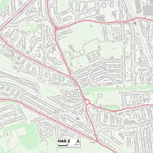
Harrow HA0 2 Map

![]()
Wall Art and Photo Gifts from Map Marketing
Harrow HA0 2 Map
Postcode Sector Map of Harrow HA0 2
Media ID 19971469
Allendale Road Ash Grove Barley Close Central Road Cherry Close Cherry Tree Close Chestnut Avenue Chestnut Grove Church Gardens Crawford Avenue Elms Lane Fernbank Avenue Fernwood Avenue Greenbank Avenue Harrow Harrow Road Harwood Close Lantern Close Napier Road Newlands Close Oaklands Court Priory Avenue Priory Close Priory Crescent Priory Gardens Priory Hill Ranelagh Road Rowan Close St Andrews Avenue St Annes Road Station Approach Station Crescent The Rise Turner Close Williams Way Elms Court Sudbury
FEATURES IN THESE COLLECTIONS
> Animals
> Fishes
> C
> Codling
> Arts
> Artists
> C
> Thomas Crawford
> Arts
> Artists
> H
> Thomas Hill
> Europe
> United Kingdom
> England
> London
> Boroughs
> Harrow
> Europe
> United Kingdom
> Scotland
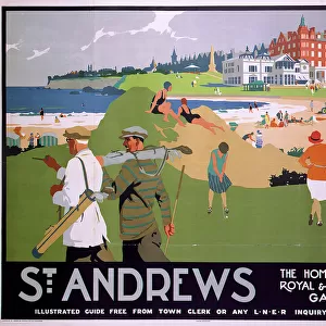
> Fife
> St Andrews
> Europe
> United Kingdom
> Scotland
> Lothian
> Related Images
> Map Marketing
> Postcode Sector Maps
> HA - Harrow
> Maps and Charts
> Related Images
MADE IN THE USA
Safe Shipping with 30 Day Money Back Guarantee
FREE PERSONALISATION*
We are proud to offer a range of customisation features including Personalised Captions, Color Filters and Picture Zoom Tools
SECURE PAYMENTS
We happily accept a wide range of payment options so you can pay for the things you need in the way that is most convenient for you
* Options may vary by product and licensing agreement. Zoomed Pictures can be adjusted in the Cart.