Home > Europe > United Kingdom > Scotland > Stirlingshire > Stirling
Liverpool L25 9 Map

![]()
Wall Art and Photo Gifts from Map Marketing
Liverpool L25 9 Map
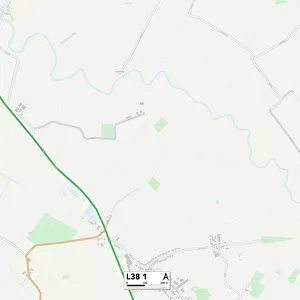
Postcode Sector Map of Liverpool L25 9
Media ID 19972632
Arncliffe Road Ashton Close Elder Place Lancing Road Layton Road Liverpool Meadow Grove Sherborne Avenue Sudbury Close Tewkesbury Close Westbury Close Woodbine Road Yew Tree Road
FEATURES IN THESE COLLECTIONS
> Europe
> United Kingdom
> Scotland
> Stirlingshire
> Stirling
> Map Marketing
> Postcode Sector Maps
> L - Liverpool
> Maps and Charts
> Related Images
MADE IN THE USA
Safe Shipping with 30 Day Money Back Guarantee
FREE PERSONALISATION*
We are proud to offer a range of customisation features including Personalised Captions, Color Filters and Picture Zoom Tools
SECURE PAYMENTS
We happily accept a wide range of payment options so you can pay for the things you need in the way that is most convenient for you
* Options may vary by product and licensing agreement. Zoomed Pictures can be adjusted in the Cart.