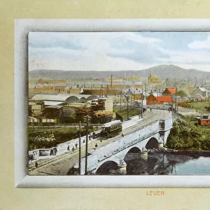
Home > Europe > United Kingdom > Scotland > Fife > Leven
Lancaster LA5 0 Map

![]()
Wall Art and Photo Gifts from Map Marketing
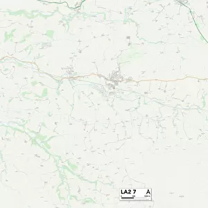
Lancaster LA5 0 Map
Postcode Sector Map of Lancaster LA5 0
Media ID 19973498
Ashleigh Road Back Lane Bank House Lane Birch Drive Birch Grove Castle Bank Chapel Lane Church Hill Church View Cove Road Ford Lane Hazelwood Hollins Lane Kings Close Knott Lane Lancaster Lawrence Drive Lindale Close Moss Lane Mount Pleasant Orchard Close Orchard Crescent Orchard Road Park Road Park View Parkside Drive Plantation Avenue Queens Drive Rock Terrace Shore Road Silverdale Silverdale Road Spinney Lane Spring Bank Springfield St Johns Avenue St Johns Grove Station Road Stewart Close Stoneleigh Court The Chase The Green The Meadows The Promenade The Row The Spinney Woodlands Drive Arnside Cause Way Red Bridge
FEATURES IN THESE COLLECTIONS
> Arts
> Artists
> F
> John Ford
> Arts
> Artists
> H
> John Hillers
> Arts
> Artists
> H
> John Hills
> Arts
> Artists
> W
> John Wood
> Europe
> United Kingdom
> England
> Cleveland
> Europe
> United Kingdom
> Scotland
> Fife
> Leven
> Map Marketing
> Postcode Sector Maps
> LA - Lancaster
> Maps and Charts
> Related Images
MADE IN THE USA
Safe Shipping with 30 Day Money Back Guarantee
FREE PERSONALISATION*
We are proud to offer a range of customisation features including Personalised Captions, Color Filters and Picture Zoom Tools
SECURE PAYMENTS
We happily accept a wide range of payment options so you can pay for the things you need in the way that is most convenient for you
* Options may vary by product and licensing agreement. Zoomed Pictures can be adjusted in the Cart.