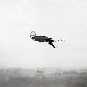
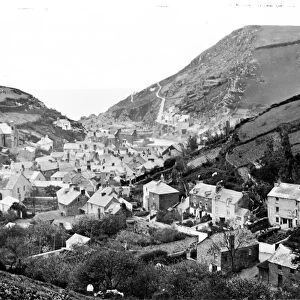
Home > Animals > Birds > Herons > Related Images
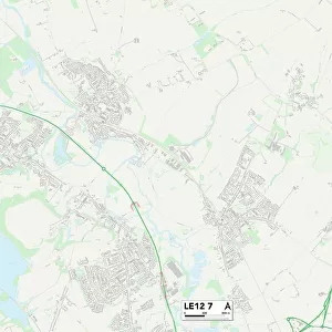
Leicester LE19 2 Map

![]()
Wall Art and Photo Gifts from Map Marketing
Leicester LE19 2 Map
Postcode Sector Map of Leicester LE19 2
Media ID 19973924
Abbey Road Alexandra Street Beechwood Road Bell Lane Bingley Road Burrows Close Carlton Avenue Cedar Crescent Chestnut Close Church Lane Church View Clarence Road Cornfield Close Coventry Road Drovers Way Farm Close Field Close Finch Way Fosse Close Hallam Close Harvest Close Hazel Close Heath Avenue Heron Way Hill View Jubilee Crescent King Edward Avenue Leicester Leicester Road Lime Tree Road Masons Close Mortimer Road Oak Road Old Church Road Park Road Parnell Close Peters Close Plough Road Poplar Road Princess Street Queens Drive Regal Court Regent Street Ridgeway Riverside Way School Lane St Johns Stable Close Station Road Sycamore Way The Meadows The Paddocks The Square Thomas Road Thornton Drive Trinity Road Victoria Street Warren Road Warwick Road William Street Williams Close Willow Close Narborough
FEATURES IN THESE COLLECTIONS
> Animals
> Birds
> Herons
> Related Images
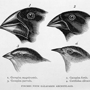
> Animals
> Birds
> Passerines
> Finches
> Related Images
> Animals
> Mammals
> Muridae
> Heath Mouse
> Animals
> Mammals
> Muridae
> Peters Mouse
> Arts
> Artists
> C
> Edward Cooper
> Arts
> Artists
> C
> William Clark
> Arts
> Artists
> F
> John Field
> Arts
> Artists
> H
> John Hillers
> Arts
> Artists
> H
> John Hills
> Arts
> Artists
> H
> Thomas Hill
> Map Marketing
> Postcode Sector Maps
> LE - Leicester
MADE IN THE USA
Safe Shipping with 30 Day Money Back Guarantee
FREE PERSONALISATION*
We are proud to offer a range of customisation features including Personalised Captions, Color Filters and Picture Zoom Tools
SECURE PAYMENTS
We happily accept a wide range of payment options so you can pay for the things you need in the way that is most convenient for you
* Options may vary by product and licensing agreement. Zoomed Pictures can be adjusted in the Cart.