Home > Europe > United Kingdom > England > London > Boroughs > Ealing
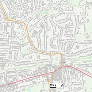
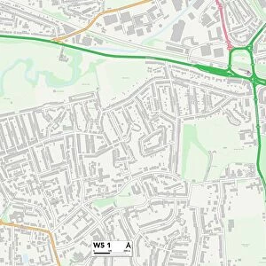
Ealing W5 1 Map

![]()
Wall Art and Photo Gifts from Map Marketing
Ealing W5 1 Map
Postcode Sector Map of Ealing W5 1
Media ID 19980992
Ainsdale Road Albert Road Barnfield Road Birkdale Road Brookfield Avenue Brunswick Gardens Brunswick Road Buckingham Close Cheriton Close Clarendon Road Curzon Road Denison Road Ealing Fox Lane Garrick Close Greystoke Gardens Hillcrest Road Hogarth Close Kent Gardens Lanark Close Lindfield Road Ludlow Road Lynwood Road Moorfield Avenue Mount Avenue Mount Pleasant Road Mulgrave Road Park Gate Princes Gardens Queens Gardens Queens Walk Royal Parade Selby Road Sovereign Close St Augustines Avenue Summerfield Road The Knoll Victoria Road West Gate Western Avenue Woodfield Avenue Woodfield Crescent Woodfield Road
FEATURES IN THESE COLLECTIONS
> Europe
> United Kingdom
> England
> Kent
> Cheriton
> Europe
> United Kingdom
> England
> London
> Boroughs
> Ealing
> Europe
> United Kingdom
> England
> London
> Boroughs
> Harrow
> Europe
> United Kingdom
> England
> London
> Sights
> Victoria Park
> Europe
> United Kingdom
> Scotland
> Strathclyde
> Lanark
> Map Marketing
> Postcode Sector Maps
> W - London W
> Maps and Charts
> Related Images
MADE IN THE USA
Safe Shipping with 30 Day Money Back Guarantee
FREE PERSONALISATION*
We are proud to offer a range of customisation features including Personalised Captions, Color Filters and Picture Zoom Tools
SECURE PAYMENTS
We happily accept a wide range of payment options so you can pay for the things you need in the way that is most convenient for you
* Options may vary by product and licensing agreement. Zoomed Pictures can be adjusted in the Cart.