Home > Europe > United Kingdom > England > Shropshire > Bridgnorth
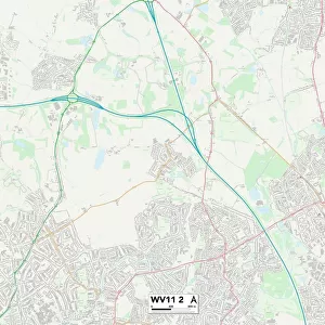
Shropshire WV16 5 Map

![]()
Wall Art and Photo Gifts from Map Marketing
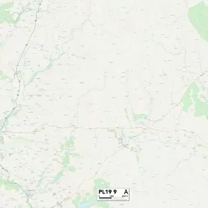
Shropshire WV16 5 Map
Postcode Sector Map of Shropshire WV16 5
Media ID 19983088
A458 Ashcroft Avondale Road Campbell Close Castlefields Conduit Lane Highfields Road Highlands Road Huntsmans Close Ludlow Road Manor Farm Lane Meadow Close Old Mill Lane Oldbury Road Orchard Close Orchard Road Ridley Close Rosehill Drive Shropshire Slade Lane Stretton Close Trevithick Close Uplands Drive Wells Close Westgate Bridgnorth Oldbury
FEATURES IN THESE COLLECTIONS
> Europe
> United Kingdom
> England
> Shropshire
> Bridgnorth
> Europe
> United Kingdom
> England
> Shropshire
> Cross Houses
> Europe
> United Kingdom
> England
> Shropshire
> Harley
> Europe
> United Kingdom
> England
> Shropshire
> Ludlow
> Europe
> United Kingdom
> England
> Shropshire
> Morville
> Europe
> United Kingdom
> England
> Shropshire
> Related Images
> Europe
> United Kingdom
> England
> Shropshire
> Rosehill
> Europe
> United Kingdom
> Scotland
> Highlands
> Related Images
> Map Marketing
> Postcode Sector Maps
> WV - Wolverhampton
> Maps and Charts
> Related Images
MADE IN THE USA
Safe Shipping with 30 Day Money Back Guarantee
FREE PERSONALISATION*
We are proud to offer a range of customisation features including Personalised Captions, Color Filters and Picture Zoom Tools
SECURE PAYMENTS
We happily accept a wide range of payment options so you can pay for the things you need in the way that is most convenient for you
* Options may vary by product and licensing agreement. Zoomed Pictures can be adjusted in the Cart.