Home > Europe > United Kingdom > Wales > Pembrokeshire > Tenby
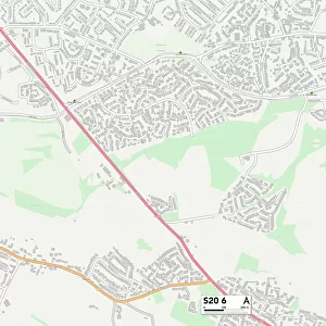
Bassetlaw S80 2 Map

![]()
Wall Art and Photo Gifts from Map Marketing
Bassetlaw S80 2 Map
Postcode Sector Map of Bassetlaw S80 2
Media ID 19980478
Abbey Street Bassetlaw Bridge Place Canal Road Cavendish Road Cemetery Road Cheapside Church Walk Clinton Street College Lane Conrad Close Dennis Street Edinburgh Road Ely Close Forest Lane Forest Rise Forest Walk Foxglove Close Gordon Close Highfield Lane Howard Street Kenilworth Close Kingston Close Kingston Road Langley Street Lincoln Street Market Street Memorial Avenue Netherton Road Newcastle Street Newgate Street Old School Place Pelham Street Potter Street Queen Street Retford Road Richmond Road Rushey Close Shelley Street Shrewsbury Road South Avenue Southmoor Road Southwell Close St Marys Gate Talbot Road The Croft The Pines Victoria Road Watson Road Waverley Place Woodland Avenue Yeoman Close Bracebridge Manton
FEATURES IN THESE COLLECTIONS
> Arts
> Artists
> P
> Paul Potter
> Arts
> Artists
> Q
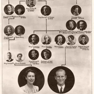
> Queen Victoria Queen Victoria
> Arts
> Landscape paintings
> Forest and woodland scenes
> Forest artwork
> Europe
> United Kingdom
> Northern Ireland
> County Down
> Newcastle
> Europe
> United Kingdom
> Scotland
> Edinburgh
> Edinburgh
> Europe
> United Kingdom
> Scotland
> Lothian
> Edinburgh
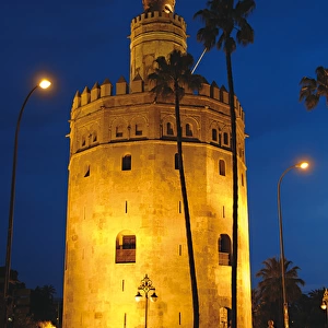
> Europe
> United Kingdom
> Wales
> Pembrokeshire
> Tenby
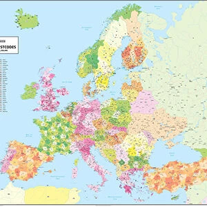
> Map Marketing
> Postcode Sector Maps
> S - Sheffield
> Map Marketing
> UK Maps
> Maps and Charts
> Related Images
MADE IN THE USA
Safe Shipping with 30 Day Money Back Guarantee
FREE PERSONALISATION*
We are proud to offer a range of customisation features including Personalised Captions, Color Filters and Picture Zoom Tools
SECURE PAYMENTS
We happily accept a wide range of payment options so you can pay for the things you need in the way that is most convenient for you
* Options may vary by product and licensing agreement. Zoomed Pictures can be adjusted in the Cart.