Home > Arts > Landscape paintings > Waterfall and river artworks > River artworks
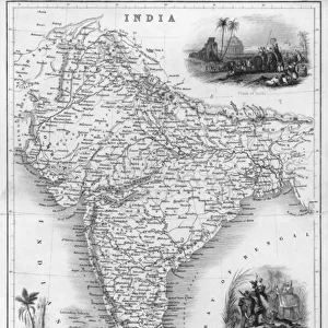
MAPS, ASIA, INDIA 1719
![]()

Wall Art and Photo Gifts from Mary Evans Picture Library
MAPS, ASIA, INDIA 1719
Crude map of northern India, previous to any extensive colonisation, including parts of Pakistan & Bangladesh & the sources of two great rivers the Ganges & Indus. A map with ornate title cartouche and floral surrounds. Date: 1719
Mary Evans Picture Library makes available wonderful images created for people to enjoy over the centuries
Media ID 20141933
© Bubblepunk
1719 Bangladesh Cartouche Colonisation Crude Extensive Ganges Indus Maps Pakistan Previous Rivers Source Surrounds Title
FEATURES IN THESE COLLECTIONS
> Arts
> Landscape paintings
> Waterfall and river artworks
> River artworks
> Asia
> Bangladesh
> Maps
> Asia
> Bangladesh
> Related Images
> Asia
> India
> Related Images
> Asia
> Pakistan
> Related Images
> Asia
> Related Images
> Maps and Charts
> India
> Maps and Charts
> Related Images
> Mary Evans Prints Online
> New Images July 2020
EDITORS COMMENTS
This intriguing map print, titled "India," dates back to the year 1719, offering a captivating glimpse into the geographical knowledge of Northern India during a time preceding extensive colonization. The map, which includes parts of modern-day Pakistan and Bangladesh, showcases the early understanding of the region's topography, with the sources of two major rivers, the Ganges and Indus, clearly marked. The map's crude yet detailed representation of the landscape is encircled by an ornate title cartouche and floral surrounds, reflecting the artistic sensibilities of the time. The title, elegantly scripted within the cartouche, further enhances the map's allure, transporting us back to an era when explorers and cartographers sought to chart the unknown, driven by curiosity and the thirst for discovery. The map's antiquity, coupled with its decorative elements, makes for a fascinating historical artifact. It serves as a reminder of the evolution of cartography and the role it played in shaping our understanding of the world. This map, a testament to the past, continues to captivate and intrigue, inviting us to explore the rich history of India and the broader Asian continent.
MADE IN THE USA
Safe Shipping with 30 Day Money Back Guarantee
FREE PERSONALISATION*
We are proud to offer a range of customisation features including Personalised Captions, Color Filters and Picture Zoom Tools
SECURE PAYMENTS
We happily accept a wide range of payment options so you can pay for the things you need in the way that is most convenient for you
* Options may vary by product and licensing agreement. Zoomed Pictures can be adjusted in the Cart.


