Rights Managed > Universal Images Group (UIG) > Art > Painting, Sculpture & Prints > Cartography
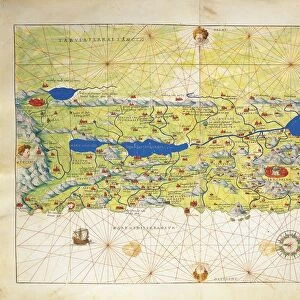
Italy, Map of Pesaro, from Theatrum civitatum et admirandorum Italiae by Joan Blaeu, engraving

Filename: 940_18_11291574.jpg
Size: 3529 x 2823 (5.9MB)
Date: 17th March 2014
Source: Universal Images Group (UIG)
Source: De Agostini Picture Library
© DEA / A. DAGLI ORTI
![]()
Wall Art and Photo Gifts from Universal Images Group (UIG)
Italy, Map of Pesaro, from Theatrum civitatum et admirandorum Italiae by Joan Blaeu, engraving
Cartography, Italy, 17th century. Map of Pesaro, from Theatrum civitatum et admirandorum Italiae by Joan Blaeu. Engraving
Universal Images Group (UIG) manages distribution for many leading specialist agencies worldwide
Media ID 9573035
© DEA / A. DAGLI ORTI
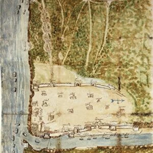
17th Century Aerial View Fortified Wall Joan Blaeu Pesaro
EDITORS COMMENTS
This print takes us back to 17th century Italy, specifically the city of Pesaro. The image is an engraving from "Theatrum civitatum et admirandorum Italiae" by Joan Blaeu, a renowned cartographer of his time. It showcases a detailed map of Pesaro, providing us with a fascinating glimpse into the city's architecture and history. From this aerial view, we can observe the intricate layout of Pesaro's streets and buildings. The horizontal composition allows us to appreciate the fortified walls that once protected this vibrant Italian town. The absence of people in the image gives it an eerie yet intriguing atmosphere, as if frozen in time. Blaeu's skillful use of illustration and painting techniques is evident in this engraved image. Every line and detail has been meticulously crafted to convey both accuracy and artistic beauty. This artwork serves as a testament to the craftsmanship involved in cartography during that era. As we gaze upon this historical artifact, our imagination transports us back centuries ago when life unfolded within these very walls. We are reminded of how much has changed over time while appreciating the rich cultural heritage preserved through such maps. This print offers not only a visual feast for art enthusiasts but also serves as an invaluable resource for historians studying Italy's past. Its significance lies not only in its aesthetic appeal but also in its ability to connect us with our roots and deepen our understanding of human history.
MADE IN THE USA
Safe Shipping with 30 Day Money Back Guarantee
FREE PERSONALISATION*
We are proud to offer a range of customisation features including Personalised Captions, Color Filters and Picture Zoom Tools
SECURE PAYMENTS
We happily accept a wide range of payment options so you can pay for the things you need in the way that is most convenient for you
* Options may vary by product and licensing agreement. Zoomed Pictures can be adjusted in the Cart.