Rights Managed > Universal Images Group (UIG) > Art > Painting, Sculpture & Prints > Cartography
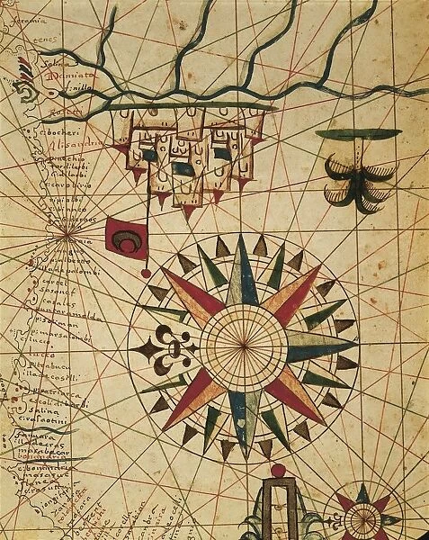
Portolan chart, map of Cairo, Egypt
Filename: 940_18_11083809.jpg
Size: 2812 x 3533 (4.3MB)
Date: 12th March 2014
Source: Universal Images Group (UIG)
Source: De Agostini Picture Library
© DEA / A. DAGLI ORTI
![]()

Wall Art and Photo Gifts from Universal Images Group (UIG)
Portolan chart, map of Cairo, Egypt
Cartography, Egypt, 16th century. Portolan chart, map of Cairo
Universal Images Group (UIG) manages distribution for many leading specialist agencies worldwide
Media ID 9504077
© DEA / A. DAGLI ORTI
16th Century Cairo City Close Up Compass Rose Flag Palm Tree River Portolan Chart
EDITORS COMMENTS
This stunning print showcases a rare and exquisite piece of cartographic history - a Portolan chart depicting the vibrant city of Cairo, Egypt in the 16th century. The intricate details and meticulous craftsmanship make this map an invaluable artifact for both historians and art enthusiasts alike. In this close-up shot, we are transported back in time to explore the bustling streets and architectural wonders of ancient Cairo. The vertical composition allows us to appreciate every minute detail, from the palm trees swaying gently in the breeze to the majestic buildings that line the riverbank. The artist's skillful use of color brings life to this illustration, with vibrant flags fluttering above each structure. A compass rose elegantly adorns one corner, reminding us of the navigational purpose behind these charts. As we delve into this artwork, it becomes evident that no people are present within its borders. This absence invites us to imagine ourselves as explorers or adventurers discovering Cairo for the first time. It serves as a poignant reminder that even though centuries have passed since this chart was created, its significance remains intact. This print is not just a mere depiction; it is an embodiment of history itself – a testament to human ingenuity and curiosity about our world. Whether displayed in homes or educational institutions, it offers endless opportunities for reflection on our past while inspiring future generations with tales yet untold.
MADE IN THE USA
Safe Shipping with 30 Day Money Back Guarantee
FREE PERSONALISATION*
We are proud to offer a range of customisation features including Personalised Captions, Color Filters and Picture Zoom Tools
SECURE PAYMENTS
We happily accept a wide range of payment options so you can pay for the things you need in the way that is most convenient for you
* Options may vary by product and licensing agreement. Zoomed Pictures can be adjusted in the Cart.


