Rights Managed > Universal Images Group (UIG) > History > Engraving
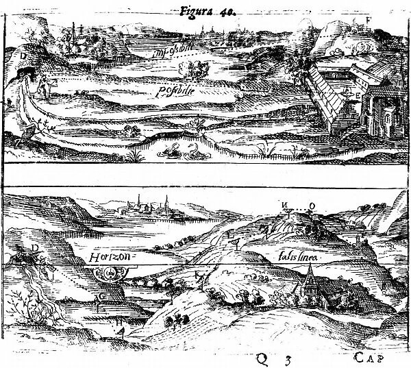
Surveying: Top: measuring angles using a quadrant. Bottom: obtaining levels and altitudes
Filename: 917_05_0460000603.jpg
Size: 6000 x 5368 (10.7MB)
Date: 29th March 2014
Source: Universal Images Group (UIG)
© Universal History Archive/Universal Images Group
![]()

Wall Art and Photo Gifts from Universal Images Group (UIG)
Surveying: Top: measuring angles using a quadrant. Bottom: obtaining levels and altitudes
Surveying: Top: measuring angles using a quadrant. Bottom: obtaining levels and altitudes using Hulsiuss planimeter. From Levinus Hulsius Instrumentorum Mechanicorum, Frankfort-am-Main, 1605. Engraving
Universal Images Group (UIG) manages distribution for many leading specialist agencies worldwide
Media ID 9780199
© Universal History Archive/Universal Images Group
1605 Angles Bottom Instrument Mathematical Measurement Measuring Quadrant Surveying Surveyor Altitudes Instrumentorum Levels Levinus Obtaining
EDITORS COMMENTS
This print from Universal Images Group (UIG) takes us back to the world of surveying in 1605. The image showcases two essential tools used by surveyors during that time: a quadrant and Hulsiuss planimeter. In the top section of the engraving, we witness a surveyor measuring angles using a quadrant. This mathematical instrument allowed them to determine precise angles between objects or landmarks, aiding in accurate mapping and measurement. Moving to the bottom part of the print, we observe another crucial aspect of surveying - obtaining levels and altitudes. Here, the surveyor is seen utilizing Hulsiuss planimeter, an innovative device for calculating areas on maps or plans. By tracing along boundaries with this mechanical tool, they could effortlessly obtain measurements needed for their surveys. The detailed craftsmanship captured in this engraving reflects both technical expertise and artistic finesse. It serves as a testament to Levinus Hulsius' contribution to instrument-making during that era. As we delve into this historical snapshot, it reminds us of how far surveying has come over centuries. From these rudimentary instruments to modern-day technology like GPS systems and laser scanners, each advancement has played its part in shaping our understanding of land measurement and spatial analysis. This print not only offers insight into early surveying techniques but also sparks curiosity about how such methods laid the foundation for today's sophisticated practices in cartography and geospatial sciences.
MADE IN THE USA
Safe Shipping with 30 Day Money Back Guarantee
FREE PERSONALISATION*
We are proud to offer a range of customisation features including Personalised Captions, Color Filters and Picture Zoom Tools
FREE COLORIZATION SERVICE
You can choose advanced AI Colorization for this picture at no extra charge!
SECURE PAYMENTS
We happily accept a wide range of payment options so you can pay for the things you need in the way that is most convenient for you
* Options may vary by product and licensing agreement. Zoomed Pictures can be adjusted in the Cart.

