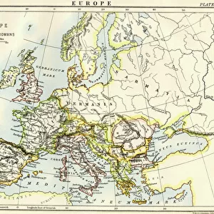
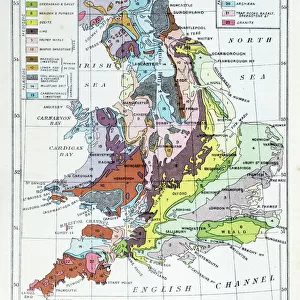
Jigsaw Puzzle : 1896, U. S. Geological Survey Geological Map of Yellowstone National Park, 4 sheets


![]()
Jigsaw Puzzles from Liszt Collection
1896, U. S. Geological Survey Geological Map of Yellowstone National Park, 4 sheets
1896, U.S. Geological Survey Geological Map of Yellowstone National Park, 4 sheets
Liszt Collection of nineteenth-century engravings and images to browse and enjoy
Media ID 14006462
© Artokoloro Quint Lox Limited
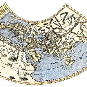
1896 Antique Map Latitude Longitude Mappa Mundi Old Antique Plan Old Antique View Ols Antique Map Rare Old Maps Topo
Jigsaw Puzzle (520 Pieces)
Discover the wonders of Yellowstone National Park with our intricately detailed jigsaw puzzles from the Media Storehouse Liszt Collection. This set features four authentic reproductions of the 1896 U.S. Geological Survey Geological Maps. Piece together the rich history and geological wonders of America's first national park. Bring the beauty of Yellowstone into your home with this challenging and rewarding puzzle experience.
Made in the USA, 520-piece puzzles measure 16" x 20" (40.6 x 50.8 cm). Every puzzle is meticulously printed on glossy photo paper, which has a strong 1.33 mm thickness. Delivered in a black storage cardboard box, these puzzles are both stylish and practical. (Note: puzzles contain small parts and are not suitable for children under 3 years of age.)
Jigsaw Puzzles are an ideal gift for any occasion
Estimated Product Size is 40.5cm x 50.8cm (15.9" x 20")
These are individually made so all sizes are approximate
Artwork printed orientated as per the preview above, with landscape (horizontal) or portrait (vertical) orientation to match the source image.
EDITORS COMMENTS
This print showcases the intricate and detailed 1896 U. S. Geological Survey Geological Map of Yellowstone National Park, spread across four sheets. A true testament to the artistry of cartography, this vintage map depicts the topography and geography of one of America's most iconic natural wonders. The illustration transports us back in time, offering a glimpse into the ancient history of this majestic region. The carefully crafted lines and grids highlight latitude and longitude coordinates, allowing viewers to navigate through Yellowstone's diverse landscapes with ease. As we admire this decorative piece, we can't help but appreciate its historical significance. This rare old map serves as a window into an era when exploration and discovery were at their peak. Its aged appearance adds charm and character, reminding us that it is not just a mere representation but also an artifact from another time. With its rich earth tones and meticulous details, this antique map invites us on a journey through space and time. It sparks our imagination as we envision early adventurers using similar maps to traverse these uncharted territories. Whether you are an avid traveler or simply fascinated by history, this remarkable print offers both beauty and educational value. It captures the essence of Yellowstone National Park while paying homage to the craftsmanship behind these old antique maps - truly a treasure for any collector or enthusiast alike.
MADE IN THE USA
Safe Shipping with 30 Day Money Back Guarantee
FREE PERSONALISATION*
We are proud to offer a range of customisation features including Personalised Captions, Color Filters and Picture Zoom Tools
SECURE PAYMENTS
We happily accept a wide range of payment options so you can pay for the things you need in the way that is most convenient for you
* Options may vary by product and licensing agreement. Zoomed Pictures can be adjusted in the Cart.