Fraud Blocker Skip to main content

Home > South America > Related Images

Related Images Collection

Choose a picture from our collection for your Wall Art and Photo Gifts

49,976 Items

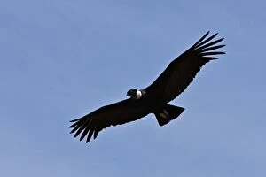
Background imageRelated Images Collection: Peru, A magnificent Andean Condor above the Colca Canyon. At 3, 191 metres

Peru, A magnificent Andean Condor above the Colca Canyon. At 3, 191 metres, this canyon is the second deepest in the world

Background imageRelated Images Collection: Kiss of the Oceans - Atlantic meets Pacific - Panama Canal

Kiss of the Oceans - Atlantic meets Pacific - Panama Canal
The Kiss of the Oceans - The Atlantic meets the Pacific due to the construction of The Panama Canal - A lovely allegorical card relating to this phenomenal engineering project

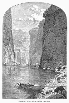
Background imageRelated Images Collection: COLORADO RIVER. Noon Day Rest in Marble Canyon. Wood engraving, 1870

COLORADO RIVER. Noon Day Rest in Marble Canyon. Wood engraving, 1870

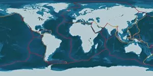
Background imageRelated Images Collection: Earths tectonic plates

Earths tectonic plates. Global map showing the boundaries of the tectonic plates that make up the Earths crust. The eight major plates are the: African Plate, Antarctic Plate, Indian Plate

Background imageRelated Images Collection: Southwest, American Indian art & handicrafts. Navajo blanket, beadwork, turquoise necklace

Southwest, American Indian art & handicrafts. Navajo blanket, beadwork, turquoise necklace, silver & turquoise belt buckle, 12-century Anasazi Mimbres bowl. PR

Background imageRelated Images Collection: Blue Ridge Springs, South-western Virginia (engraving)

Blue Ridge Springs, South-western Virginia (engraving)
7170691 Blue Ridge Springs, South-western Virginia (engraving) by American School, (19th century); Private Collection; (add.info.: Blue Ridge Springs, South-western Virginia)

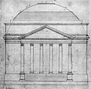
Background imageRelated Images Collection: Thomas Jeffersons plan in his own hand, of the front elevation of the Rotunda of the University of

Thomas Jeffersons plan in his own hand, of the front elevation of the Rotunda of the University of Virginia, 1821
UNIVERSITY OF VIRGINIA. Thomas Jeffersons plan in his own hand, of the front elevation of the Rotunda of the University of Virginia, 1821

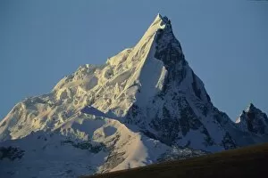
Background imageRelated Images Collection: Peru, Andes, Cordillera Blanca, Huantsan Chico, 5703 meters

Peru, Andes, Cordillera Blanca, Huantsan Chico, 5703 meters

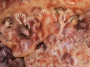
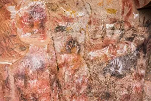
Background imageRelated Images Collection: Cave of the hands, Argentina

Cave of the hands, Argentina
Olympus Digital Camera

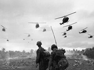
Background imageRelated Images Collection: Search And Destroy

Search And Destroy
The second wave of combat helicopters of the 1st Air Cavalry Division fly over an RTO and his commander on an isolated landing zone during Operation Pershing

Background imageRelated Images Collection: Political map of South America

Political map of South America
Vector illustration of the political map of South America Reference map was created by the US Central Intelligence Agency

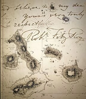
Background imageRelated Images Collection: Galapagos Admiralty map by Fitzroy Beagle

Galapagos Admiralty map by Fitzroy Beagle
Admiralty map of Galapagos 1845 resulting from Captain Robert Fitzroys Beagle charts, overlain with a portion of a letter written by Fitzroy. Robert Fitzroy (b. 5 July 1805- d)

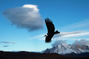
Background imageRelated Images Collection: Andean condor (Vultur gryphus) flying over Torres del Paine National Park, Chilean Patagonia

Andean condor (Vultur gryphus) flying over Torres del Paine National Park, Chilean Patagonia, Chile, South America

Background imageRelated Images Collection: Continental drift after 250 million years

Continental drift after 250 million years, showing the supercontinent of Pangea Ultima, which was named for the ancient supercontinent of Pangea

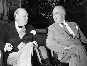
Background imageRelated Images Collection: Churchill and Roosevelt

Churchill and Roosevelt
Washington D.C. Prime Minister Winston Churchill and President Roosevelt relax in the south grounds of the White House prior to the daily meeting of the combined British and U.S

Background imageRelated Images Collection: Cueva de las Manos (Cave of hands), Santa Cruz Province, Patagonia, Argentina, South

Cueva de las Manos (Cave of hands), Santa Cruz Province, Patagonia, Argentina, South America

Background imageRelated Images Collection: Louisiana Heron, by John James Audubon

Louisiana Heron, by John James Audubon
Louisiana Heron, Ardea Ludoviciana, by John James Audubon (1785-1851). A colour plate in The Birds of America: From Original Drawings. Date: 1827-1838

Background imageRelated Images Collection: GONE WITH THE WIND, 1939. Hattie McDaniel assists Vivien Leigh while offering some unwelcomed advice

GONE WITH THE WIND, 1939. Hattie McDaniel assists Vivien Leigh while offering some unwelcomed advice

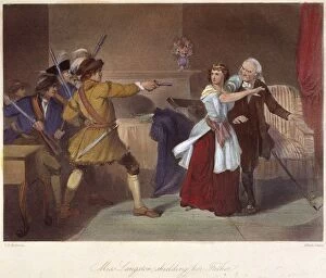
Background imageRelated Images Collection: Laodicea Dicey Langston of South Carolina protecting her elderly father

Laodicea Dicey Langston of South Carolina protecting her elderly father, a known supporter of the revolutionary cause
SOUTH CAROLINA: LOYALISTS. Laodicea Dicey Langston of South Carolina protecting her elderly father, a known supporter of the revolutionary cause

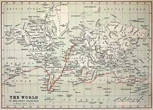
Background imageRelated Images Collection: Map Darwins Beagle Voyage South America

Map Darwins Beagle Voyage South America
Map of the World with Voyage of the Beagle coloured in red. Appendix from " The Voyage of HMS Beagle" by Charles Darwin (Cover Title) New Edition 1890 John Murray Publishers

Background imageRelated Images Collection: HMS Beagle Ship laid up Darwins Voyage

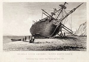
HMS Beagle Ship laid up Darwins Voyage
" Beagle laid ashore, River Santa Cruz". Copperplate engraving, art by Conrad Martens, engraved by T. Landseer. Published by H. Colburn 1838

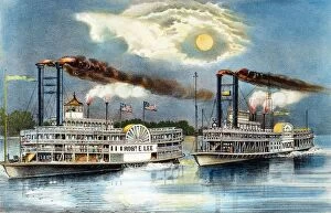
Background imageRelated Images Collection: STEAMBOAT RACE, 1870. The Great Mississippi Steamboat Race between the Robert E

STEAMBOAT RACE, 1870. The Great Mississippi Steamboat Race between the Robert E. Lee and the Natchez from New Orleans to St. Louis won by the Robert E

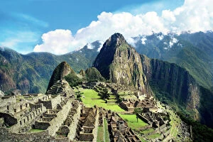
Background imageRelated Images Collection: Peru, Machu Picchu, The lost city of the Inca

Peru, Machu Picchu, The lost city of the Inca

Background imageRelated Images Collection: Butterfly illustration by Maria Sibylla Merian

Butterfly illustration by Maria Sibylla Merian (1647-1717), German-born naturalist and scientific illustrator, engraved by J Mulder, from a visit to Suriname, South America

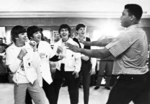
Background imageRelated Images Collection: The Beatles (from left: Ringo Starr, John Lennon, George Harrison, and Paul McCartney)

The Beatles (from left: Ringo Starr, John Lennon, George Harrison, and Paul McCartney)
BEATLES AND CLAY, 1964. The Beatles (from left: Ringo Starr, John Lennon, George Harrison, and Paul McCartney) clowning with boxer Cassius Clay (later Muhammad Ali)

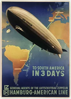
Background imageRelated Images Collection: Poster, Zeppelin to South America

Poster, Zeppelin to South America
Poster advertising the German Zeppelin Hamburg-American Line, LZ 127 Graf Zeppelin airship service from Friedrichshafen, Germany, to Buenos Aires, Argentina. circa 1934

Background imageRelated Images Collection: 17th century world map

17th century world map
World map, published around 1664 in Amsterdam, the Netherlands, by Dutch mapmaker Joan Blaeu (c.1599- 1673). The Latin title is Nova et Accuratissima Totius Terrarum Orbis Tabula

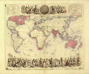
Background imageRelated Images Collection: British Empire world map, 19th century

British Empire world map, 19th century
British Empire world map. This world map shows the 19th-century British Empire (pink) and its indigenous peoples. Five illustrations (clockwise from upper left) show the people of Australia

Background imageRelated Images Collection: South point, Isla Mujeres Island, Riviera Maya, Quintana Roo, Mexico, North America

South point, Isla Mujeres Island, Riviera Maya, Quintana Roo, Mexico, North America

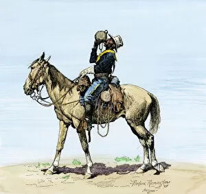
Background imageRelated Images Collection: Buffalo soldier drinking from his canteen

Buffalo soldier drinking from his canteen on a desert march. Hand-colored woodcut of a 19th-century Frederic Remington illustration

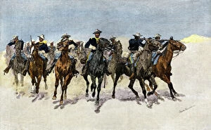
Background imageRelated Images Collection: Buffalo soldiers charging to the rescue

Buffalo soldiers charging to the rescue
Captain Dodges black troopers to the rescue in the west. Hand-colored woodcut of a 19th-century Frederic Remington illustration

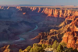
Background imageRelated Images Collection: Grand Canyon - panoramic view from Grandview Point into the Grand Canyon

Grand Canyon - panoramic view from Grandview Point into the Grand Canyon and the Colorado River - dusk - Grand Canyon
SAS-1911 Grand Canyon - panoramic view from Grandview Point into the Grand Canyon and the Colorado River dusk - Grand Canyon National Park - South Rim - Arizona - USA Steffen & Alexandra Sailer

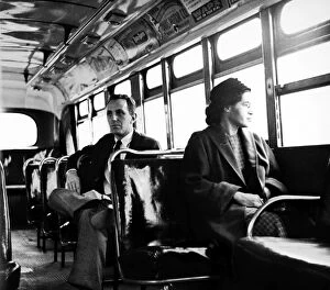
Background imageRelated Images Collection: American civil rights advocate. Parks sits at the front of a public bus (formerly whites only)

American civil rights advocate. Parks sits at the front of a public bus (formerly whites only ) in Montgomery, Alabama
ROSA PARKS (1913-2005). American civil rights advocate. Parks sits at the front of a public bus (formerly whites only ) in Montgomery, Alabama, 21 December 1956

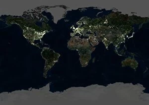
Background imageRelated Images Collection: Whole Earth at night, satellite image

Whole Earth at night, satellite image
Whole Earth map at night, satellite image. Here, Africa is seen at centre. City lights (yellow) of increasing intensity show areas of increasing population

Background imageRelated Images Collection: A painted sign for Inca Kola

A painted sign for Inca Kola, the most successful soft drink in Peru and sold widely through Latin America. PERU, La Libertad, Trujillo A painted sign for Inca Kola

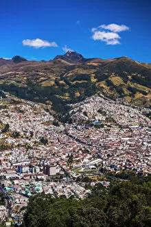
Background imageRelated Images Collection: Quito, with Pichincha Volcano in the background, Ecuador, South America

Quito, with Pichincha Volcano in the background, Ecuador, South America

Background imageRelated Images Collection: Butterfly illustration by Maria Sibylla Merian

Butterfly illustration by Maria Sibylla Merian (1647-1717), German-born naturalist and scientific illustrator, engraved by P Sluyter, from a visit to Suriname, South America

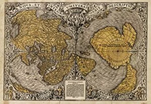
Background imageRelated Images Collection: Oronce Fines world map, 1531

Oronce Fines world map, 1531
Oronce Fines world map. Map of the worlds northern and southern hemispheres by the French mathematician and cartographer Oronce Fine (1494-1555)

Background imageRelated Images Collection: USS Yorktown Aircraft Carrier, Patriots Point Naval and Maritime Museum

USS Yorktown Aircraft Carrier, Patriots Point Naval and Maritime Museum, Charleston, South Carolina, United States of America, North America

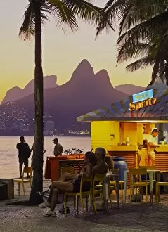
Background imageRelated Images Collection: Brazil, City of Rio de Janeiro, Beach Bar at the Ipanema Beach with a view of the

Brazil, City of Rio de Janeiro, Beach Bar at the Ipanema Beach with a view of the Morro Dois Irmaos

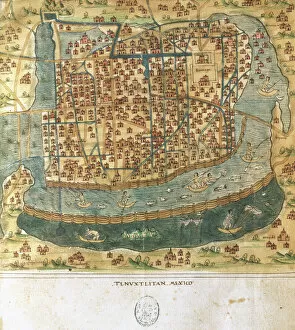
Background imageRelated Images Collection: Map of Tenochtitlan. Mexico, 1560. By Alonso de Santa Cruz

Map of Tenochtitlan. Mexico, 1560. By Alonso de Santa Cruz
Map of Tenochtitlan. Mexico, 1560. General islario of all the islands in the world. Work of the chronicler and cosmographer Alonso de Santa Cruz (1505-1567). National Library. Madrid. Spain

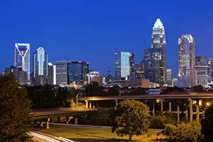
Background imageRelated Images Collection: USA, North Carolina, Charlotte, elevated view of the city skyline from Route 74, dawn

USA, North Carolina, Charlotte, elevated view of the city skyline from Route 74, dawn

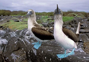
Background imageRelated Images Collection: South America, Ecuador, Galapagos Islands, Hood Island. Blue Footed Boobies (Sula

South America, Ecuador, Galapagos Islands, Hood Island. Blue Footed Boobies (Sula nebouxii)

Background imageRelated Images Collection: Charles Darwin, British naturalist

Charles Darwin, British naturalist
Charles Darwin (1809-1882), British naturalist. Darwin had briefly studied medicine and then trained in the clergy, but his interest was in natural history

Background imageRelated Images Collection: PCWR3P-00006

PCWR3P-00006
Confederate General Robert E. Lee in 1862 or 1863. Photograph 19th century

Background imageRelated Images Collection: Nathan Bedford Forrest

Nathan Bedford Forrest
Confederate General Nathan Bedford Forrest in the Civil War. Hand-colored woodcut of a 19th-century photograph

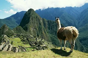
Background imageRelated Images Collection: Llama FG 8898 Photographed at Machu Picchu, Peru. Lama glama © Francois Gohier / ARDEA LONDON

Llama FG 8898 Photographed at Machu Picchu, Peru. Lama glama © Francois Gohier / ARDEA LONDON
FG-8898 LLAMA At Machu Picchu, Inca site. Peru Lama glama Francois Gohier Please note that prints are for personal display purposes only and may not be reproduced in any way.

Background imageRelated Images Collection: Mabry Mill, restored and working, Blue Ridge Parkway, south Appalachian Mountains

Mabry Mill, restored and working, Blue Ridge Parkway, south Appalachian Mountains, Virginia, United States of America, North America


All Professionally Made to Order for Quick Shipping


-

Why Choose Us?

We are a leading provider of Art Prints and Photo Gifts since 2003, working in partnership with a range of Sporting Clubs, Charities, Museums and Picture Libraries. A large share of profits from any of their images will go directly towards supporting that charity or club. Our archive of images is carefully curated to bring you a wide range of subjects, including landscapes, wildlife, architecture, and more. We ship from our partner labs in the UK, USA, EU (Netherlands) and Australia.
+

How do I place an order?

Ordering is quick & easy - Just follow 5 Simple Steps:
  1. Find your image: Use our search box or browse our online photo Collections to find the image you want.

  2. Choose your print format: Select your desired product and add it to your cart.

  3. Enter your details: If you're a returning customer, simply enter your email address and password, and we'll fill in your billing and shipping address details. All personal details are held securely and are fully GDPR compliant. As standard, we remove all Personally Identifiable Information after 12 months.

  4. Pay for your purchase: We use state-of-the-art security for online shopping and do not have access to your card details.

  5. Sit back and relax: We'll email you confirmation of your order and when it's dispatched. Registered customers can also track orders in the 'My Account' area.

+

How do I pay for an order?

You can pay for your order with most of the major credit and debit cards, or PayPal. For added security, major financial institutions process payment details separately and securely on our behalf. We do not have access to your online payment card details. Online payments are preferred however we do take phone orders. For UK customers only we accept cheques issued against a UK bank.
+

Is my data safe?

We take data security very seriously. We do not have access to your full card details and all payments are requested over a fully secure connection. Additionally, we fully comply with current European and GDPR legislation, and automatically remove all personal data after at most 12 months (unless you have an account with us and have signed in recently). We also have a strict opt-in policy and would never sell your personal details. Your data is only used to fulfill your order promptly and efficiently.
+

Is wall art ready to hang?

For quick and easy installation all wall art, including framed prints, canvas prints and metal prints are supplied with a ready to hang solution on the back. Generally, saw tooth hangers are applied as they allow wall art to hang flush against the wall. The serrated edge of the hanger prevents the frame from shifting or tilting when hung.
+

Are the photo prints fade resistant?

Yes, we use archival quality photo paper photographic paper for vivid reproduction Prints are an accurate representations of the original artwork, which is preserved for artistic character and authenticity. We guarantee they match previews shown on our web site