Canvas Print > Arts > Authors
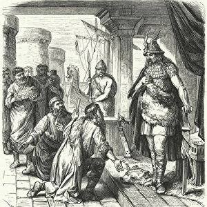
Canvas Print : Geography: portulan of the Mediterranean and Black Seas (author Gabriele?), 1449. Archivio di Stato di Florence
, 1449. Archivio di Stato di Florence")
, 1449. Archivio di Stato di Florence")

![]()
Canvas Prints from Fine Art Finder
Geography: portulan of the Mediterranean and Black Seas (author Gabriele?), 1449. Archivio di Stato di Florence
BEN5464243 Geography: portulan of the Mediterranean and Black Seas (author Gabriele?), 1449. Archivio di Stato di Florence.; Photo © Raffaello Bencini
Media ID 38512184
© © Raffaello Bencini / Bridgeman Images
15eme Siecle Black Sea Boat Dock Geographie Harbor Area Harbour Area Harbours Mediterranean Sea Mediterrean Sea Mer Mèditerranèe Port Area 15th 15 Xv Xvth Fifteenth Century Geographer Seawater
30"x20" (76x51cm) Canvas Print
Transport yourself back in time with this stunning canvas print of a 15th century portulan map of the Mediterranean and Black Seas. A true masterpiece from Fine Art Finder, this piece is sure to add a touch of history and sophistication to any space.
Delivered stretched and ready to hang our premium quality canvas prints are made from a polyester/cotton blend canvas and stretched over a 1.25" (32mm) kiln dried knot free wood stretcher bar. Packaged in a plastic bag and secured to a cardboard insert for safe transit.
Canvas Prints add colour, depth and texture to any space. Professionally Stretched Canvas over a hidden Wooden Box Frame and Ready to Hang
Estimated Product Size is 50.8cm x 76.2cm (20" x 30")
These are individually made so all sizes are approximate
Artwork printed orientated as per the preview above, with portrait (vertical) orientation to match the source image.
FEATURES IN THESE COLLECTIONS
> Maps and Charts
> Related Images
> Fine Art Finder
> Artists
> Franz (after) Hogenberg
EDITORS COMMENTS
This stunning print captures a piece of history from the 15th century - a portulan map of the Mediterranean and Black Seas, believed to be authored by Gabriele. The intricate details and accuracy of this map showcase the expertise of geographers during this time period.
The map not only serves as a navigational tool for sailors but also provides valuable insight into the geographical knowledge and maritime activities of the era. It highlights important ports, harbors, and sea routes that were crucial for trade and exploration in the Mediterranean and Black Seas.
As we gaze upon this historical artifact, we are transported back in time to an age where seafaring was at its peak. The meticulous craftsmanship involved in creating such maps is truly remarkable, showcasing the dedication and skill of cartographers like Gabriele.
The Archivio di Stato di Florence has preserved this invaluable piece of geography for centuries, allowing us to appreciate its beauty and significance today. Thanks to photographers like Raffaello Bencini, we can admire these works of art from afar and marvel at the wonders of our world's past.
Let this print serve as a reminder of how far we have come in terms of mapping our world, yet also how much there is still left to discover.
MADE IN THE USA
Safe Shipping with 30 Day Money Back Guarantee
FREE PERSONALISATION*
We are proud to offer a range of customisation features including Personalised Captions, Color Filters and Picture Zoom Tools
SECURE PAYMENTS
We happily accept a wide range of payment options so you can pay for the things you need in the way that is most convenient for you
* Options may vary by product and licensing agreement. Zoomed Pictures can be adjusted in the Cart.