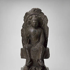
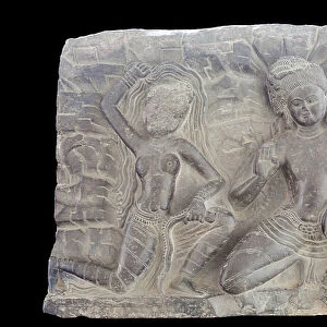
Canvas Print > Arts > Artists > N > Nepalese School
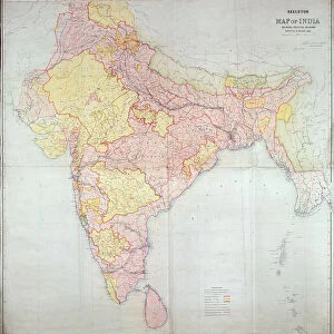
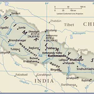
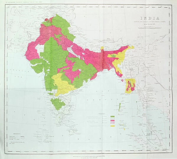
Canvas Print : Map of India, showing the progress of the Imperial Surveys, published under the direction


![]()
Canvas Prints from Fine Art Finder
Map of India, showing the progress of the Imperial Surveys, published under the direction
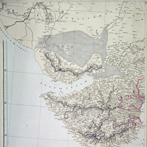
XCF306005 Map of India, showing the progress of the Imperial Surveys, published under the direction of Colonel H.R. Thuillier, R.E. Surveyor General of India, 1888 (colour litho) by English School, (19th century); Private Collection; English, out of copyright
Media ID 18254895
© Private Collection / Bridgeman Images
Bay Of Bengal Boundaries British Empire Ceylon Colonies Frontier Geographic Indian Ocean Mapping Nepal Pakistan Regions Sri Lanka States Territories Territory
20"x16" (51x41cm) Canvas Print
Enhance your home or office decor with a stunning Canvas Print from Media Storehouse. This exquisite piece features a historically significant map of India, showcasing the progress of the Imperial Surveys as published under the direction of Colonel H.R. Thuillier, R.E. Produced from the high-quality image by Bridgeman Images from Fine Art Finder, this canvas print offers a vibrant and detailed representation of the map. Bring a touch of history and sophistication to your space with this beautiful and intriguing artwork.
Delivered stretched and ready to hang our premium quality canvas prints are made from a polyester/cotton blend canvas and stretched over a 1.25" (32mm) kiln dried knot free wood stretcher bar. Packaged in a plastic bag and secured to a cardboard insert for safe transit.
Canvas Prints add colour, depth and texture to any space. Professionally Stretched Canvas over a hidden Wooden Box Frame and Ready to Hang
Estimated Product Size is 50.8cm x 40.6cm (20" x 16")
These are individually made so all sizes are approximate
Artwork printed orientated as per the preview above, with landscape (horizontal) orientation to match the source image.
FEATURES IN THESE COLLECTIONS
> Arts
> Artists
> I
> Indian School Indian School
> Arts
> Artists
> N
> Nepalese School
> Arts
> Artists
> O
> Oceanic Oceanic
> Asia
> India
> Related Images
> Asia
> Nepal
> Related Images
> Asia
> Pakistan
> Related Images
> Asia
> Related Images
> Fine Art Finder
> Schools
> English School
EDITORS COMMENTS
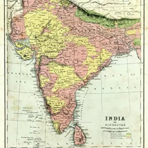
This print showcases the "Map of India, showing the progress of the Imperial Surveys" a significant publication directed by Colonel H. R. Thuillier, R. E. , Surveyor General of India in 1888. The map, created by an anonymous English School artist from the 19th century, is now part of a private collection and is no longer subject to copyright restrictions. With its vibrant colors and intricate details, this cartographic masterpiece provides a comprehensive view of India's political divisions, territories, and frontiers during the British Empire era. It encompasses not only mainland India but also neighboring countries such as Nepal and Sri Lanka (formerly known as Ceylon). The Bay of Bengal and Indian Ocean are prominently featured on this map as well. The map serves as a valuable historical artifact that sheds light on colonial borders and territorial claims within Asia at that time. It offers insights into how geographic boundaries were defined under British rule while showcasing various regions within India. Whether you are interested in cartography or simply fascinated by history, this stunning print invites you to explore the rich tapestry of Asian geography through its meticulous mapping techniques. Its presence in Fine Art Finder's collection ensures that this remarkable piece can be appreciated for generations to come.
MADE IN THE USA
Safe Shipping with 30 Day Money Back Guarantee
FREE PERSONALISATION*
We are proud to offer a range of customisation features including Personalised Captions, Color Filters and Picture Zoom Tools
SECURE PAYMENTS
We happily accept a wide range of payment options so you can pay for the things you need in the way that is most convenient for you
* Options may vary by product and licensing agreement. Zoomed Pictures can be adjusted in the Cart.