Canvas Print > Historic > Ancient civilizations > Ancient Greece > Athens
Canvas Print : Map of Athens, c.1900 (engraving)
")
")

![]()
Canvas Prints from Fine Art Finder
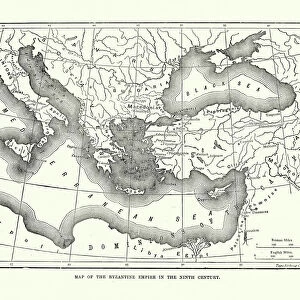
Map of Athens, c.1900 (engraving)
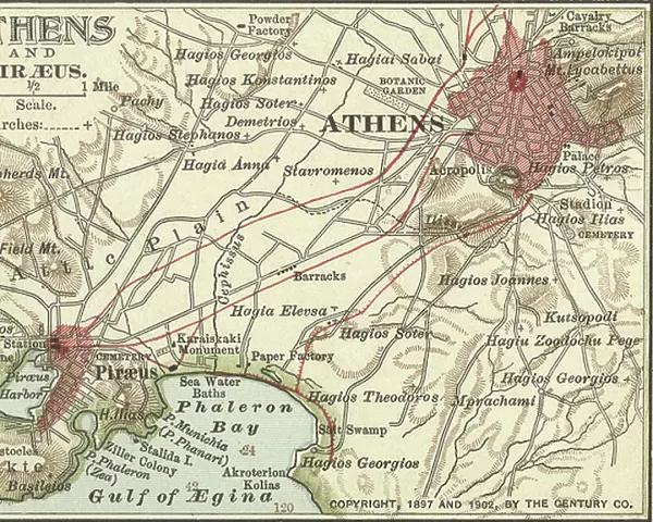
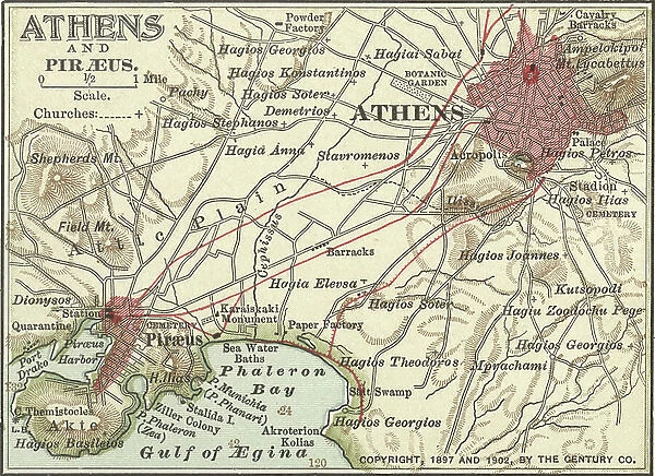
532702 Map of Athens, c.1900 (engraving); (add.info.: Map showing the historical churches of Athens and Piraeus, circa 1900, from the 10th edition of Encyclopaedia Britannica.); Encyclopaedia Britannica/UIG
Media ID 38309780
© Encyclopaedia Britannica/UIG / Bridgeman Images
1900 19th Century Style Capital Cities City Map Direction Guidance Illustration Technique Navigational Equipment Number Old Fashioned Part Of Physical Geography Piraeus The Past Western Script Athens Greece Gulf Of Aegina
20"x16" (51x41cm) Canvas Print
Explore the rich history of Athens with this stunning canvas print featuring a vintage map from 1900. Perfect for adding a touch of sophistication to any space.
Delivered stretched and ready to hang our premium quality canvas prints are made from a polyester/cotton blend canvas and stretched over a 1.25" (32mm) kiln dried knot free wood stretcher bar. Packaged in a plastic bag and secured to a cardboard insert for safe transit.
Canvas Prints add colour, depth and texture to any space. Professionally Stretched Canvas over a hidden Wooden Box Frame and Ready to Hang
Estimated Product Size is 50.8cm x 40.6cm (20" x 16")
These are individually made so all sizes are approximate
Artwork printed orientated as per the preview above, with landscape (horizontal) orientation to match the source image.
FEATURES IN THESE COLLECTIONS
> Europe
> Greece
> Related Images
> Historic
> Ancient civilizations
> Ancient Greece
> Athens
> Historic
> Ancient civilizations
> Ancient Greece
> Greek history
> Maps and Charts
> Early Maps
> Fine Art Finder
> Temp Classification
EDITORS COMMENTS
This stunning engraving of a Map of Athens, circa 1900, offers a glimpse into the historical churches and landmarks of this ancient city. The intricate details captured in this print showcase the Western script labeling each part of Athens and Piraeus with precision and accuracy.
As you study this map, you can almost imagine yourself navigating through the bustling streets and winding alleys of Athens during the turn of the century. The bay glistens in the background, providing a picturesque backdrop to this detailed cartography piece.
The old-fashioned style of this map transports you back in time, offering a unique perspective on the layout and geography of Athens at that moment in history. Each church is carefully marked, giving insight into the religious significance that played a vital role in shaping Athenian culture.
Whether you are an avid explorer or simply appreciate historical artifacts, this Map of Athens from 1900 is sure to captivate your imagination. Let it guide you through the past as you uncover hidden treasures within its intricate illustrations.
MADE IN THE USA
Safe Shipping with 30 Day Money Back Guarantee
FREE PERSONALISATION*
We are proud to offer a range of customisation features including Personalised Captions, Color Filters and Picture Zoom Tools
SECURE PAYMENTS
We happily accept a wide range of payment options so you can pay for the things you need in the way that is most convenient for you
* Options may vary by product and licensing agreement. Zoomed Pictures can be adjusted in the Cart.