
Canvas Print > Maps and Charts > Flat Earth
Canvas Print : A T-map, tenth century


![]()
Canvas Prints from Fine Art Finder
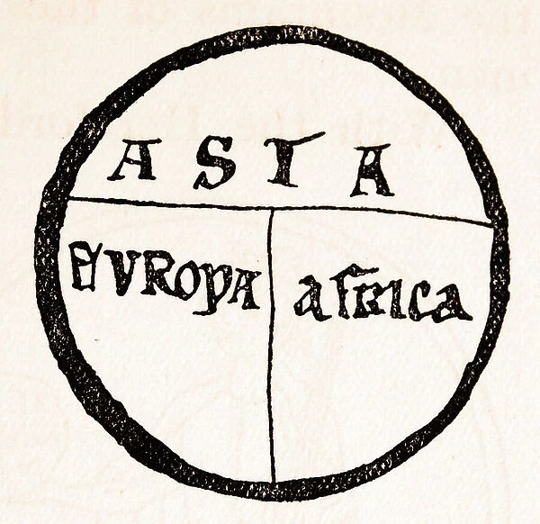
A T-map, tenth century
1578434 A T-map, tenth century; (add.info.: A T-map, showing three known continents on a flat earth projection from the 10th century.); Universal History Archive/UIG
Media ID 38310644
© Universal History Archive/UIG / Bridgeman Images
20"x16" (51x41cm) Canvas Print
Bring history to life with our collection of Canvas Prints featuring iconic images like "A T-map, tenth century" by Bridgeman Images. Perfect for adding a touch of sophistication and culture to any space.
Delivered stretched and ready to hang our premium quality canvas prints are made from a polyester/cotton blend canvas and stretched over a 1.25" (32mm) kiln dried knot free wood stretcher bar. Packaged in a plastic bag and secured to a cardboard insert for safe transit.
Canvas Prints add colour, depth and texture to any space. Professionally Stretched Canvas over a hidden Wooden Box Frame and Ready to Hang
Estimated Product Size is 50.8cm x 40.6cm (20" x 16")
These are individually made so all sizes are approximate
Artwork printed orientated as per the preview above, with landscape (horizontal) orientation to match the source image.
FEATURES IN THESE COLLECTIONS
> Maps and Charts
> Flat Earth
> Fine Art Finder
> Temp Classification
EDITORS COMMENTS
This fascinating print showcases a T-map from the tenth century, offering a glimpse into the cartography of medieval times. The map depicts three known continents - Asia, Africa, and Europe - on a flat earth projection, providing insight into how explorers viewed the world during this period.
The intricate details and design of the T-map highlight the ingenuity and creativity of early mapmakers who sought to navigate uncharted territories and understand the vast expanse of our planet. It serves as a reminder of the curiosity and adventurous spirit that drove explorers to embark on perilous journeys in search of new lands and discoveries.
As we study this historical artifact, we are transported back in time to an era when maps were not only tools for navigation but also works of art that reflected cultural beliefs and geographical knowledge. The precision with which each continent is depicted on this T-map is a testament to the dedication and skill of those who meticulously crafted it centuries ago.
Through this print from Bridgeman Images, we are able to appreciate the significance of cartography in shaping our understanding of the world around us. It serves as a reminder that even in ancient times, humans were driven by a desire to explore, discover, and connect with distant lands beyond their own borders.
MADE IN THE USA
Safe Shipping with 30 Day Money Back Guarantee
FREE PERSONALISATION*
We are proud to offer a range of customisation features including Personalised Captions, Color Filters and Picture Zoom Tools
SECURE PAYMENTS
We happily accept a wide range of payment options so you can pay for the things you need in the way that is most convenient for you
* Options may vary by product and licensing agreement. Zoomed Pictures can be adjusted in the Cart.


