Canvas Print > Europe > Denmark > Maps
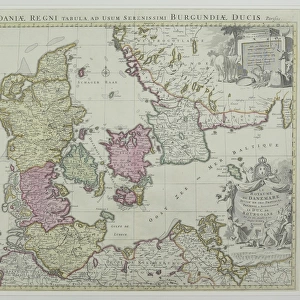
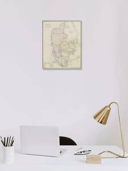
Canvas Print : Antique map of Denmark


![]()
Canvas Prints from Fine Art Storehouse
Antique map of Denmark
Unleash your creativity and transform your space into a visual masterpiece!
Hemera Technologies
Media ID 13597655
© Getty Images
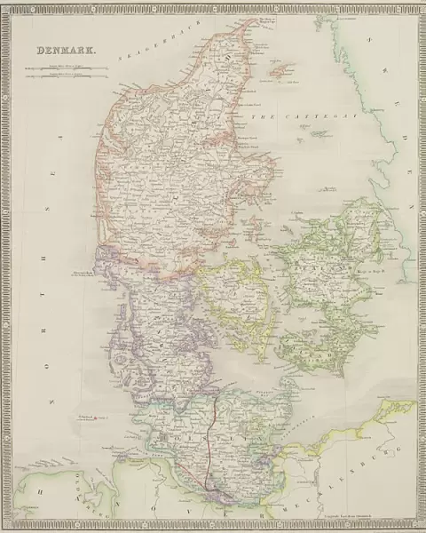
Border Country Decorative Denmark Document Geography Latitude Longitude Nation National North Sea Ornamental Ornate Scale
20"x16" (51x41cm) Canvas Print
"Discover the rich history of Denmark with our exquisite Antique Map of Denmark Canvas Print from the Media Storehouse Fine Art Collection. This beautiful piece, brought to you by Hemera Technologies, transports you back in time with intricate details and authentic cartography. The vintage map design, printed on high-quality canvas, adds an elegant touch to any room in your home or office. Each canvas print is individually hand-galleried wrapped on wooden stretcher bars, ensuring a flawless finish. Bring history to life with this unique and captivating addition to your decor."
Delivered stretched and ready to hang our premium quality canvas prints are made from a polyester/cotton blend canvas and stretched over a 1.25" (32mm) kiln dried knot free wood stretcher bar. Packaged in a plastic bag and secured to a cardboard insert for safe transit.
Canvas Prints add colour, depth and texture to any space. Professionally Stretched Canvas over a hidden Wooden Box Frame and Ready to Hang
Estimated Product Size is 40.6cm x 50.8cm (16" x 20")
These are individually made so all sizes are approximate
Artwork printed orientated as per the preview above, with portrait (vertical) orientation to match the source image.
FEATURES IN THESE COLLECTIONS
> Europe
> Denmark
> Related Images
> Europe
> Related Images
> Maps and Charts
> Early Maps
> Maps and Charts
> Related Images
> Fine Art Storehouse
> Map
> Denmark Maps
> Fine Art Storehouse
> Map
> Historical Maps
EDITORS COMMENTS
This print showcases an exquisite antique map of Denmark, meticulously crafted with intricate details and ornate borders. A true testament to the artistry of cartography, this vintage piece takes us on a journey through time, unraveling the historical significance of this Nordic nation. The map's rich colors and vertical composition evoke a sense of grandeur as we explore Denmark's geographical features. From its northern shores along the North Sea to its southern border with Germany, every latitude and longitude is carefully plotted, offering a glimpse into the country's physical geography. As we delve deeper into this archival gem, it becomes evident that more than just a navigational tool, this map serves as a document preserving Denmark's past. Its decorative elements add an extra layer of charm and elegance to its purposeful design. With no people in sight, our focus shifts solely towards appreciating the history encapsulated within these lines and symbols. It reminds us that behind every nation lies centuries of stories waiting to be discovered. Photographed by Hemera Technologies for Fine Art Storehouse, this remarkable print invites us to immerse ourselves in Danish heritage while adding an air of sophistication to any space it graces. Whether displayed in homes or offices alike, it serves as both a conversation starter and a visual ode to the beauty found within maps from yesteryears.
MADE IN THE USA
Safe Shipping with 30 Day Money Back Guarantee
FREE PERSONALISATION*
We are proud to offer a range of customisation features including Personalised Captions, Color Filters and Picture Zoom Tools
SECURE PAYMENTS
We happily accept a wide range of payment options so you can pay for the things you need in the way that is most convenient for you
* Options may vary by product and licensing agreement. Zoomed Pictures can be adjusted in the Cart.