Canvas Print > Europe > France > Maps
Canvas Print : Antique Map of The French Riviera, France, 1890s, 19th Century


![]()
Canvas Prints from Fine Art Storehouse
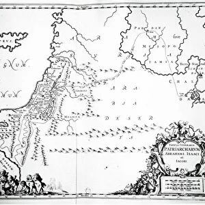
Antique Map of The French Riviera, France, 1890s, 19th Century
Unleash your creativity and transform your space into a visual masterpiece!
duncan1890
Media ID 21142635
© of Duncan P Walker
20"x16" (51x41cm) Canvas Print
Step back in time with our exquisite Canvas Print of an Antique Map of The French Riviera from the 1890s. This stunning 19th Century map, sourced from the Fine Art Storehouse and created by the talented artist duncan1890, transports you to a bygone era. The intricate details of the map's winding roads, quaint villages, and crystal-clear waters bring the beauty of the French Riviera to life. Hang this captivating piece in your home or office to add a touch of history and charm to any space.
Delivered stretched and ready to hang our premium quality canvas prints are made from a polyester/cotton blend canvas and stretched over a 1.25" (32mm) kiln dried knot free wood stretcher bar. Packaged in a plastic bag and secured to a cardboard insert for safe transit.
Canvas Prints add colour, depth and texture to any space. Professionally Stretched Canvas over a hidden Wooden Box Frame and Ready to Hang
Estimated Product Size is 50.8cm x 40.6cm (20" x 16")
These are individually made so all sizes are approximate
Artwork printed orientated as per the preview above, with landscape (horizontal) orientation to match the source image.
FEATURES IN THESE COLLECTIONS
> Maps and Charts
> Related Images
> Fine Art Storehouse
> Map
> Historical Maps
EDITORS COMMENTS
This print showcases an exquisite Antique Map of The French Riviera, France, dating back to the 1890s. A true treasure from the 19th Century, this map takes us on a journey through time and geography. With its intricate details and delicate craftsmanship, it offers a glimpse into the rich history of this iconic region. The map's vintage allure is enhanced by its Victorian aesthetic, evoking a sense of nostalgia for a bygone era. Its faded hues and aged texture add depth and character to the piece, inviting viewers to explore every nook and cranny of this coastal paradise. As we gaze upon this remarkable work of art, we are transported to an era when travel was more adventurous and discoveries were made with pen in hand. It reminds us that even in our modern world filled with technology and instant information at our fingertips, there is still something enchanting about old maps that can't be replicated. Whether you have visited the French Riviera or dreamt of doing so one day, this Antique Map serves as both a decorative piece for your home or office space as well as an invitation to embark on your own personal exploration. Let it inspire you to delve into the history and charm of one of France's most beloved destinations – where azure waters meet golden sands under endless blue skies.
MADE IN THE USA
Safe Shipping with 30 Day Money Back Guarantee
FREE PERSONALISATION*
We are proud to offer a range of customisation features including Personalised Captions, Color Filters and Picture Zoom Tools
SECURE PAYMENTS
We happily accept a wide range of payment options so you can pay for the things you need in the way that is most convenient for you
* Options may vary by product and licensing agreement. Zoomed Pictures can be adjusted in the Cart.