Canvas Print > North America > United States of America > New York > New York > Maps
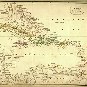
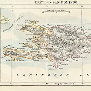
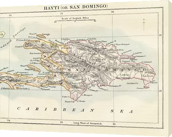
Canvas Print : Haiti and Dominican republic map 1883


![]()
Canvas Prints from Fine Art Storehouse
Haiti and Dominican republic map 1883
Encyclopedia Britannica 9th Edition New York Samuel L. Hall 1883 Vol XI
Unleash your creativity and transform your space into a visual masterpiece!
THEPALMER
Media ID 14756796
© This content is subject to copyright
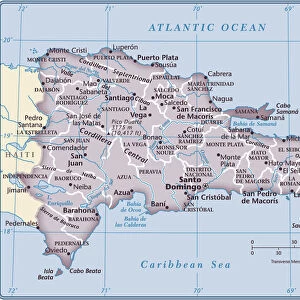
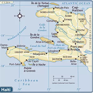
Caribbean Sea Haiti Island Santo Domingo
20"x16" (51x41cm) Canvas Print
Introducing the captivating "Haiti and Dominican Republic Map 1883" canvas print from Media Storehouse's Fine Art Storehouse collection. This exquisite piece is a reproduction of the original map from the Encyclopedia Britannica 9th Edition, published in New York by Samuel L. Hall in 1883. Transport yourself back in time as you explore the intricate details of this antique map, which beautifully illustrates the boundaries and geographical features of Haiti and the Dominican Republic during the late 19th century. The rich, vibrant colors and high-quality canvas material bring out the intricacies of THEPALMER's original map drawing, making it a stunning addition to any home or office. Bring history into your living space and start a conversation with this unique and educational canvas print. Order yours today from Media Storehouse's Fine Art Storehouse collection and enjoy the beauty and historical significance of this captivating map.
Delivered stretched and ready to hang our premium quality canvas prints are made from a polyester/cotton blend canvas and stretched over a 1.25" (32mm) kiln dried knot free wood stretcher bar. Packaged in a plastic bag and secured to a cardboard insert for safe transit.
Canvas Prints add colour, depth and texture to any space. Professionally Stretched Canvas over a hidden Wooden Box Frame and Ready to Hang
Estimated Product Size is 50.8cm x 40.6cm (20" x 16")
These are individually made so all sizes are approximate
Artwork printed orientated as per the preview above, with landscape (horizontal) orientation to match the source image.
FEATURES IN THESE COLLECTIONS
> Maps and Charts
> Related Images
> North America
> Dominican Republic
> Dominican Republic Heritage Sites
> Colonial City of Santo Domingo
> North America
> Dominican Republic
> Maps
> North America
> Dominican Republic
> Related Images
> North America
> Dominican Republic
> Santo Domingo
> North America
> Haiti
> Maps
> North America
> Haiti
> Related Images
> North America
> United States of America
> New York
> New York
> Maps
> North America
> United States of America
> New York
> Related Images
> Fine Art Storehouse
> Map
> Historical Maps
EDITORS COMMENTS
In this print titled "Haiti and Dominican Republic Map 1883" we are transported back in time to the late 19th century, where cartography was a meticulous art form. This particular piece is sourced from the Encyclopedia Britannica's 9th Edition, published in New York by Samuel L. Hall in 1883. The map showcases the beautiful islands of Haiti and the Dominican Republic nestled within the Caribbean Sea. With intricate details and precise markings, it provides a fascinating glimpse into the geographical landscape of these two nations during that era. As we examine this vintage map, our eyes are drawn to Santo Domingo, an important city on Hispaniola Island that has witnessed centuries of history unfold. The delicate lines trace rivers, mountains, and coastlines with remarkable accuracy—reminding us of how early explorers navigated these lands without modern technology. This print by THEPALMER captures not only historical significance but also serves as a visual testament to human curiosity and exploration. It invites us to reflect upon how boundaries have shifted over time while appreciating the enduring beauty of these Caribbean nations. Whether displayed in a study or gallery space, this artwork transports viewers back to an age when maps were cherished artifacts representing knowledge and discovery. Through its rich historical context and artistic presentation, "Haiti and Dominican Republic Map 1883" offers both educational value and aesthetic appeal for admirers of fine art prints.
MADE IN THE USA
Safe Shipping with 30 Day Money Back Guarantee
FREE PERSONALISATION*
We are proud to offer a range of customisation features including Personalised Captions, Color Filters and Picture Zoom Tools
SECURE PAYMENTS
We happily accept a wide range of payment options so you can pay for the things you need in the way that is most convenient for you
* Options may vary by product and licensing agreement. Zoomed Pictures can be adjusted in the Cart.