Canvas Print > Popular Themes > Railway Posters
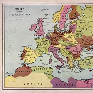
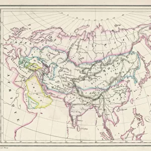
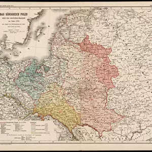
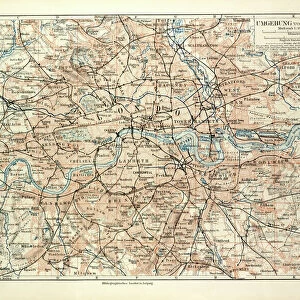
Canvas Print : Map of European Railway Lines


![]()
Canvas Prints from Liszt Collection
Map of European Railway Lines
Liszt Collection of nineteenth-century engravings and images to browse and enjoy
Media ID 12980509
© Quint Lox Limited
Plan Rail Railroad Track Traffic Train Transport Transportation Railway Lines
20"x16" (51x41cm) Canvas Print
Step into the past with our exquisite Canvas Print of "Map of European Railway Lines" by 000035 from the renowned Liszt Collection. This captivating piece brings the history of European railway development to your home or office. The intricate details of the map are beautifully rendered on high-quality canvas, creating a stunning visual representation of the intricate web of railways that connected Europe. Hang it up and let the rich history of European transportation transport you.
Delivered stretched and ready to hang our premium quality canvas prints are made from a polyester/cotton blend canvas and stretched over a 1.25" (32mm) kiln dried knot free wood stretcher bar. Packaged in a plastic bag and secured to a cardboard insert for safe transit.
Canvas Prints add colour, depth and texture to any space. Professionally Stretched Canvas over a hidden Wooden Box Frame and Ready to Hang
Estimated Product Size is 50.8cm x 40.6cm (20" x 16")
These are individually made so all sizes are approximate
Artwork printed orientated as per the preview above, with landscape (horizontal) orientation to match the source image.
FEATURES IN THESE COLLECTIONS
> Maps and Charts
> Related Images
> Popular Themes
> Railway Posters
> Transportation
> Trains
> Liszt Collection
> Engravings
EDITORS COMMENTS
This print titled "Map of European Railway Lines" takes us on a nostalgic journey back to the nineteenth century. The intricate details and illustrative technique showcased in this engraved image transport us to an era when railroads were at the forefront of transportation innovation. The map itself is a testament to the rich history and cultural significance of European railways, with its carefully plotted tracks crisscrossing across various countries. It serves as a visual reminder of how these railway lines played a pivotal role in connecting nations, facilitating trade, and fostering travel throughout Europe. The vintage charm exuded by this retro-styled artwork adds an extra layer of allure, evoking feelings of nostalgia for simpler times. Its Victorian aesthetic captures the essence of an era characterized by elegance and sophistication. As we gaze upon this remarkable piece from Liszt Collection's archives, we can't help but appreciate the artistry behind its creation. The engravement technique employed here showcases meticulous craftsmanship that was prevalent during that period. Whether you are a history enthusiast or simply captivated by the beauty of vintage art, this print offers both educational value and aesthetic pleasure. It serves as a window into Europe's past while also reminding us how far we have come in terms of transportation technology.
MADE IN THE USA
Safe Shipping with 30 Day Money Back Guarantee
FREE PERSONALISATION*
We are proud to offer a range of customisation features including Personalised Captions, Color Filters and Picture Zoom Tools
SECURE PAYMENTS
We happily accept a wide range of payment options so you can pay for the things you need in the way that is most convenient for you
* Options may vary by product and licensing agreement. Zoomed Pictures can be adjusted in the Cart.