Home > Maps and Charts > Americas
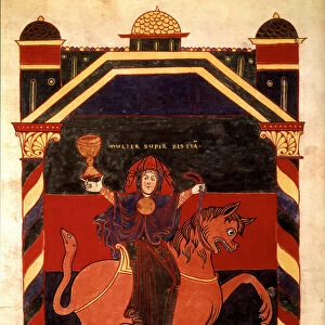
Portion of the Hauslab Globe based on the Martin Hylacomylus Waltzemu¨ller map of 1507. From the book Life of Christopher Columbus by Clements R. Markham published 1892

![]()
Wall Art and Photo Gifts from Fine Art Finder
Portion of the Hauslab Globe based on the Martin Hylacomylus Waltzemu¨ller map of 1507. From the book Life of Christopher Columbus by Clements R. Markham published 1892
2915319 Portion of the Hauslab Globe based on the Martin Hylacomylus Waltzemu¨ller map of 1507. From the book Life of Christopher Columbus by Clements R. Markham published 1892.; Photo © Hilary Morgan
Media ID 38105470
© © Hilary Morgan / Bridgeman Images
Chart Geographical Globe Mapmaking Martin Portion 1507 Waldseemuller
FEATURES IN THESE COLLECTIONS
> Fine Art Finder
> Artists
> (c.90-168)(after) Ptolemy
> Maps and Charts
> Related Images
> Maps and Charts
> World
EDITORS COMMENTS
This stunning print captures a portion of the Hauslab Globe, which is based on the Martin Hylacomylus Waltzemu¨ller map of 1507. The intricate details and precision of this cartographic masterpiece are truly awe-inspiring, showcasing the artistry and skill of early mapmakers.
The Hauslab Globe offers a glimpse into the geographical knowledge and understanding of the world in the early 16th century. It serves as a testament to human curiosity and exploration, as well as our desire to chart unknown territories and expand our horizons.
As we gaze upon this historical artifact, we are transported back in time to an era when America was still a mysterious land waiting to be discovered. The careful craftsmanship and attention to detail evident in this portion of the globe remind us of the dedication and expertise required for accurate mapmaking.
Through studying maps like these, we gain insight into how past civilizations viewed their world and navigated its vast expanses. Each line, symbol, and label on this map tells a story of discovery, adventure, and innovation that continues to inspire us today.
This print is not just a representation of geography; it is a window into our collective past and a reminder of the endless possibilities that lie beyond the edges of every map.
MADE IN THE USA
Safe Shipping with 30 Day Money Back Guarantee
FREE PERSONALISATION*
We are proud to offer a range of customisation features including Personalised Captions, Color Filters and Picture Zoom Tools
SECURE PAYMENTS
We happily accept a wide range of payment options so you can pay for the things you need in the way that is most convenient for you
* Options may vary by product and licensing agreement. Zoomed Pictures can be adjusted in the Cart.