Home > Animals > Mammals > Muridae > Western Mouse
Isobars and Isohyets, United States and Canada (colour litho)
")
![]()
Wall Art and Photo Gifts from Fine Art Finder
Isobars and Isohyets, United States and Canada (colour litho)
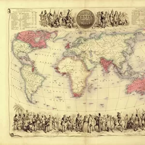
6015865 Isobars and Isohyets, United States and Canada (colour litho) by English School, (19th century); Private Collection; (add.info.: Isobars and Isohyets, United States and Canada. Illustration for Atlas of Meteorology, Volume III of Bartholomews Physical Atlas, prepared by J G Bartholomew and A J Herbertson (The Royal Geographical Society, 1899). A set of maps that give a perspective of global weather at the end of the nineteenth century.); © Look and Learn
Media ID 22325450
© Look and Learn / Bridgeman Images
Atmospheric Change Cool Cooling Earth Forecasting Global Isobars Isohyets Meteorlogical Meteorological Meteorologists Temperature Warm Warming Canadians
FEATURES IN THESE COLLECTIONS
> Animals
> Mammals
> Muridae
> Western Mouse
> Fine Art Finder
> Artists
> English School
> Maps and Charts
> Early Maps
> Maps and Charts
> Related Images
> Maps and Charts
> World
> North America
> Canada
> Maps
> North America
> Canada
> Related Images
> North America
> Related Images
> North America
> United States of America
> Maps
EDITORS COMMENTS
This print titled "Isobars and Isohyets, United States and Canada" takes us back to the 19th century when meteorology was still in its early stages. The image showcases a colour lithograph from Bartholomews Physical Atlas, created by J G Bartholomew and A J Herbertson in 1899. The map provides a unique perspective on global weather patterns at that time, specifically focusing on the United States and Canada. Isobars, lines connecting areas of equal atmospheric pressure, are intricately illustrated alongside isohyets, which represent regions with equal amounts of precipitation. As we gaze upon this historical piece of scientific artistry, it reminds us of the significant advancements made in meteorology over the years. It serves as a visual representation of how our understanding of weather systems has evolved since the late 1800s. Beyond its scientific significance, this print also offers an intriguing glimpse into North America's past. It highlights the interconnectedness between climate and geography while showcasing both countries' diverse landscapes. Whether you're fascinated by history or have an interest in meteorology, this artwork transports you to a time when forecasting techniques were just beginning to take shape. It serves as a reminder that even centuries-old maps can continue to inspire curiosity about our ever-changing world.
MADE IN THE USA
Safe Shipping with 30 Day Money Back Guarantee
FREE PERSONALISATION*
We are proud to offer a range of customisation features including Personalised Captions, Color Filters and Picture Zoom Tools
SECURE PAYMENTS
We happily accept a wide range of payment options so you can pay for the things you need in the way that is most convenient for you
* Options may vary by product and licensing agreement. Zoomed Pictures can be adjusted in the Cart.